.svg@webp)
Resolution vs. Altitude: Do 50 Megapixels Actually Matter?
 Lukas
Zmejevskis
Lukas
Zmejevskis

New DJI drones have Quad Bayer sensors with inflated megapixel amounts. We all know that megapixels are not the only defining factor of image quality, and the megapixel race is long over. However, we need to know their uses when we have two resolution options. I will test and compare photos taken at different altitudes in this article. Let me show you the practical differences in what, in theory, might seem equal.
50 vs. 12 Megapixels - In Theory
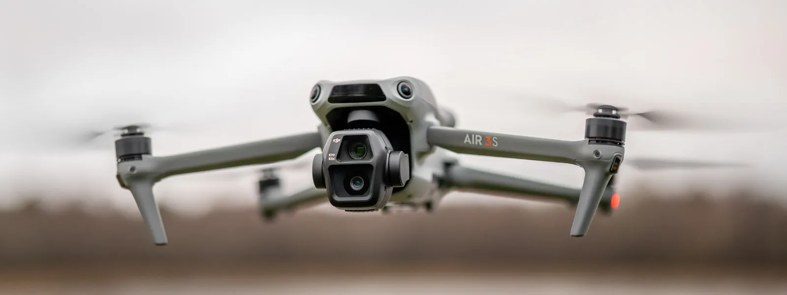
I am using the overall best drone on the market right now—the DJI Air 3S with the DJI RC2 remote controller. It has two cameras, and each of these cameras has two photo resolution modes. The primary camera can shoot either 50- or 12-megapixel photos, which, in theory, sounds great. This is twice the resolution on each side, and we should get considerably more detail if everything else is equal in the comparison.
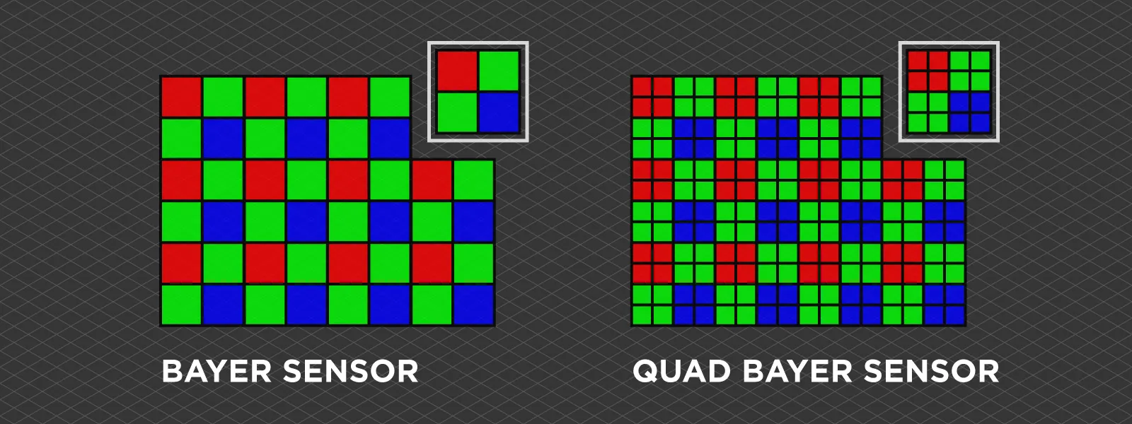
 But it is not equal. First, the Quad Bayer sensor. There are no traditional 50 megapixels of resolution; each RGB pixel is split into four. This kind of sensor uses specific algorithms to produce either resolution photo, and the results will vary depending on each case.
Overall, we will always see an advantage in the higher-resolution files, especially if we shoot RAW first, with good exposure and no motion blur, and convert that to JPEG. Will we ever see twice the resolution? No, that is not possible.
 There are also practical drawbacks to shooting in 50-megapixel mode. The files are larger, and the speed at which we can take photos is reduced (compared to 12-megapixel mode). The most obvious effect of this is the minimum interval in timed shot mode. When shooting in 12 megapixels, we can take a photo every 2 seconds, while in 50 megapixels—every 5 seconds. That is a huge difference if we need to take hundreds of pictures for photogrammetric scans.
Pixpro Waypoints - Slower Interval Shooting
It is time to test that. Theoretically, I can fly twice as high when taking 50-megapixel photos with the DJI Air 3S and get the same theoretical ground sampling distance (GSD) resolution for my orthophoto image. Flying twice as high allows me to take significantly fewer pictures. This counterbalances the 5-second interval requirement to some degree.

 I will use Pixpro Waypoints to execute two flights over the exact same area at two different altitudes with the same overlap setting. The lower altitude flight will use the 12-megapixel mode with a 2-second interval, while the 120-meter altitude flight will use the 50-megapixel mode with a 5-second interval.
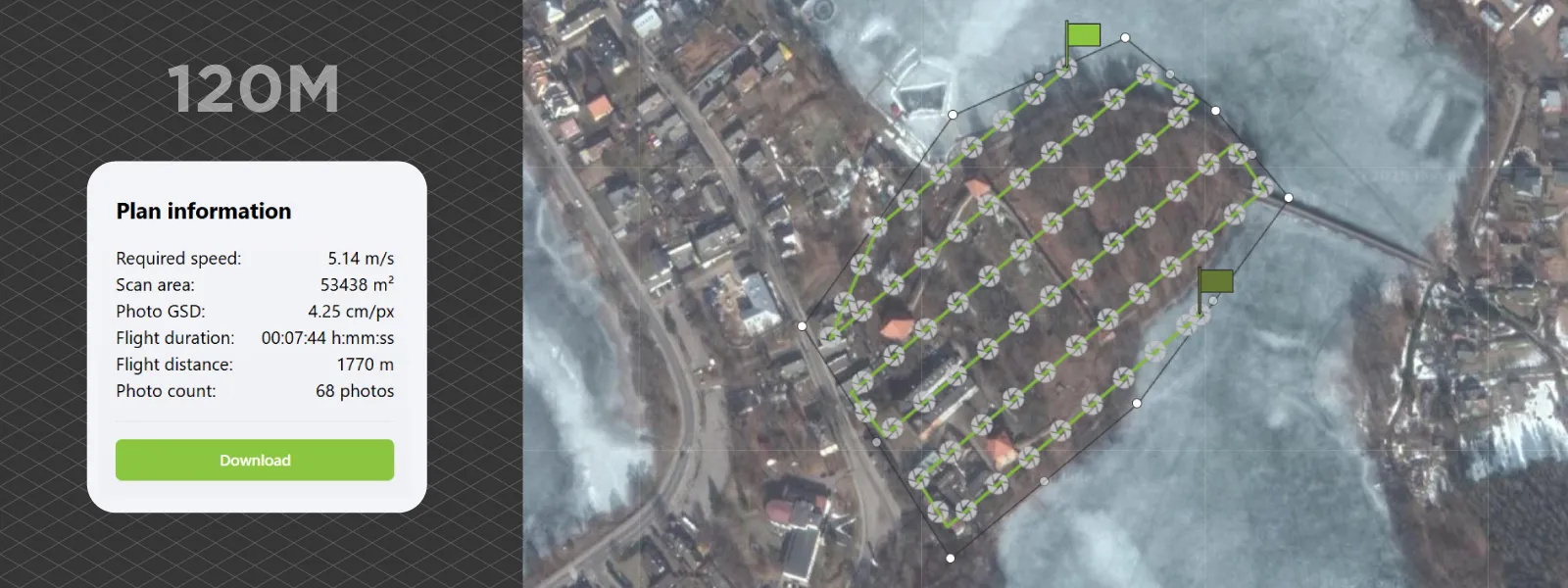
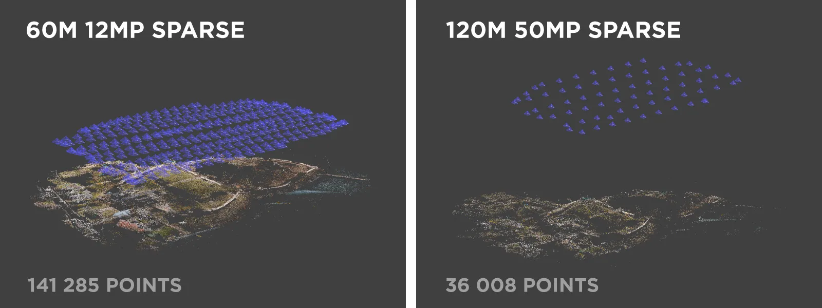
 The waypoint service shows the plan differences immediately. As expected, the photo count is four times lower, and flight time is 30 percent shorter for the 120-meter height flight. The statistics show GSD for the 12-megapixel mode only, so that value needs to be divided by two for the 120-meter flight.
 If necessary, I will also add a couple of orbital flights for oblique data to fix the 3D reconstruction. Our area has some surface undulations. However, nadir scans (camera looking straight down) often fail due to insufficient oblique data. Or we get the bowing effect, as described in a previous article.
Photogrammetric Processing
I did the flights on an incredibly windy day, so the photo amount and flight time will be slightly off from the Pixpro Waypoints estimation. Still, the proportion is the same—294 12-megapixel photos vs. 98 50-megapixel images at a higher altitude (flight duration: 11 vs. 8 minutes). That equates to 3,528 vs. 4,900 megapixels, respectively, for the software to process. Higher-altitude flights have some practical benefits—the perspective is less pronounced when the camera is further from the ground, making it easier to correct when creating an orthophoto. Higher-altitude flying is also more stealthy, and shutter speed requirements are slightly lower.
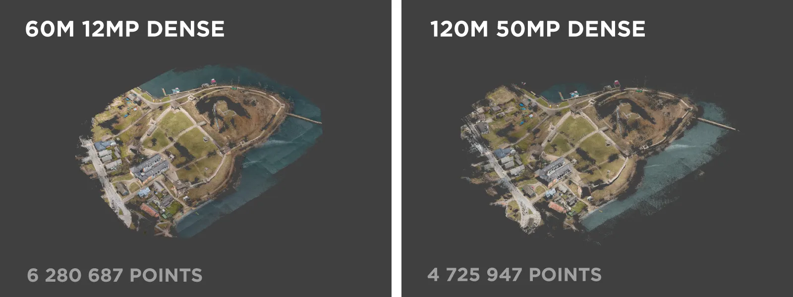
 It took about 57 minutes of processing to obtain a result (dense point cloud) for the 60-meter altitude flight and 32 minutes for the higher one. Adding orbitals was unnecessary, and the results were satisfactory with just the grid photos. Because it was a windy day, atmospheric haze was not a factor in this example. However, if the conditions were a little hazy, doubling the distance from the camera to the subject would definitely have an impact on visibility, and perceived resolution would decrease.
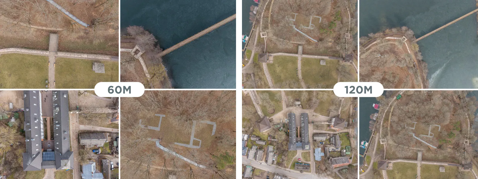
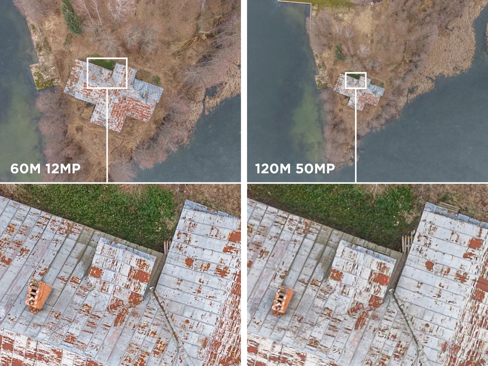
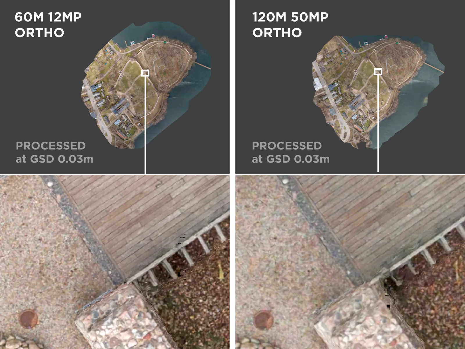
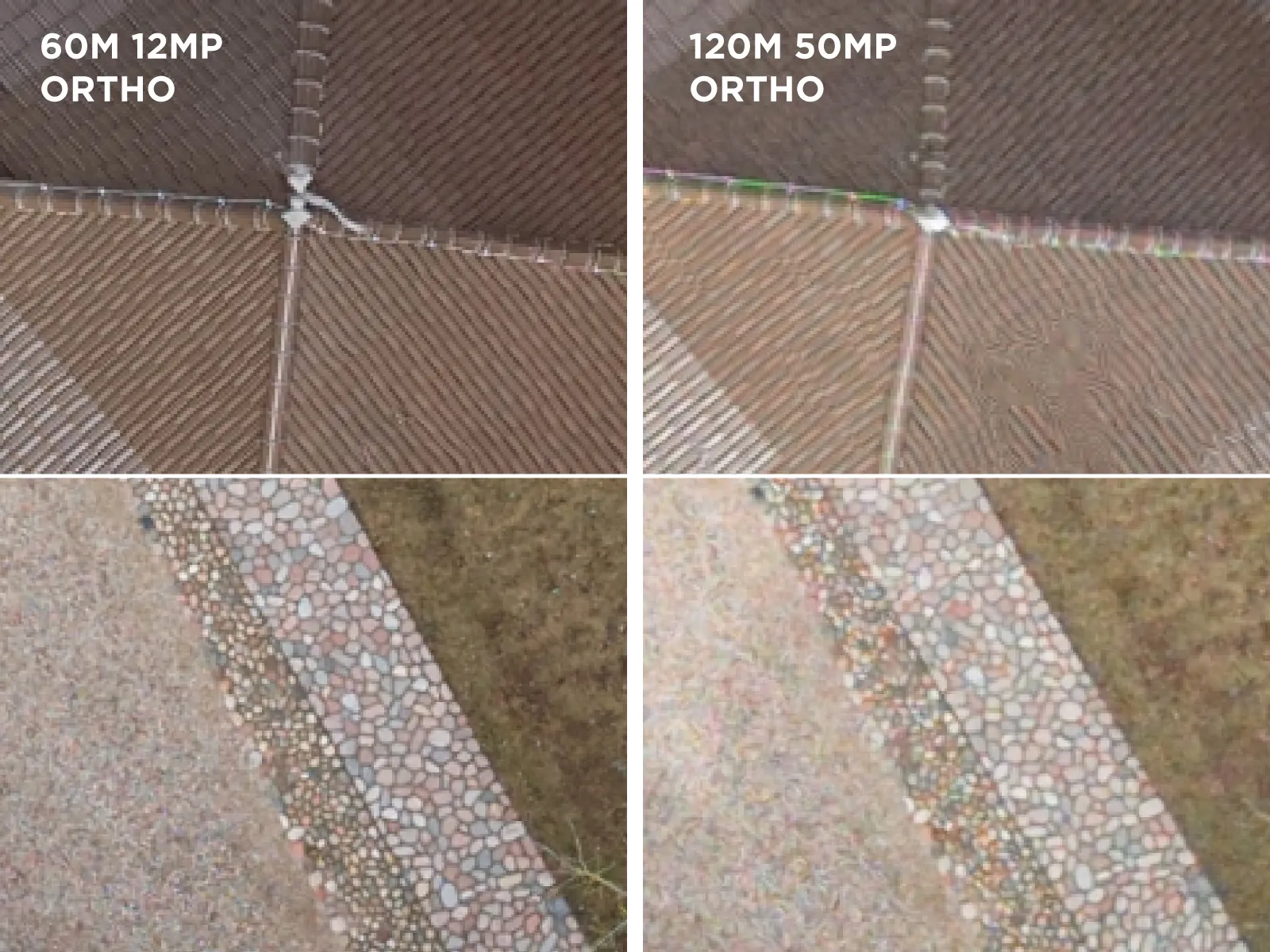
 In my opinion, the clarity between the two sets of photos is not even close to being equivalent despite having the same theoretical GSD resolution—as expected. After all, the drone processes data from the entire sensor and downsamples/debayers it to 12 megapixels.
12-megapixel photos are much crisper when viewed at the same magnification, which is reflected in the photogrammetric results. Is it worth spending more time capturing and processing? That will be up to you for each case.
 Conclusion
Capturing data at a higher resolution and a higher altitude is undoubtedly an option. However, do not expect the same results in practice, even if GSD seems the same on paper. There may also be a middle ground where the 5-second capture limit is not yet as impactful, and higher-resolution photos could match the output of the 12-megapixel ones. But that would negate the main benefit of speed when flying high. I hope these examples show the real difference in practice and help you decide if shooting different resolution photos is something you should explore.
Photographer - Drone Pilot - Photogrammetrist. Years of experience in gathering data for photogrammetry projects, client support and consultations, software testing, and working with development and marketing teams. Feel free to contact me via Pixpro Discord or email (l.zmejevskis@pix-pro.com) if you have any questions about our blog.
Related Blog Posts
Our Related Posts
All of our tools and technologies are designed, modified and updated keeping your needs in mind
Where do we use Photogrammetry? A list of 3D scanning use cases.
Photogrammetry has revolutionized numerous industries by transforming real world scenes into 3D models, using only simple photographs and processing algorithms.
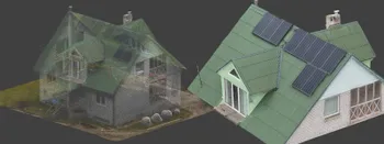
Roof Scan for Inspection and Solar Panel Addition – Use Case
Roof photogrammetry is one of our client base's most common use cases. Obtaining accurate measurements is essential for designing a solar panel layout, determining how many panels fit on a roof, and conducting a prior inspection.
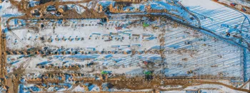
Dealing with Snow and High Contrast - Aerial Construction Site Scan
Aerial photogrammetry is dependent on the weather conditions, and there is no other way around it. While we can not fly our drones during extreme weather - dealing with something like a little cold or snow is not that hard.
Ready to get started with your project?
You can choose from our three different plans or ask for a custom solution where you can process as many photos as you like!
Free 14-day trial. Cancel any time.