.svg@webp)
Other

DJI Mini 3 Pro for Photogrammetry – Tool or Toy?
DJI Mini 3 Pro – the latest compact DJI drone equipped with a capable camera. We purchased the drone with our money to evaluate using it for photogrammetry, just like we did with the Mavic 3. This article will not be a review, but an overview, emphasizing photogrammetry.

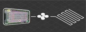
Drone Duty – a Flight Planner for Photogrammetry
During years of photogrammetric software development, the Pixpro team faced challenges acquiring and processing photographs made for photogrammetry purposes.
Measuring With Photogrammetry – Pixpro Software Advantage
Measuring with photogrammetry can be helpful in many industries and professions. Surveying, inspection, mapping, construction, and other fields require measurements for various goals.
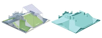
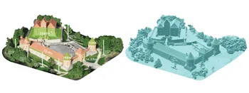
Measuring Roofs with Photogrammetry
For solar panel experts, measuring roofs and modeling photovoltaic power plants are daily tasks that can involve dangerous procedures. But with the help of drones and photogrammetry, the efficiency and safety of many methods can be improved.

Referencing in Photogrammetry – Important Basics
Referencing in photogrammetry – is a set of actions in the field and post-processing that allows to scale, orientate and place a photogrammetry project correctly. A photogrammetry project with referencing is in the correct position in relation to the real world, has a scale, and can be measured.
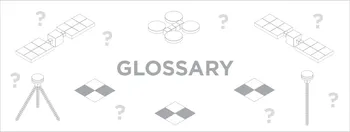
Glossary
In our blog and software help we often use terminology that might not be clear for everyone. Thus we decided to create our own glossary of most common terms used in the context of photogrammetry.
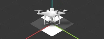
How to use an RTK Drone as a GNSS Rover?
We explored the pros and cons of using an RTK drone and GNSS rover ground control points for accurate aerial photogrammetry referencing in another article. Not unexpectedly best results were achieved using both sources for referencing simultaneously.
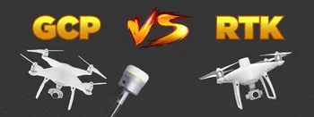
Ground Control Points vs. Real Time Kinematic
With aerial photogrammetry, there are two most commonly used types of referencing – GPS metadata in the photos and ground control points in the scene. GPS metadata can come in the level of RTK precision, while ground control points (further GCPs) are always made with survey-grade equipment.
Flight Planner. Do I Need One?
Drones have become a standard instrument for businesses worldwide, including agriculture, real estate, photography, and manufacturing. Unmanned aerial vehicles significantly improved our capacities in 3D mapping, business automation, and even military operations.
Ready to get started with your project?
You can choose from our three different plans or ask for a custom solution where you can process as many photos as you like!
Free 14-day trial. Cancel any time.
Welcome to Pixpro
Sign in
And access your account.