.svg@webp)
Cemetery Inspection. Monitoring. Planning – Photogrammetry Use Case
 Lukas
Zmejevskis
Lukas
Zmejevskis

I have another practical use case—this time from the services industry. Cemeteries are just a part of the human circle of life and a commodity that requires resources. A spatial resource, to be precise, which requires management. Ancient cemeteries are often shaded by old trees, giving that special atmosphere. Still, more recent ones—or those placed in non-woodland biomes—have clear skies, which opens up the area for aerial photogrammetry. I scanned one such cemetery to gather data for inspection and further capacity evaluation.
3D Scanning With Air 3S
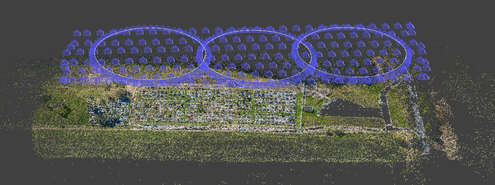
For data collection, I used my favorite drone—the DJI Air 3S with the DJI RC2 remote—and automatic flights from the Pixpro Waypoints service. I planned a nadir grid flight over the area (80 percent overall, as usual). I added three 110-meter diameter orbits side by side to provide some oblique data for the scan.
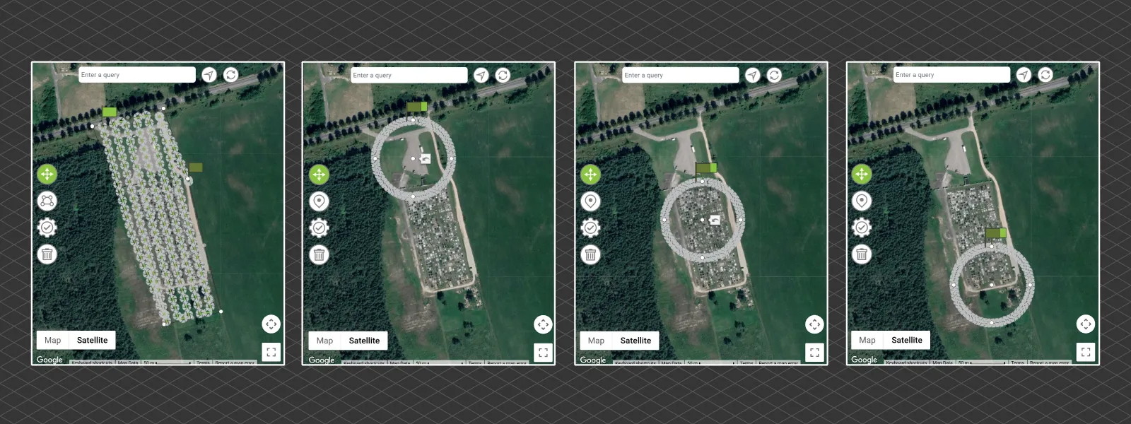 Oblique data helps avoid artifacts and the bowing effect, which would be an issue in this case because the surface of the cemetery is relatively flat, and it doesn’t reconstruct correctly without additional data. Ground control points also help in such cases but require additional workflow and professional equipment. Do as I always do: add oblique data for safety to your grid flights. My favorite workflow is to add multiple orbits covering the same area.
 Data Processing
I captured 50-megapixel RAW photos this time, wanting to push the maximum theoretical image quality for the resulting orthophoto. I converted the RAW photos using Adobe Lightroom Classic with my usual conservative processing style: contrast tweaks, white balance equalization, and a few others. There was no cropping, resolution changes, color edits, or metadata stripping.
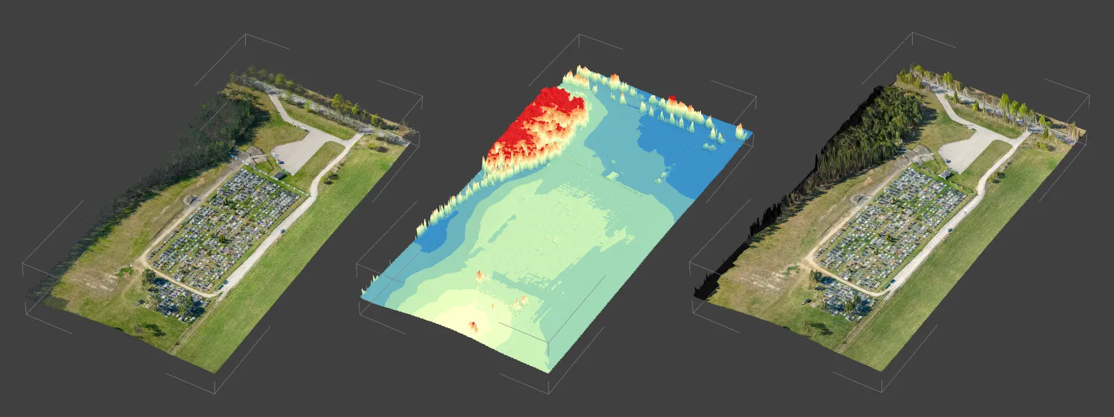
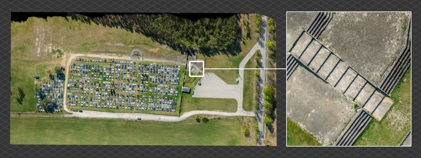
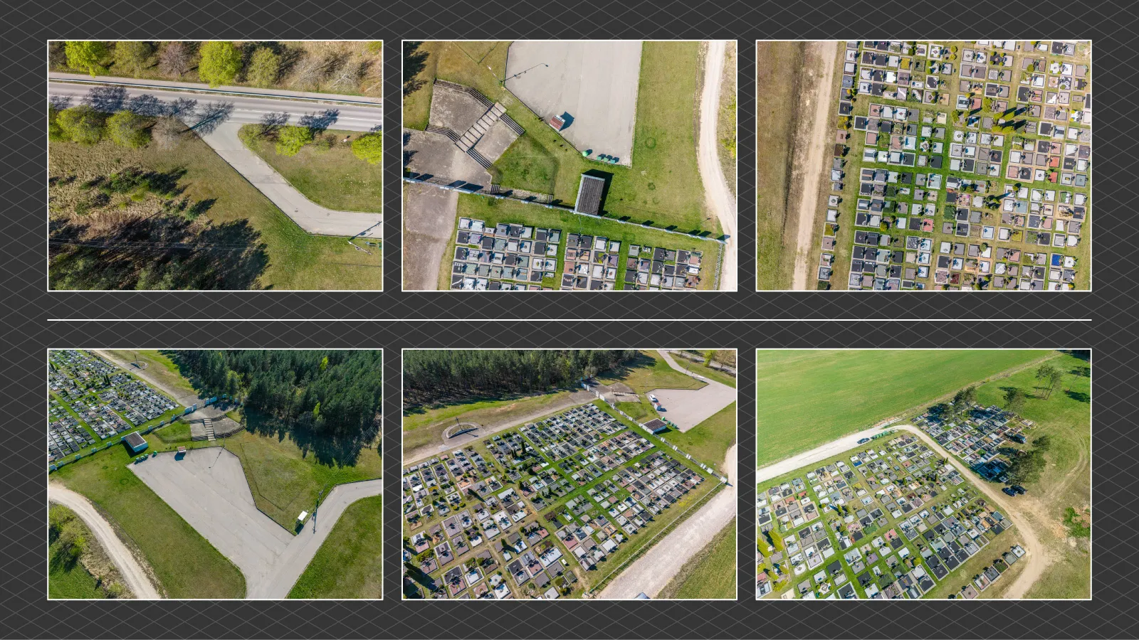 After removing some duplicates (always remember to filter those out), I had 385 photos for the project. I processed the 3D reconstruction and dense point cloud in Pixpro, then did some clipping and created a digital elevation map and an orthophoto image using nadir photos only. Not using the orbitals yields cleaner results, while the 3D structure of the elevation map remains sound.
 Measurements and Inspection in Pixpro
Lastly is the data analysis step. In Pixpro, we can measure in all dimensions: area, linear distance, and volume if needed. Knowing the standard size of a single plot, we can determine how much space is left in the cemetery, project when it will be full, and calculate how much pathway or fencing might be needed.
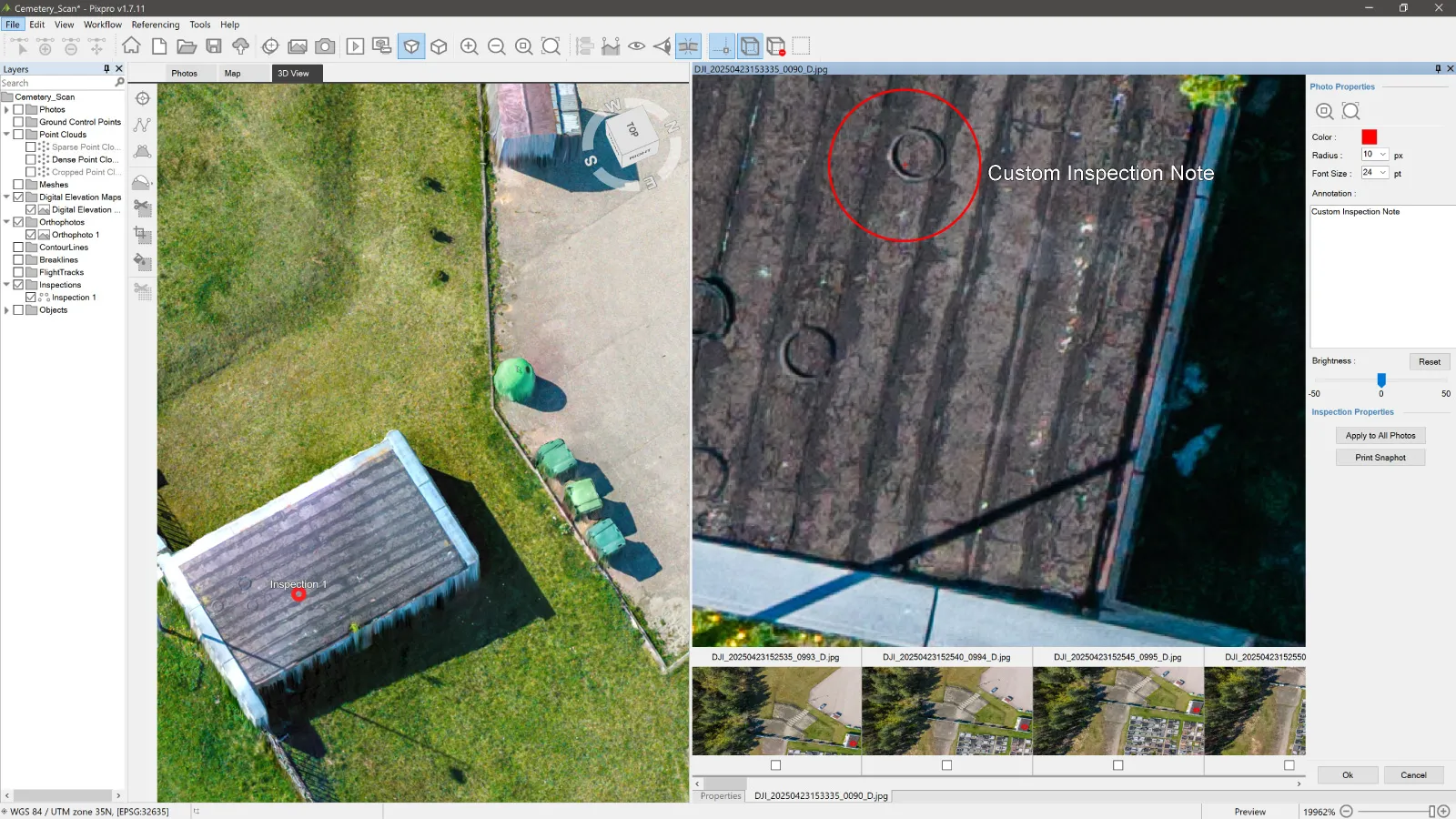
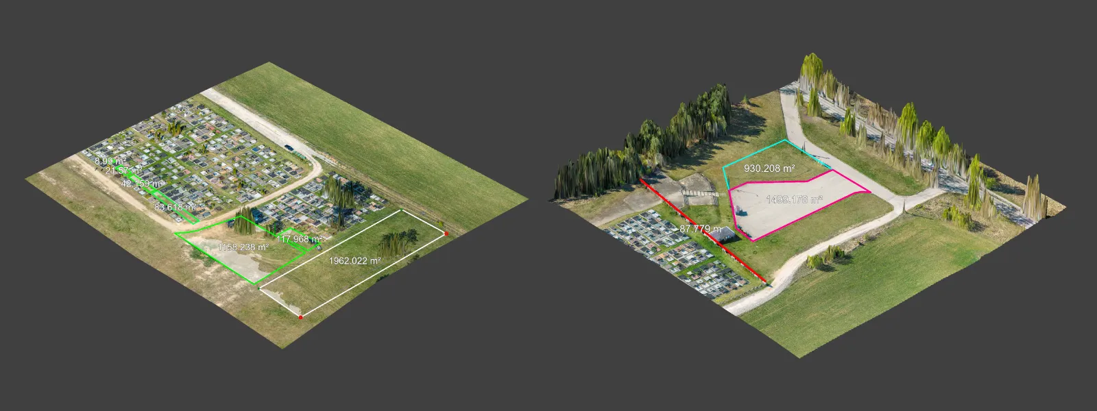 We can also inspect the photos at full resolution to check for any obvious infrastructure defects. We can also get a top-down view of the parking lot and other surfaces to assess their current condition.
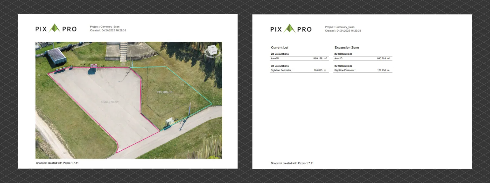
 Finally, we can export the data to other software if needed. Everything we generate or draw can be exported. Pixpro also allows you to make reports, such as basic screenshots with annotations or full measurement summaries.
 Conclusion
There are even larger open-field cemeteries than this one, and using a drone is the most efficient way of inspecting and planning. The entire area—however large—can be right on your screen, on perfect scale, and accurately positioned on the map. If more detail is required, we can lower the flight altitude to the point of being able to read epitaphs if necessary. That’s simply a matter of data density, which doesn’t change anything fundamentally. If you manage cemeteries and require a modern monitoring solution, aerial photogrammetry is the way to go.
Photographer - Drone Pilot - Photogrammetrist. Years of experience in gathering data for photogrammetry projects, client support and consultations, software testing, and working with development and marketing teams. Feel free to contact me via Pixpro Discord or email (l.zmejevskis@pix-pro.com) if you have any questions about our blog.
Related Blog Posts
Our Related Posts
All of our tools and technologies are designed, modified and updated keeping your needs in mind
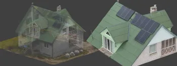
Roof Scan for Inspection and Solar Panel Addition – Use Case
Roof photogrammetry is one of our client base's most common use cases. Obtaining accurate measurements is essential for designing a solar panel layout, determining how many panels fit on a roof, and conducting a prior inspection.
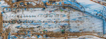
Dealing with Snow and High Contrast - Aerial Construction Site Scan
Aerial photogrammetry is dependent on the weather conditions, and there is no other way around it. While we can not fly our drones during extreme weather - dealing with something like a little cold or snow is not that hard.

Small Scale Scan Part 2 - Cross Polarization for Difficult Objects
This time, however, we are tackling a much more difficult object as promised, which could be considered a worst-case scenario, but still scannable.
Ready to get started with your project?
You can choose from our three different plans or ask for a custom solution where you can process as many photos as you like!
Free 14-day trial. Cancel any time.