.svg@webp)
Pixpro Waypoints - Orbitals with 3X Camera
 Lukas
Zmejevskis
Lukas
Zmejevskis

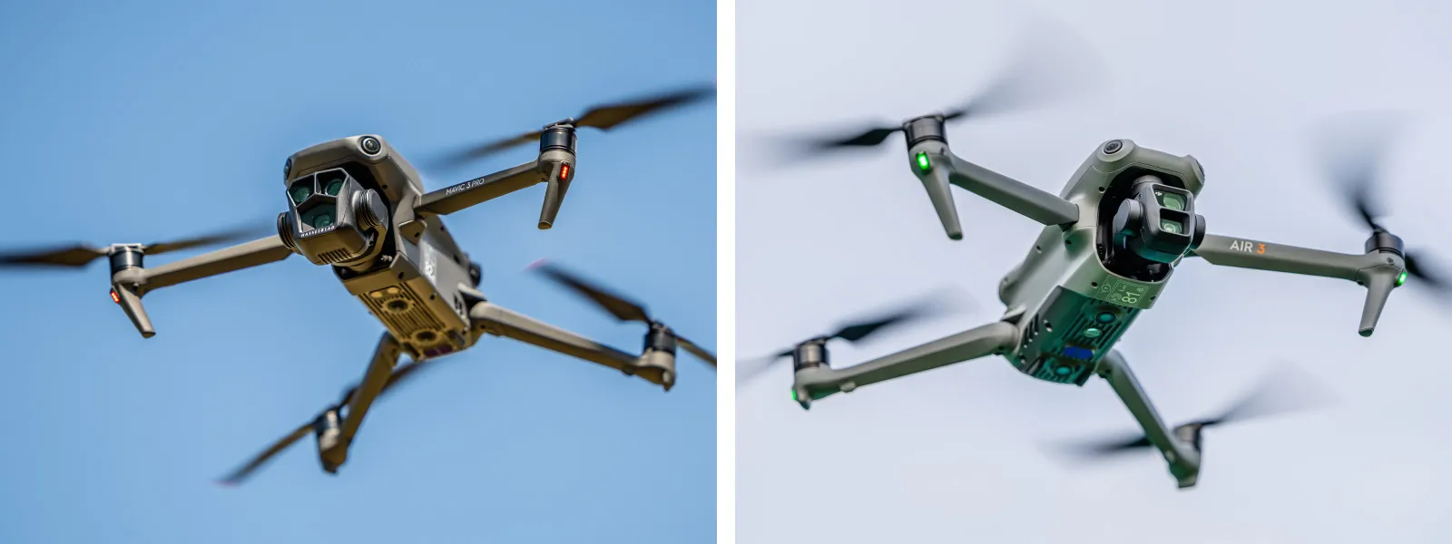
Pixpro Waypoints is a service that generates a flight path and provides capture interval information for photogrammetric scans. At the moment, it has two flight plans—single grid and orbital. Whichever plan you need, the photo capture settings and initiation are up to you. The service is compatible with the latest DJI drones, including Mavic 3 Pro and DJI Air 3, which have 3x cameras. In this article, we will briefly explore using the 3X lens with Pixpro waypoints for inspection and dual capture.
Use Cases
Using a telephoto camera helps in a few cases: when we cannot get closer to our subject or when we want more details from the same distance. The 3X camera will still provide more detail when compared to the Mavic 3 Pros' admittedly superior main 1x module and will definitely outperform the Air 3 1x module when distance change is not an option. So, it allows us to get close without flying too close and, therefore, maintain the safety of a flight.
 Inspection and, generally, more detailed 3D model creation can benefit from orbital flights. Using grids with a 3x camera is less rational and harder to achieve. We may explore this in the future, but generally, using the main 1x camera module for grid plans is the best choice. Thus, we will focus on orbitals in this article.
How To
If we are planning to use the 3X camera for our orbital scan, we might need to consider the flight height and orbital diameter to accommodate a different focal length. We can also just plan for the regular 1x flight and add 3X capture as a bonus while executing the same flight twice but changing the camera.
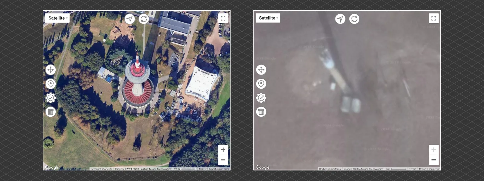
Using the Pixpro Waypoint service to plan an orbital flight is relatively easy. You can read an entire article on how to do that here. When considering using more telephoto modules, one main point is placing the orbital center correctly. Maps and real life will never be perfectly aligned, but Google Maps—which is the provider we use in Pixpro waypoints—is actually quite accurate despite sometimes lacking orthorectification.
Orthorectification is a process when perspective is removed, and the top-down view of an area is portrayed perfectly as if always seen from above. Pixpro photogrammetry software, for example, provides a true orthorectified photo when the data is sufficient. However, some areas on the map, even in cities, sometimes do not have this. So, buildings and towers are not photographed directly from above. It looks like this:
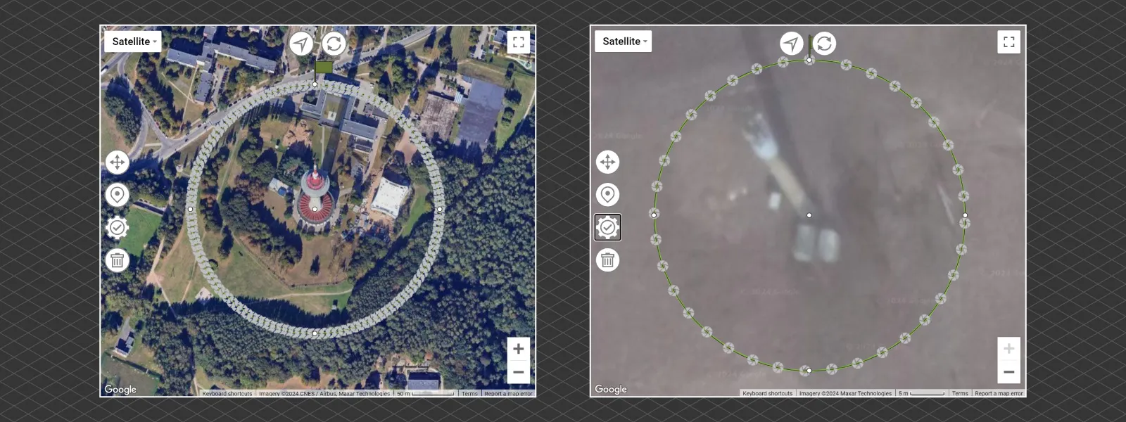
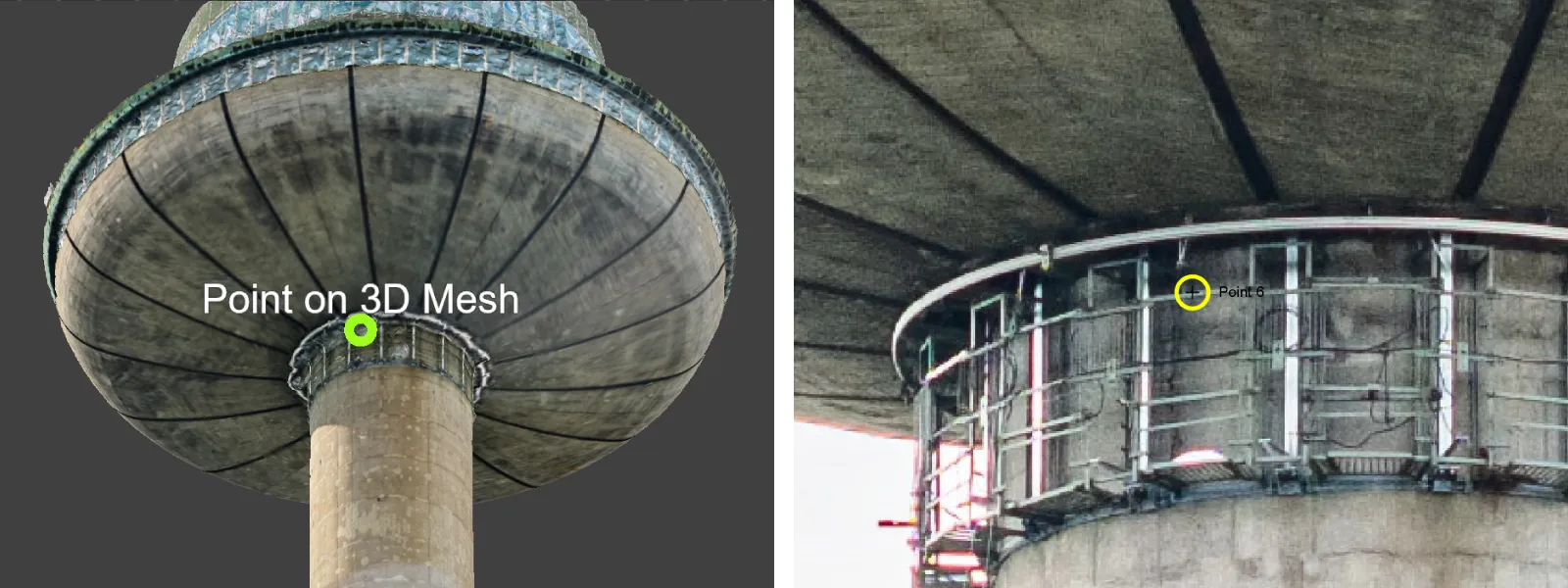
 In such a case, we must always select the orbital center at the base of a tall structure, sometimes even imagining that it goes deeper underground to compensate. Here are the plans for the examples we took, and you can see where we marked the centers for the orbitals.
Examples
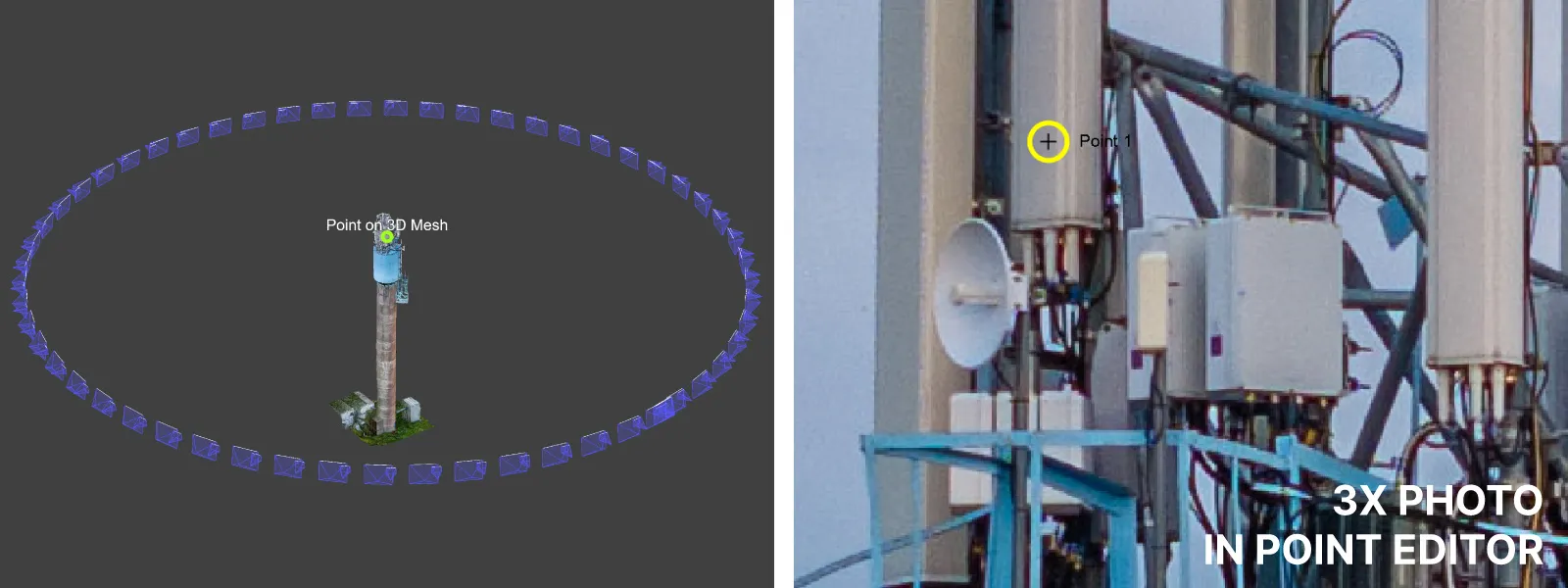
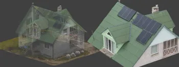
We created a couple of examples. One - a small water tower nowadays used for communications. We are simulating inspection with this one. We drew an orbit around it and executed two flights. During flight number one, we took 1x photos with the primary camera of the DJI Mavic 3 Pro. Again, we took the same flight with the same interval and speed but with the 3X camera pointing at the antennae at the top of the tower. Example photos below:
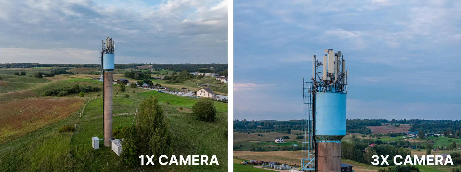
Ultimately, we got a 3D model of the entire tower that allowed us to inspect the equipment closer in the 3X photos. We could have gone closer to the tower, but as you can see in the video made with the same exact waypoint flight, not perfect centering will result in the subject gradually shifting out of the frame.
If this happens, we can try again, selecting the center of the orbit even "deeper" until we find a sweet spot. If you nail it, you can maybe even experiment using the 7X camera on the Mavic 3 Pro. The 3X camera already provides a decent close-up look for rough inspection, even from this distance, even in evening lighting conditions.
 Another example we made is much grander in scale: the Vilnius TV tower. We planned an orbital around the tower's base at 120 meters above ground. We did three primary camera passes and two 3X camera passes. This means that we used the same orbit five times but adjusted the camera orientation for each flight.
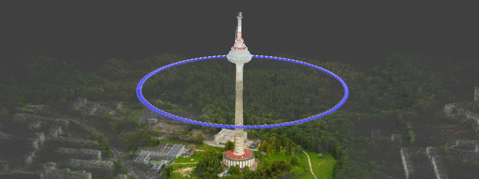 We kept a very safe 150-meter distance from the tower, so the detail may not be the best, but getting close to objects like this may require formal flight planning and advance notice in many countries. Still, the 3X camera provides detail for rough inspection and better detail in key areas.
Conclusion
If you have the DJI Air 3 or Mavic 3 Pro, the 3X camera is a powerful tool. Its perspective removes the usual wide-angle "drone look for photos and video," and the parallax effect can be pretty amazing. But as you can see, it also has uses in photogrammetry, for more close-up inspections and detail. It does not require anything more than using the same Pixpro Waypoints orbital with minor camera adjustments.
Photographer - Drone Pilot - Photogrammetrist. Years of experience in gathering data for photogrammetry projects, client support and consultations, software testing, and working with development and marketing teams. Feel free to contact me via Pixpro Discord or email (l.zmejevskis@pix-pro.com) if you have any questions about our blog.
Related Blog Posts
Our Related Posts
All of our tools and technologies are designed, modified and updated keeping your needs in mind
Where do we use Photogrammetry? A list of 3D scanning use cases.
Photogrammetry has revolutionized numerous industries by transforming real world scenes into 3D models, using only simple photographs and processing algorithms.
Roof Scan for Inspection and Solar Panel Addition – Use Case
Roof photogrammetry is one of our client base's most common use cases. Obtaining accurate measurements is essential for designing a solar panel layout, determining how many panels fit on a roof, and conducting a prior inspection.
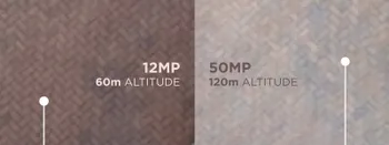
Resolution vs. Altitude: Do 50 Megapixels Actually Matter?
We all know that megapixels are not the only defining factor of image quality, and the megapixel race is long over. However, we need to know their uses when we have two resolution options.
Ready to get started with your project?
You can choose from our three different plans or ask for a custom solution where you can process as many photos as you like!
Free 14-day trial. Cancel any time.