.svg@webp)
Property Scanning for Lawn Mowing Evaluation
 Lukas
Zmejevskis
Lukas
Zmejevskis

Our photogrammetry software users often ask us questions about software and specific use cases, some of which we hear for the first time. One such case was property scanning for lawn mover system installation. It turns out photogrammetry is actually the only logical way of remotely evaluating a considerably sized area for such a task. In this case, we provide the software and the data collection service, and we will briefly describe what we did.
The Premise
Lawn mover system installation companies need information about the property to properly advise on which equipment they should recommend. At least a reputable one would not just recommend the most expensive stuff. The traditional way is for a representative to come to the property and evaluate the area. This may not be an option when the company in question operates internationally or entirely remotely. Or it can be a much more expensive ordeal than a photogrammetric scan. This is where photogrammetry begins to make the most sense.
Inspecting a 3D property model, which accurately represents the real world, is even better in some cases than visiting the property. It can be done anywhere in the world, on any PC, and the entire property is at the palm of your hand, or rather your screen. Pixpro has all of the measurement tools required to measure distances, areas, and slope angles, which are the main requirements for the specifications of lawn mowing equipment. Visual inspection also helps to set up the best locations for various elements of the system, such as docks for robots.
Photogrammetric Scanning
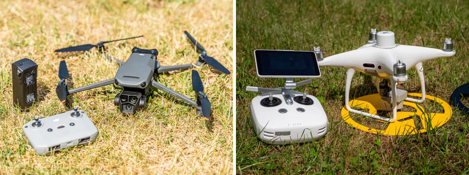
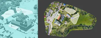
To scan a considerably sized property, we need to use aerial photogrammetry, which means a drone with a camera. In this case, we used Phantom 4 RTK, which provides RTK-level GPS data. This is a better, more accurate version of regular GPS, which allows us to get not only relative accuracy for measurements but also absolute positioning accuracy down to a few centimeters.
If your case does not require absolute accuracy—so there is no need to have accurate placement on the map—you can use any regular drone. However, to get accurate measurements, you need good 3D reconstruction, which is a matter of good image quality and proper capture.
Our blog has many articles on that, and we have a capture solution for DJI Mavic 3, Air3, or Mini 4 Pro drones. You can use Pixpro Waypoints service for automatic capture and Pixpro photogrammetry software for data processing and analysis. Alongside all the answers in our blog, you may find a complete solution here.
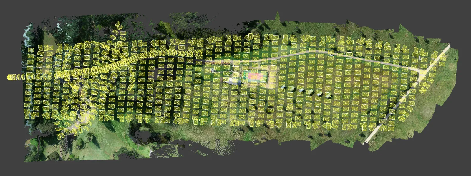
 We did a nadir grid above the entire property and a few manual oblique photos in the more wooded area. Generally, oblique data is a must in nadir scans, even in this case where we have quite an undulating terrain. RTK significantly reduces that need, but we still added oblique data in the more wooded area to avoid processing issues. If you can, always add oblique data in nadir scans to prevent bowing and other detrimental effects that may make the entire project unusable. The best way is to add orbitals over the same area. In this case, because the Phantom RTK does not have orbit plans handy, we did some manual flying instead.
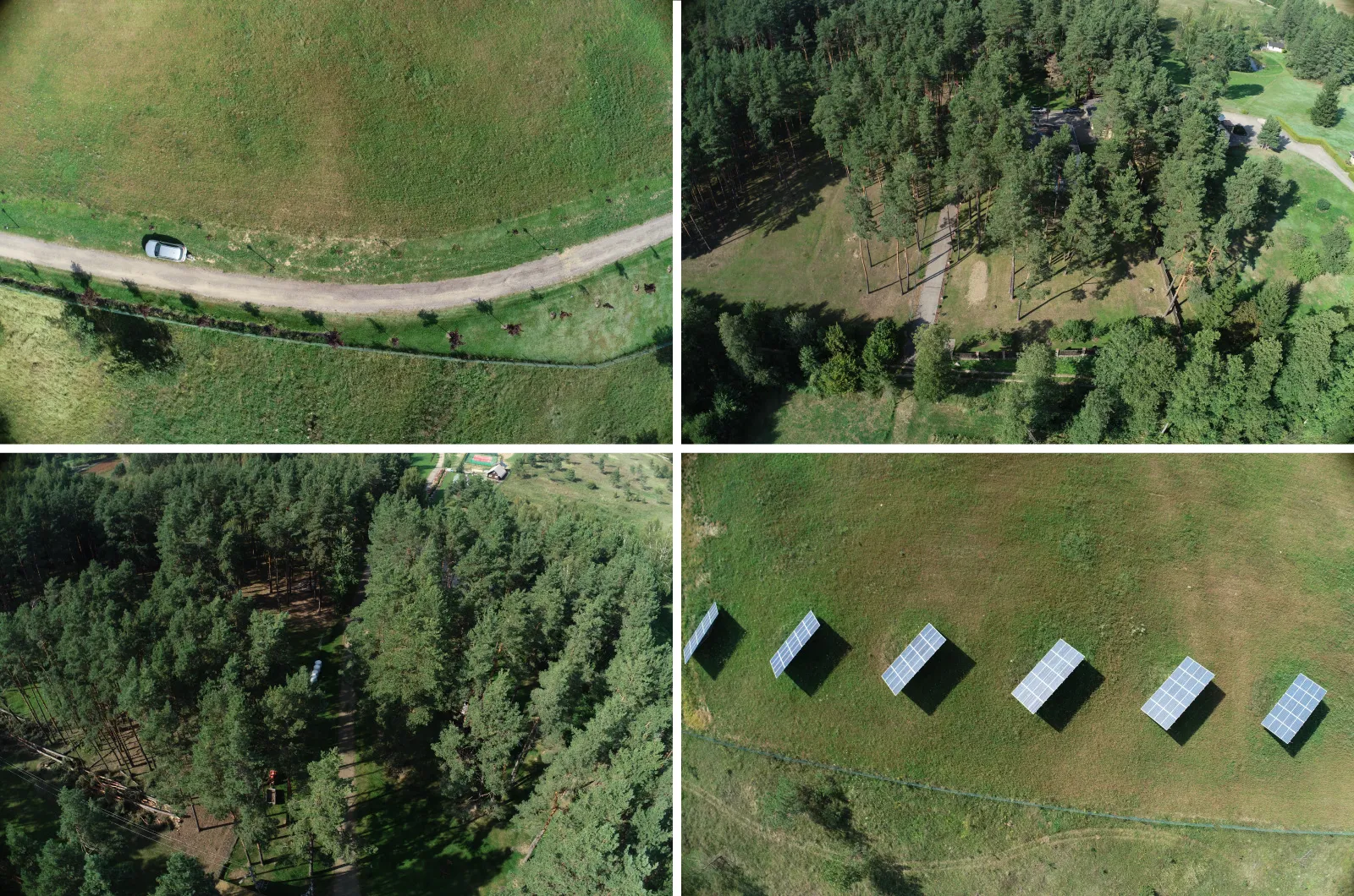 We flew with the camera in shutter priority mode at 1/1000th of a second during a perfect summer's day. All overlap settings were set to 80/80 percent, and we shot in jpeg with the white balance fixed as "sunny," full resolution, with no distortion correction in the drone. We got 819 photos in total.
 Data Processing
We processed all photos using Pixpro photogrammetry software. Because we ensure image quality, coverage, and overlap, the processing is just a click of a button. Run a full workflow with default settings, wait a few hours, and all of the layers are done. Processing is that simple.
 If you do not have a reasonably powerful PC or laptop, you can also use Pixpros cloud computing, which will offload processing to our servers. Then, it becomes a matter of having a good, stable internet connection.
 Once the processing is done either way, we will be ready for data analysis. If you are not going to analyze the data yourself, we have an inelegant but highly effective solution of sharing data with an expert who will. You can buy an additional cheapest Pixpro license and then allow the expert to install and view the project you made. Our cheapest license will not have any data viewing or analysis limitations, only processing. So, an 800+ photo project can be opened and analyzed by anyone with such a license.
Data Analysis - Measurements
If you are the person who will do the measurements, it is pretty straightforward. In Pixpro, to obtain a measurement, you just have to draw an appropriate object, be it a line or a polygon.
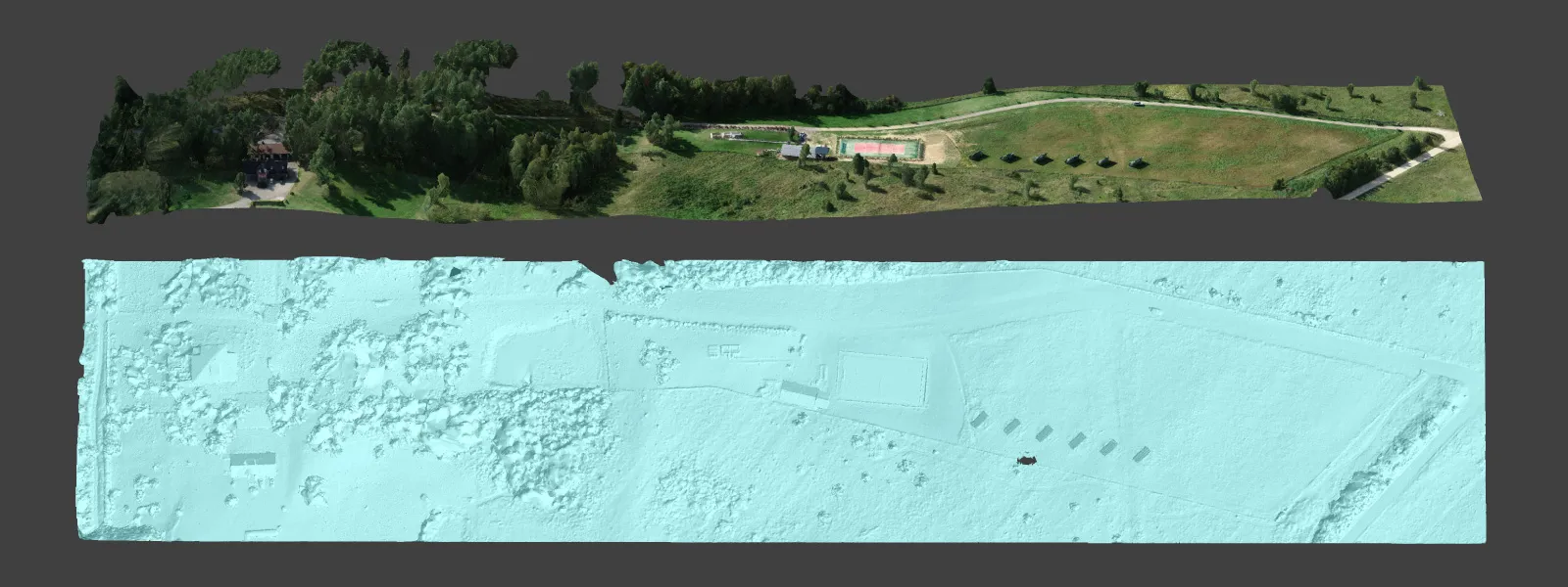
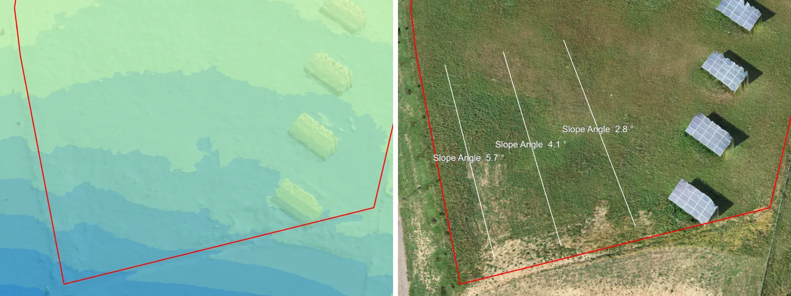
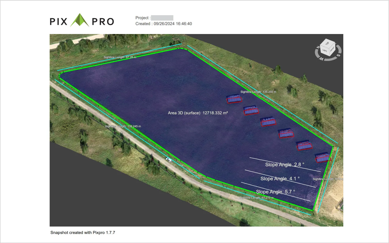
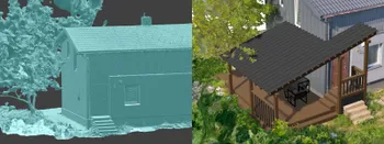
 Lines will contain linear and angle measurements, while polygons will contain area, surface, and volumetric measurements. In our case, we drew lines and polygons on the digital elevation map with an orthophoto layer and 3D mesh with texture to measure the sections and areas the client pointed out.
 We exported these measurements as Pixpro snapshots, which, alongside the project, were sent to the client and the people selling the lawn-mowing robots. We did quite a lot of these, and we are showing just a few examples here.
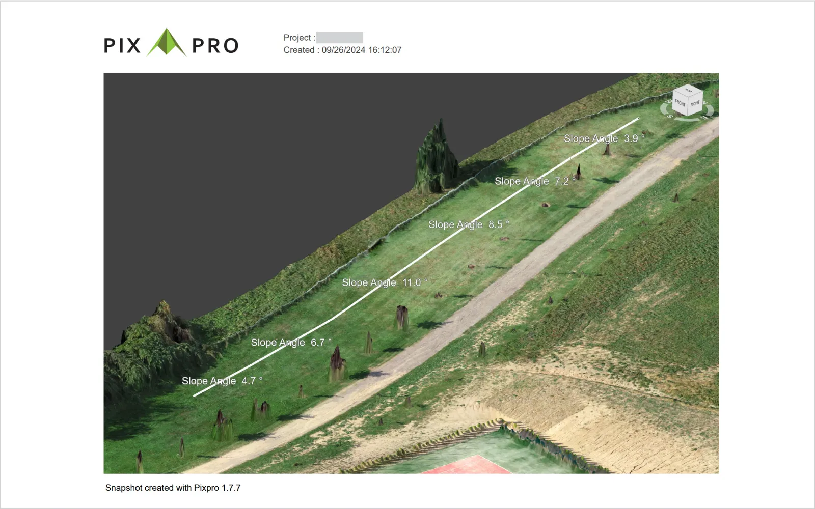 But you can imagine that the size of grassy areas, potential obstacles, and slope angles were the most critical information points. The mowing robots can be limited by the terrain slope they must overcome and, of course, by the area they have to service. Because we are measuring the scene in 3D, we have actual surface area measurements, which can not be obtained by just measuring orthophoto layers in maps.
 Conclusion
Another use case is another job done in a particular field. In the past, we encountered some landscape design use cases; this one was particular and practical. Now, the property owner and equipment deal have actual data to go on and make the best decisions. Automated systems for such areas will not be cheap, and getting things right the first time is essential. It is improbable that the property will change that much so that data will be long-lasting. All are done with Pixpro photogrammetry and have a bit of experience.

Photographer - Drone Pilot - Photogrammetrist. Years of experience in gathering data for photogrammetry projects, client support and consultations, software testing, and working with development and marketing teams. Feel free to contact me via Pixpro Discord or email (l.zmejevskis@pix-pro.com) if you have any questions about our blog.
Related Blog Posts
Our Related Posts
All of our tools and technologies are designed, modified and updated keeping your needs in mind
Handheld Photogrammetry Construction Interior Scan Use Case
Interior 3D scanning can be useful in a myriad of ways. In this article, I present a scan of a residential building construction site, with its foundation walls and roof almost complete. Further construction will require some visualizations and design according to “the fact.”
Event Planning with Photogrammetry – Use Case from A to Z
Photogrammetry for event planning was the first use case I wrote about on this blog. Now we are back with another venue and an event that will take place in a couple of months.
Individual Property Architecture - Photogrammetry Use Case
If you love doing your own small-scale renovations, planning, and building—this use case is for you. Photogrammetry can provide a framework that allows you to eliminate dozens of questions, replace traditional time-consuming methods, and reach a better result.
Ready to get started with your project?
You can choose from our three different plans or ask for a custom solution where you can process as many photos as you like!
Free 14-day trial. Cancel any time.