Multi-battery Scans with Pixpro Waypoints
 Lukas
Zmejevskis

Pixpro waypoint service enables us to do grid flights with the best consumer-grade drones on the market. It is based on the current waypoint functionality, which has a limit of 101 waypoints. With a grid flight, such a limit means little, and we can still plan massive flights. In most cases, our limit will be how many batteries we have. In this article, we go over how to change batteries during a large grid scan when using waypoints.
Single Battery
The flight time of a drone battery depends on a few key factors:
-
Ambient temperature. Temperatures below 10 degrees Celsius will reduce the flight time due to cold, while extreme heat above 40 C might mean battery overheating. Well-designed drones have "built-in" cooling, with the propellers moving air through the drone body itself, so overheating during flight is rarely an issue.
-
Wind conditions. If a flying drone has to fight wind - the efficiency drops substantially.
-
Battery health. How old is the battery, and how many cycles it has. Batteries drop the actual capacity and even the discharge voltage with time and use. Modern batteries have self-care; all we have to do is not leave almost empty batteries. Just charge them if depleted, and the batteries will discharge themselves to a storage state when enough time passes.
Changing Batteries in a Waypoint Flight
When using waypoint flights, there is no "automated" process of ending and resuming a flight, but the workflow is quite straightforward. We can choose from which waypoint we begin the flight. This allows us to select any starting point as long as it corresponds to any of the waypoints. When a waypoint plan is loaded in the DJI fly app, each waypoint is marked with a number as a dot. You can also see the direction the drone will face from that waypoint.
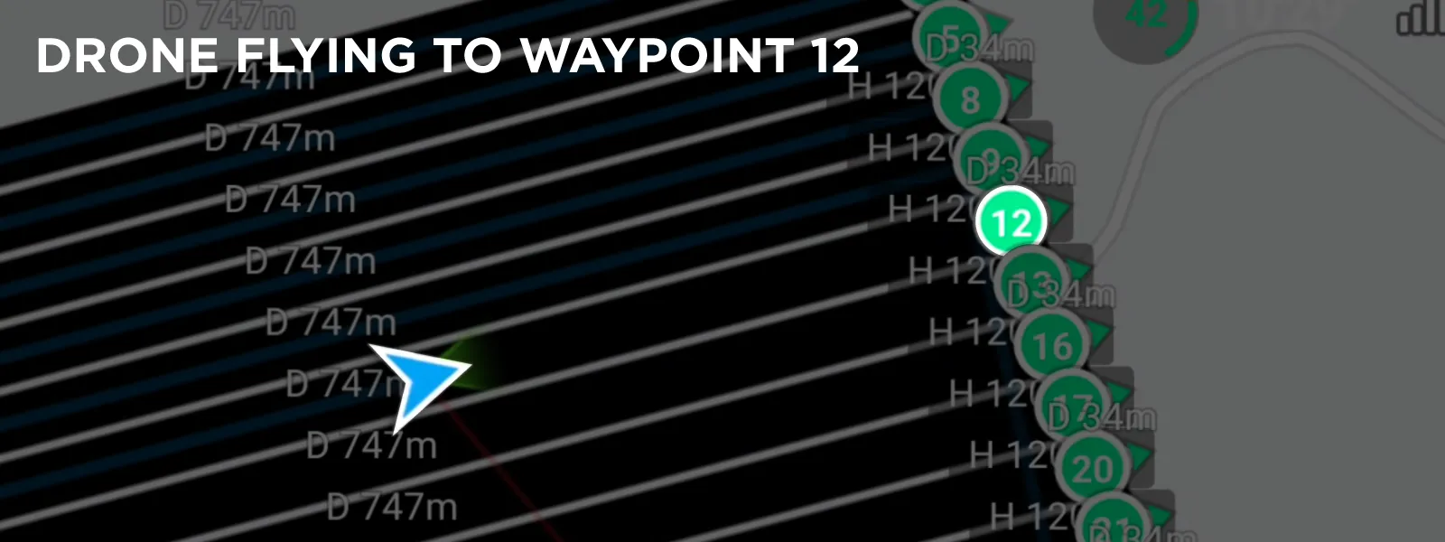 A grid flight has a clear pattern of points, so you essentially have one option—terminate the flight at the end or beginning of one of the lines. Just monitor the waypoint pattern during the flight, and once you feel like there is enough battery to get back, pause the waypoint flight and head home. Remember the last point the drone visited, and this will be your starting point after you change the battery. The previous waypoint is displayed in the progress section at the bottom.
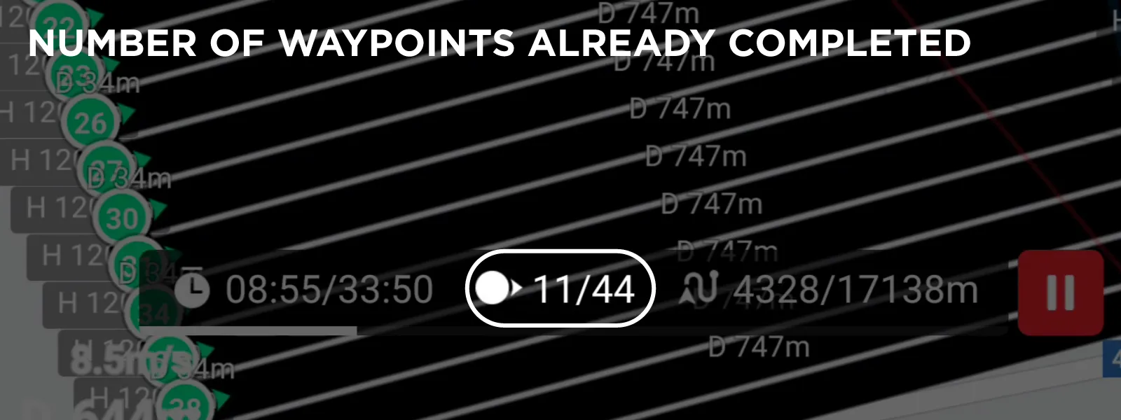 Once you land with a paused waypoint flight, it will reset, so you must remember the last point from which you need to resume the flight. Change the battery and choose your starting waypoint accordingly. Below is a screen capture of the processes described above.
Additional Tips
Here is a list of practical suggestions and tips when it comes to large grid scans and using Pixpro waypoints service:
-
The service estimates the flight time by calculating the length of the total flight path plus adding some time for takeoff and landing. It does not take into consideration the number of takeoffs and landings, so always keep in mind that the total time of the job will be considerably higher.
-
Notice how long it takes the drone to reach the grid's starting point and how much battery it takes to even begin the grid flight.
-
If possible, position your takeoff location within the scan area to maximize battery use by eliminating the need for the drone to reach the area first. If you can move with the drone while it is flying, that is even better; just do not get in the camera's field of view.
-
During a large, long scan, you are likely to encounter changing conditions, as we did when making our example. Choose auto shutter speed for exposure and fixed or auto ISO to mitigate that. You can fix ISO sensitivity at 100 on a bright, sunny day.
-
Shooting raw is always safer, but remember that raw images take up much more space, which may concern large datasets.
-
With the screen recording on a bright summer day in direct sunlight, the phone running the app overheated during the long flight. This is just something to keep in mind.
Big Scan Example
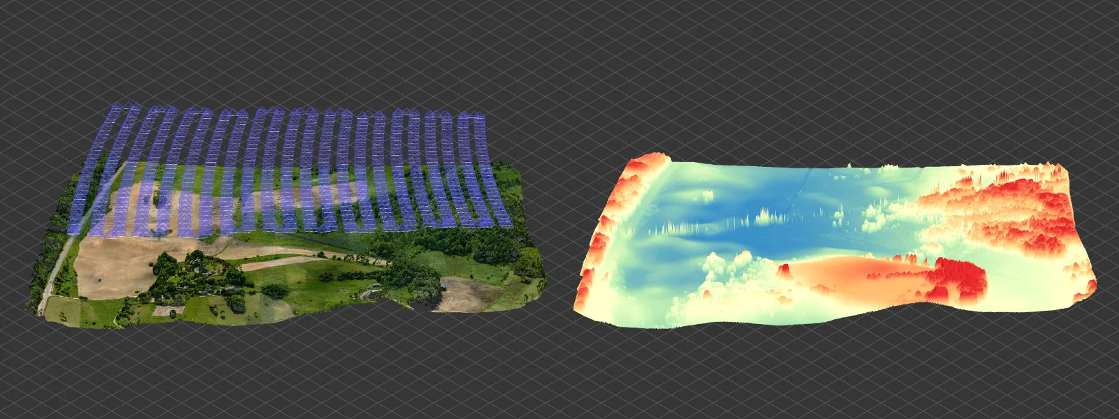
As a test, we did an example scan, which was quite large. The initial estimation on the Waypoints service was 36 minutes. However, including all of the battery changes, the total time of the job was 44 minutes, of which maybe 3 were spent on the ground changing batteries.
We made two battery changes and completed the area scan by using three fully charged batteries with the DJI Mini 4 Pro. One of those batteries was a less powerful one. Pixpro waypoints service estimated 680 photos, but we got 711 in total.
 We played it safe and did not push the batteries to the estimated RTH values. In our long-term experience, the return to home works quite well, and we rarely get anxious about the drone not returning in time. As we had three full batteries this time, the standard fly more kit, we could afford to return just a bit early. You can see the screen capture of the flight we did below.
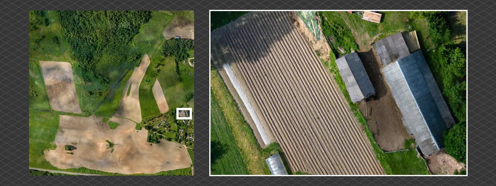
We processed the photos using Pixpro photogrammetry software and obtained a reasonable reconstruction of the scanned terrain. The terrain is not flat, so there were no issues with the 3D reconstruction, even without adding any oblique data. As a final result, we made an orthophoto image.
Conclusion
The battery change is relatively easy, and we hope this article helps you prepare for large gird flights you may take using the Pixpro waypoints service. The service is available for every Pixpro user with an active license or free trial, and we have version 2 with improvements on the way. With our service, you can achieve large-scale scans without paying the inflated price of enterprise drones.

Photographer - Drone Pilot - Photogrammetrist. Years of experience in gathering data for photogrammetry projects, client support and consultations, software testing, and working with development and marketing teams. Feel free to contact me via Pixpro Discord or email (l.zmejevskis@pix-pro.com) if you have any questions about our blog.
Related Blog Posts
Our Related Posts
All of our tools and technologies are designed, modified and updated keeping your needs in mind

Viltrox 14mm vs. Pergear 14 mm Lens – Choosing for Interior Photogrammetry
Ultrawide-angle lenses are most commonly used in photogrammetry for interior scanning. I am planning to do an interior-type construction site scan, so I need a lens for my Sony full-frame camera. There are plenty of premium wide-angle options, but I need something that provides the best image qualit

Gaussian Splatting vs. Photogrammetry
Every few years, something new shows up online claiming to “revolutionize” 3D reconstruction. A while back it was NeRFs. Now it is Gaussian splatting — with endless YouTube clips of people walking through photorealistic 3D scenes that seem to render instantly.
Photo Dynamic Range - Real Life Tests and Advice
Dynamic range is an inescapable term when talking about digital photo or video capture. Our human vision has an incredible ability to adapt, allowing us to perceive both very dark and very bright scenes. When a digital imaging sensor or even a chemical negative captures a scene frozen in time, it is
Ready to get started with your project?
You can choose from our three different plans or ask for a custom solution where you can process as many photos as you like!
Free 14-day trial. Cancel any time.
.svg@webp)
