Multi Camera Photogrammetry in Pixpro
 Lukas
Zmejevskis
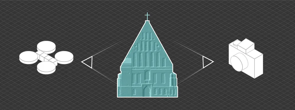
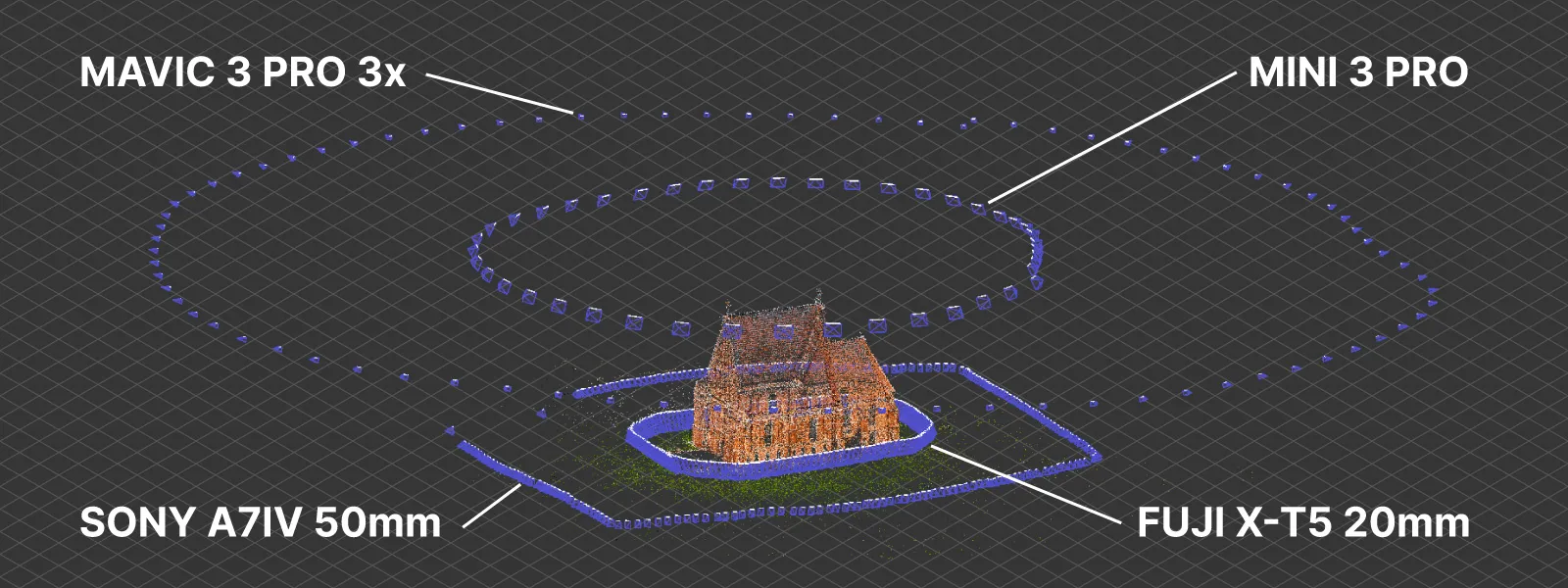
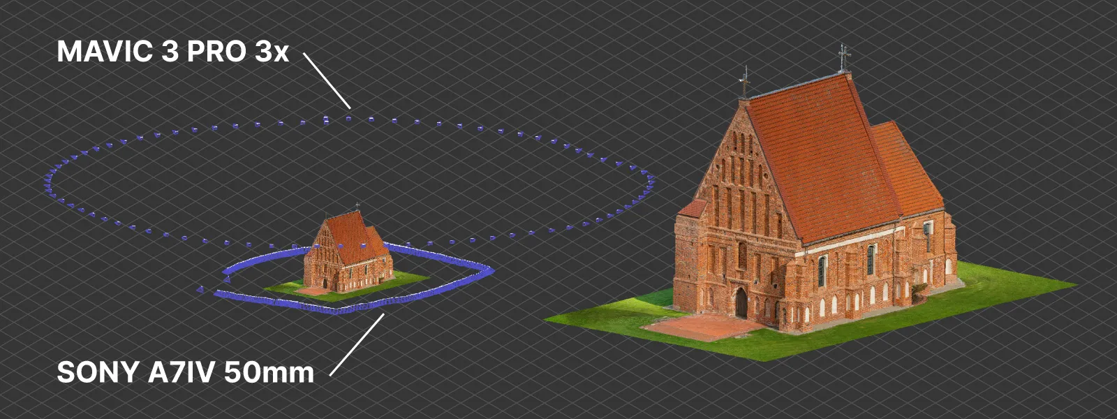
Using two or more cameras in a single scan provides better coverage, detail, and convenience. But it also poses a few challenges. In this blog post, we will go over the fundamentals of combining two or more different imagery sources to get a successful 3D reconstruction in one go. We have a simple use case of combining terrestrial camera shots with drone photos for a building scan, and we will be using Pixpro software’s latest version.
Why Use Multiple Cameras?
Using a few cameras may be essential for more difficult scans or if the detail and quality requirements for the end product are high. In our use case, we combine terrestrial photos with aerial photography, which provides a different perspective and helps retain the detail lost with aerial scans unless you can fly really low. Meanwhile, aerial images provide a top-down perspective and enable scaling via GPS photo metadata (most terrestrial cameras cannot store decently accurate GPS data). So even if a large number of photos do not contain GPS data, those that do allow the entire project to be measured and placed correctly on the map.
Advice on Multi-camera Photogrammetry
All of the basic 3D photogrammetry fundamentals apply in our use case. The most critical factors are excellent photo quality, overlap between photos, and coverage of the entire subject. However, we have different imagery sources, for example - terrestrial and aerial. In that case, we must take great care to ensure overlap between different sets of photos.
Overlap between different sets is much harder to quantify, and degrees of acceptability will vary according to the software used, reconstruction settings, and the subject itself. It is challenging to give exact advice on capturing from multiple cameras and avoiding split or failed reconstructions. These are our thoughts currently:
-
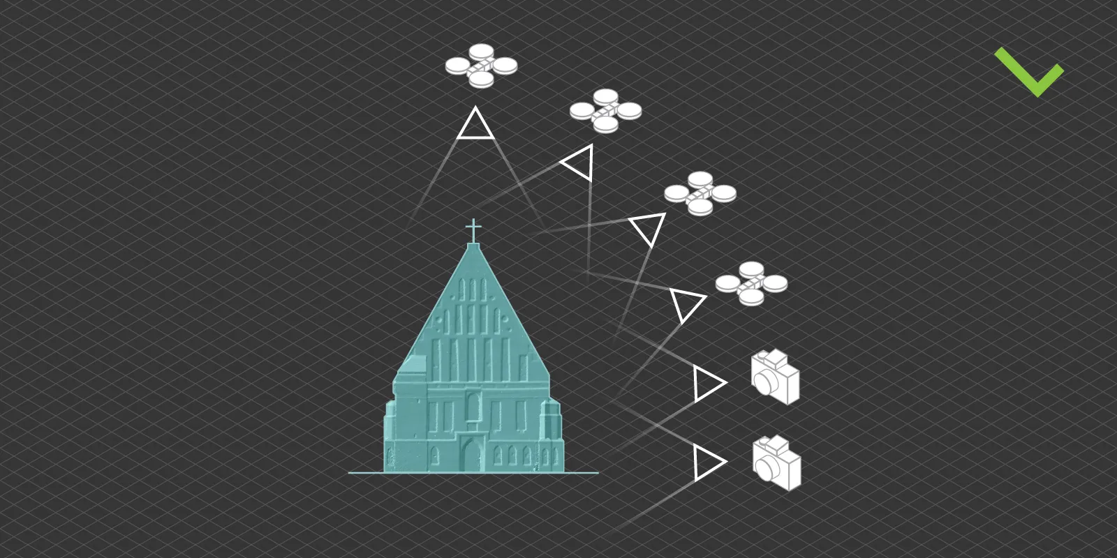
For the safest approach, treat both cameras as one and keep the path and overlap the same. This is the most tedious and time-consuming approach, but it is the safe bet. It would involve flying your drone as low as possible and taking over with a camera at the heights you can physically reach. However, this approach is not necessary for good 3D reconstruction.
-
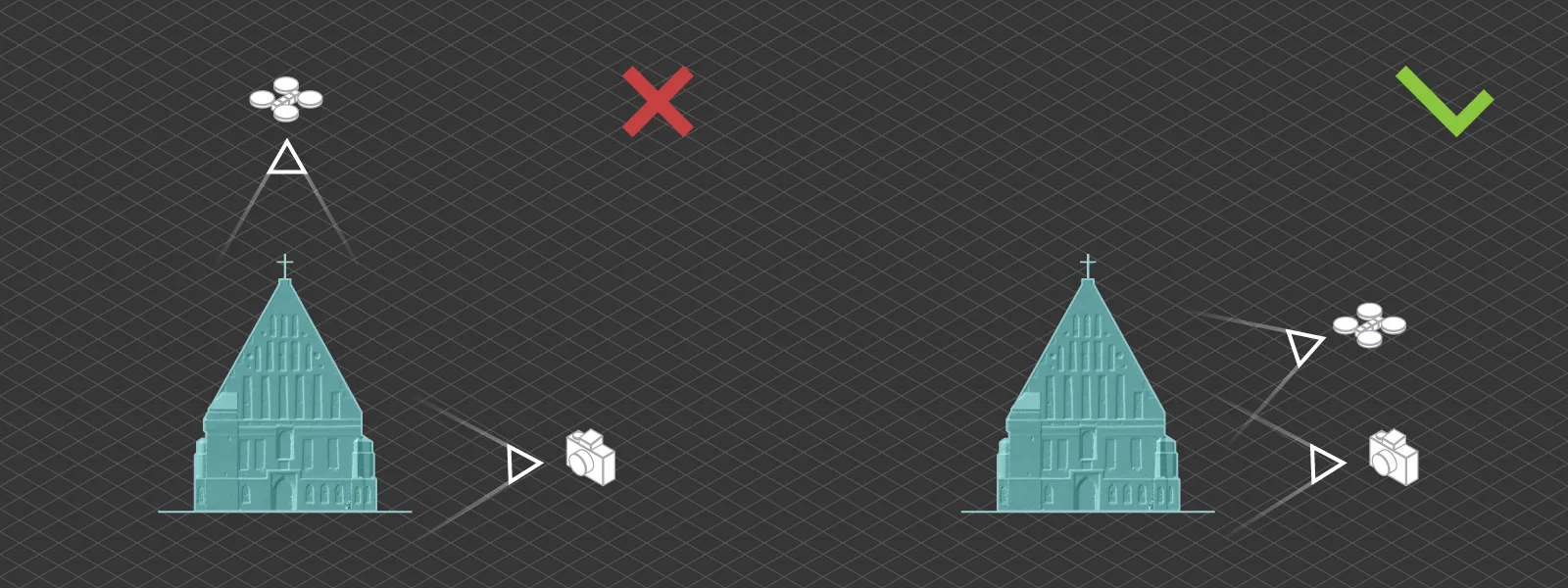
Use your vision and keep the subject equally recognizable in all cameras. This means that the subject must remain of similar size in all camera views, and the angle changes between different photo sets can not be drastically different. For example, you will not find success combining orbital sets made at 90-degree angles to each other.
-
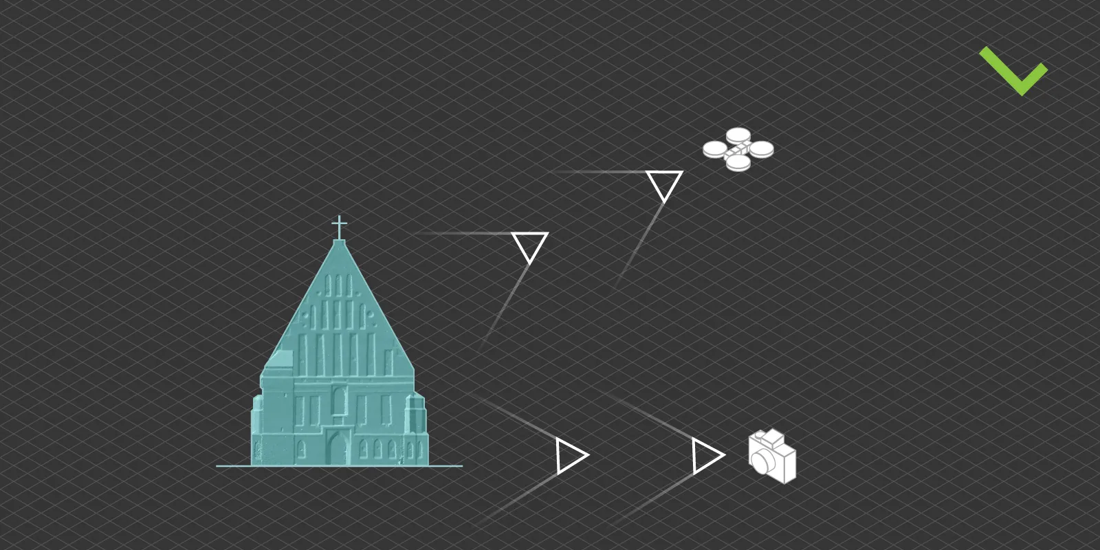
Add plenty of “overarching” photo sets from all cameras containing the subject and the environment. Combine these sets with the more detailed scans, which may help fill the gaps where overlap may be insufficient.
-
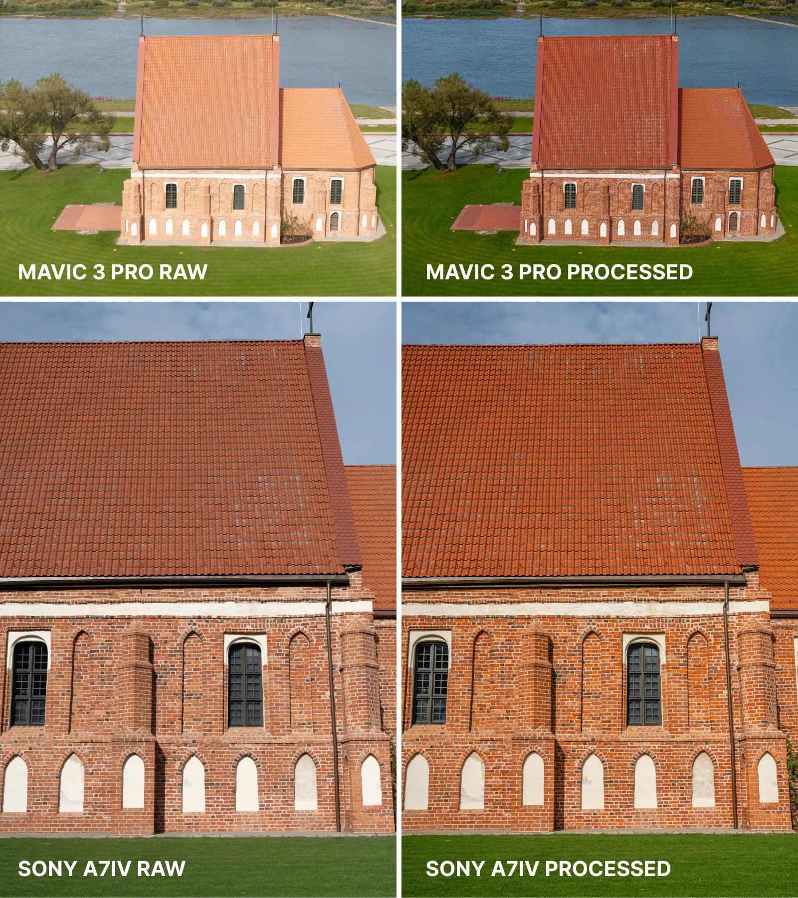
Keep photos technically similar between different devices. So - identical exposure, equal color balance, and proper focus on the subject. Motion blur should also be controlled equally well in all photo sets.
As we also learn to use multi-camera sets with our software, we will expand this list of advice to help ensure the best results.
Raw Processing for Photogrammetry
Shooting raw also has additional benefits when using a few different cameras. Different sensor and lens combinations provide slightly different outcomes even if you meticulously sync up all camera photo settings. Suppose you capture your photos in raw format initially. In that case, you can adjust exposure, contrast, and white balance with no or minimal loss of quality. If you are serious about texture aesthetics, you can do color-matching work to make results indistinguishable between different cameras.
Also check our article on Raw Processing for Photogrammetry
Workflow in Pixpro Software
The workflow in Pixpro remains unchanged, whether using one or more cameras. Select your photos and the workflow settings, and you are good to go. Our recently implemented camera manager will list all the cameras in the project and their intrinsic values after the reconstruction is complete if you are interested in the details.
Otherwise, all other general aspects of working with Pixpro apply. We always recommend cropping the point cloud to include only the area of interest before generating 3D meshes or digital elevation maps; default settings are usually the best option for many.
Pixpro 1.7.3
This article coincides with a minor new version release of Pixpro, including improvements for multi-camera support under the hood. Other notable changes or features are:
-
More graphical flexibility for point lines and polygon objects.
-
Automatically estimated clipping box to reduce initial point cloud size.
-
General orthophoto quality and color corrections improvements.
-
Expanded list of available coordinate systems.
-
More formats for object import and export (.csv, .gpx, etc.)
-
Additional global options for performance and visuals.
And many more small improvements under the hood. You can try the latest version of Pixpro photogrammetry software by downloading it from this website.
Conclusion
Creating multi-camera photo sets for photogrammetry will involve trial and error, and it is an advanced skill for a photogrammetrist. It also unlocks such opportunities as combining interior and exterior scans or scans with varying levels of detail in different areas of interest. Nevertheless, it is another tool, and you can try it now with our software.

Photographer - Drone Pilot - Photogrammetrist. Years of experience in gathering data for photogrammetry projects, client support and consultations, software testing, and working with development and marketing teams. Feel free to contact me via Pixpro Discord or email (l.zmejevskis@pix-pro.com) if you have any questions about our blog.
Related Blog Posts
Our Related Posts
All of our tools and technologies are designed, modified and updated keeping your needs in mind
Handheld Photogrammetry Construction Interior Scan Use Case
Interior 3D scanning can be useful in a myriad of ways. In this article, I present a scan of a residential building construction site, with its foundation walls and roof almost complete. Further construction will require some visualizations and design according to “the fact.”
Event Planning with Photogrammetry – Use Case from A to Z
Photogrammetry for event planning was the first use case I wrote about on this blog. Now we are back with another venue and an event that will take place in a couple of months.
Individual Property Architecture - Photogrammetry Use Case
If you love doing your own small-scale renovations, planning, and building—this use case is for you. Photogrammetry can provide a framework that allows you to eliminate dozens of questions, replace traditional time-consuming methods, and reach a better result.
Ready to get started with your project?
You can choose from our three different plans or ask for a custom solution where you can process as many photos as you like!
Free 14-day trial. Cancel any time.
.svg@webp)
