Responsible Waste Management With Photogrammetry

| Industry | Waste management, Mining, Inspection, Environment protection |
| Objective | Proper formation of the waste heap, timely landslide prevention |
| Drone | DJI Phantom 4 Pro RTK |
| Flight Data | Camera angulation: Nadir (90o) Grid: Single Grid Height: 101 m Duration: 36min |
| Dataset Size | 610 images |
| Data Processing | 40 min using medium software settings |
| Hardware | Intel i7 8700, 16 GB of RAM, dual Radeon rx580, SSD drive |
Proper Waste Heap Formation
Nowadays, the waste management is strictly regulated all over European Union. Countries are striving to recycle as much waste as possible to collect, accumulate and utilize them properly. Waste management with photogrammetry helps to meet all requirements.
The dumps must be piled up separately, one after another in a row. This ensures the collected water and filtrate shall be collected separately from the contaminated water.
The landfill bottom must be designed to be prevented from the slope erosion.
The dump projects must include an environment monitoring program. Hence, the dumps must be exploited so that the negative impact on the environment and human health is as low as possible. Noteworthy, contaminants, dust, smells and volatile waste as well as aerosol clouds and fires may have grave consequences on human health.
The dumped waste must be piled up in the manner that ensures the landfill construction as well as waste pile stays stable and solid without any landslide.
After that, the landfill is closed according to the prepared and approved project.
During the dump exploitation period and after it, as long as the dump may cause any danger to the environment and human health, the operator must carry out the dump monitoring in accordance with the established method approved by the environmental law.
The regional departments of the Ministry of Environment can revoke the permissions for the use of natural resources and ban the exploitation of the dump. This might happen if the operator does not apply the established means of dump management and/or closing stated in the dump management plan.
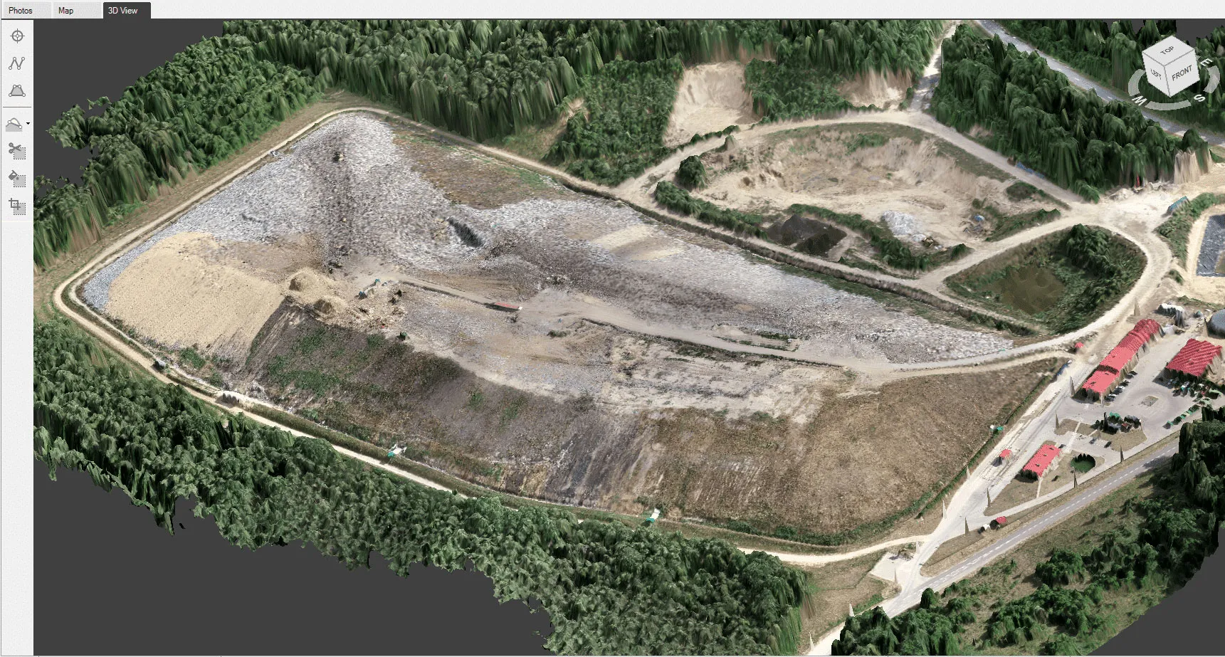
To ensure timely and comprehensive monitoring of the dump, we have employed photogrammetry. The photogrammetric approach enables collecting comprehensive factual data as well as comparing the data to the available project data and drawings.
Data Gathering for Waste Management
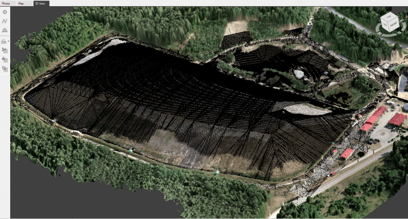
To gather the necessary data for the 3D model reconstruction of this waste pile, a DJI Phantom 4 Pro RTK drone was flown at an altitude of 101 meters. 610 images were done using a 20-megapixel, 1-inch imaging sensor camera. Total flight time took 36 minutes.
Data Processing
The Pixpro software reconstructed this waste pile in 3 hours 27 minutes. The full analysis of the object was performed on the DEM layer which provides extremely accurate and only slightly averaged data.
Data Analysis
Probably the most important task of the dump operator is a formation of the waste heap and evaluation of the capacity of waste in the landfill.
Nowadays, almost all dumps have project drawings which they follow whilst forming the waste heap and monitor potential deviations on regular basis as well as guide themselves to provide the declarations to the environmental institutions.
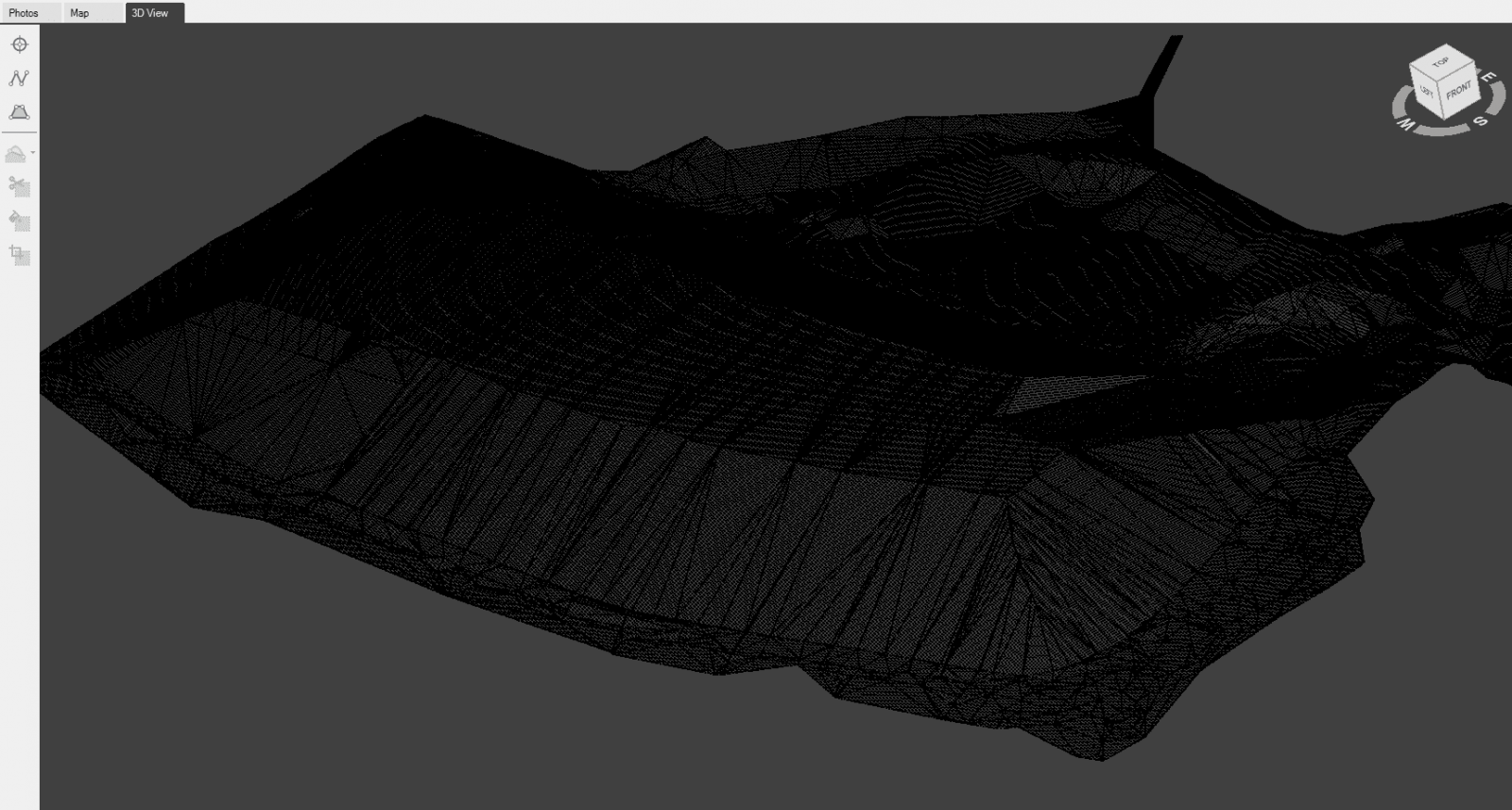
Unfortunately, currently the monitoring is carried out only once a year due to the highly time-consuming and expensive methods.
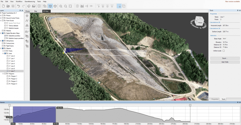
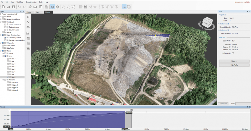
Using the photogrammetric method, the reconstructed 3D model of the waste landfill consists of rich and wide range-data. This includes:
- area: 2D and 3D (e.g. in case it is important to evaluate the evaporating surface area)
- volume (including possibility to choose various bottom interpretation options)
- distance between selected points
- accurate geographic data
- slope height and angles
- waste heap cross-cut (profile)
The acquired data creates even more value when the data is compared with:
- the 3D model data that was gained during previous session
- AutoCad drawing data

Data comparison is rather easy and fast. The obtained data provides both numeric and visual information.
Visually, you can detect:
- The landslides if any
- The exceeded heights of particular sections if any

- The evenness of the surface
- The possible amount of the waste to deliver additionally

Digitally, you can compare the difference in volumes.
The mentioned information is exceptionally useful since it allows performing heap corrections without waiting one more year to come. That is faster and simpler.
Photogrammetry For Waste Management
Waste management with photogrammetry, enables the necessary information to be collected quickly and simply. The operator does not need to walk around the waste heaps. It is enough to fly the drone and make the photos of the dump.
It is a speedy method as the photo capturing using the drone takes up to 30 minutes, and the data processing – up to a couple of hours.
The reconstructed 3D model of the waste heap provides a lot of highly valuable information. You can perform various measurements on any point of the model’s surface.
Data comparability is unrivaled when accurately evaluating the process of waste heap formation and whether it goes according to the plan. It can be done both visually and numerically.
Data persistence. The collected data never disappears. Even after several years, you can measure the old heap in different places within the old project.
Photogrammetry significantly cuts down time consumption and financial expenses. Therefore, the dump management companies tend to prefer more frequent data control and faster perform required heap formation corrections.
Related Blog Posts
Our Related Posts
All of our tools and technologies are designed, modified and updated keeping your needs in mind
Handheld Photogrammetry Construction Interior Scan Use Case
Interior 3D scanning can be useful in a myriad of ways. In this article, I present a scan of a residential building construction site, with its foundation walls and roof almost complete. Further construction will require some visualizations and design according to “the fact.”
Event Planning with Photogrammetry – Use Case from A to Z
Photogrammetry for event planning was the first use case I wrote about on this blog. Now we are back with another venue and an event that will take place in a couple of months.
Individual Property Architecture - Photogrammetry Use Case
If you love doing your own small-scale renovations, planning, and building—this use case is for you. Photogrammetry can provide a framework that allows you to eliminate dozens of questions, replace traditional time-consuming methods, and reach a better result.
Ready to get started with your project?
You can choose from our three different plans or ask for a custom solution where you can process as many photos as you like!
Free 14-day trial. Cancel any time.
.svg@webp)
