Drone Mapping Industry Evolution
Drone mapping evolution is so fast that it is hard to follow all the industry news. UAVs are getting smarter, faster and overall more complex but there are a couple of trends that are about to move the drone photogrammetry to the next level.
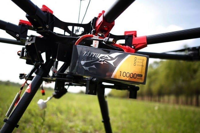
Smaller drones with good battery life is the future
The launch of DJI Mavic Pro showed that hardware providers are working on making smaller and lighter devices. Besides the portability, the reason for that is the battery life. The more you save on size and weight, the longer your drone can last on a single charge and today the flight time is the biggest limitation of the technology.
There is a linear relation between the size of the area you can map during a single flight and the battery life. Normally, fixed wing drones can survey up to several square kilometers and copter drones below half a square kilometer during a single flight. Extending the battery life could enable plenty of new applications or significantly improve currently offered drone mapping services.
Drones with various sensors and capabilities
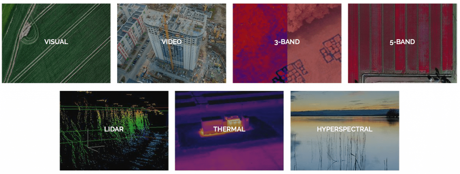
Most of the drone mapping use cases (you can read ours at: https://www.pix-pro.com/blog/category/use-case) today are based on a regular RGB visual sensors. The price decrease of advanced sensor technologies now allows using them with UAV platforms. Some companies already offer a whole range of mapping sensors including multispectral, hyperspectral and thermal cameras as well as LiDAR.
Automated drone flights for efficiency
Today, UAVs are typically controlled by human operators, that have to plan the flight, go to the field, launch a drone, complete the survey in single or multiple rounds. The scope of the project is limited by a range of the drone and the required resolution. So, if you have a large object to survey, you need many drones with multiple operators or one operator that gradually collects data for the whole project area. It complicates the operations in the field, increases the cost and compromises the available temporal resolution.
The developments in drone control technologies will soon solve the problem. Imagine that an operator controls not a single UAV but a whole fleet of dozens of autonomous flying robots. The central system divides the survey area between them. Real-time flight path tracking and dynamic flight recomputation allow the fleet to autonomously correct their route depending on the location of other devices.
Surveying and photogrammetry with UAVs
A growing number of surveying companies are working with UAVs. These are equipped with digital cameras to provide high resolution aerial imagery, which is then further processed to produce highly precise orthophotos, point clouds and 3D models. Drones build on photogrammetry’s key strengths: affordability, availability and versatility.
Based on photogrammetry and computer vision, Pixpro created its software solution. With Pixpro software everyone can process both handheld or aerial photos for high accuracy reconstruction, sleek visualization and detailed analysis of the object in a 3D mode.
3D object reconstruction with photogrammetry
With photographs and photogrammetric software one can create realistic 3D models. If we have at least 3 photos taken from a different angle (collected manually or with drones), we can already reconstruct the 3D model of the object. However, the more pictures, the better. Using photogrammetry software that reconstructs 3D objects from aerial images, one can get not only an overview of the actual situation, but also to perform various simulations, plan work, increase safety, and anticipate the use of vehicles.
3D reconstruction is made using native Pixpro photogrammetric engine. User can generate sparse point cloud, clone it and use it for DEM creation or generate more accurate dense point cloud. 3D object reconstruction with a drone does not face any limits. Therefore, data processing is simple, accurate and can be run as often as required.
In order to facilitate data processing, there is a number of optimization functionalities, that simplifies the whole process:
- Unlimited size orthophoto;
- Unlimited digital elevation map size;
- Fast and more advanced project loading;
- Possibility to select Intrinsic Optimization mode before reconstruction;
- Auto calibration mode;
- Possibility to select predefined intrinsic set form internal database.
Drone mapping industry future – photogrammetry
All of these developments are indicative the revolution of drone mapping industry. The desire to figure out what it means to effectively integrate drones into a surveying business or workflow showcase why the opportunities that exist for drones in this space are especially lucrative and efficient.
Related Blog Posts
Our Related Posts
All of our tools and technologies are designed, modified and updated keeping your needs in mind
Drone Flight Simulators – GPS, FPV, Fixed-Wing Drones?
Flying drones is fun—and it can be helpful. In this article, I will tackle a few questions you may naturally ask when getting into the drone thing. We will also look at virtual flying, the logical first step when learning anything in the radio control hobby space.
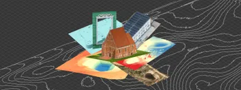
Where do we use Photogrammetry? A list of 3D scanning use cases.
Photogrammetry has revolutionized numerous industries by transforming real world scenes into 3D models, using only simple photographs and processing algorithms.
ChatGPT – Image Quality Checking for Photogrammetry with AI
Good input data is everything in photogrammetry. The results we get from processing can never "exceed" what we input into the software. If only we could always check our input data before starting the relatively long process of 3D reconstruction.
Ready to get started with your project?
You can choose from our three different plans or ask for a custom solution where you can process as many photos as you like!
Free 14-day trial. Cancel any time.
.svg@webp)