.svg@webp)
Pixpro photogrammetry blog
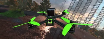
Drone Flight Simulators – GPS, FPV, Fixed-Wing Drones?
Flying drones is fun—and it can be helpful. In this article, I will tackle a few questions you may naturally ask when getting into the drone thing. We will also look at virtual flying, the logical first step when learning anything in the radio control hobby space.
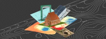
Where do we use Photogrammetry? A list of 3D scanning use cases.
Photogrammetry has revolutionized numerous industries by transforming real world scenes into 3D models, using only simple photographs and processing algorithms.

ChatGPT – Image Quality Checking for Photogrammetry with AI
Good input data is everything in photogrammetry. The results we get from processing can never "exceed" what we input into the software. If only we could always check our input data before starting the relatively long process of 3D reconstruction.
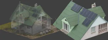
Roof Scan for Inspection and Solar Panel Addition – Use Case
Roof photogrammetry is one of our client base's most common use cases. Obtaining accurate measurements is essential for designing a solar panel layout, determining how many panels fit on a roof, and conducting a prior inspection.
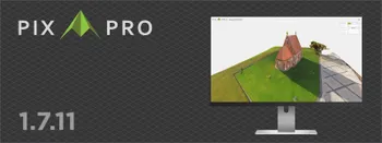
Pixpro 1.7.11 - Seamless Model Sharing
We are keeping the development cycle relatively short these days, so here is a new update to our photogrammetry software. Update 1.7.11 brings improvements related to our cloud service.

No. 1 Mistake You Are Making in Photogrammetry Right Now
As photogrammetry software developers, we need to troubleshoot multiple projects from our clients every week. The number one mistake, especially when making measuring projects, is using redundant photos. These photos can appear for a few reasons, which I will describe, and they can be quickly dealt
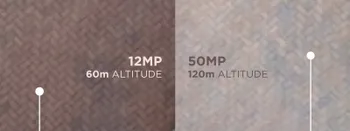
Resolution vs. Altitude: Do 50 Megapixels Actually Matter?
We all know that megapixels are not the only defining factor of image quality, and the megapixel race is long over. However, we need to know their uses when we have two resolution options.
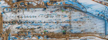
Dealing with Snow and High Contrast - Aerial Construction Site Scan
Aerial photogrammetry is dependent on the weather conditions, and there is no other way around it. While we can not fly our drones during extreme weather - dealing with something like a little cold or snow is not that hard.
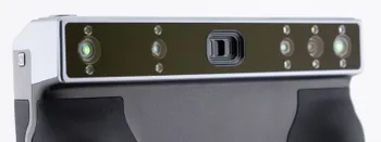
Revopoint Miraco Plus 3D Scanner - First Impressions
3D scanners were these exotic, expensive devices that seemed to do magic. This is not the case anymore. This article is not a full review, but it contains my first impressions and initial thoughts while keeping my experience in photogrammetry in mind.
Ready to get started with your project?
You can choose from our three different plans or ask for a custom solution where you can process as many photos as you like!
Free 14-day trial. Cancel any time.
Welcome to Pixpro
Sign in
And access your account.