.svg@webp)
Surveying and Mapping
Blogs posts and use cases regarding the Surveying and Mapping activities.
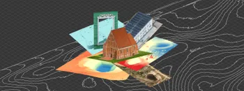
Where do we use Photogrammetry? A list of 3D scanning use cases.
Photogrammetry has revolutionized numerous industries by transforming real world scenes into 3D models, using only simple photographs and processing algorithms.
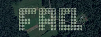
Most Asked Questions - Pixpro Waypoints
We have been receiving a lot of questions about our waypoint service. Pixpro Waypoints allow users to use the latest DJI drones for automated photogrammetry scans.
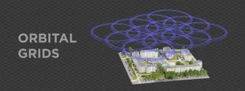
Multiple Overlapping Orbits - Pixpro Waypoints
Orbital flights are an effective and straightforward way of obtaining good-quality scans of isolated or more homogenous objects. However, if we overlap many orbits side by side, it becomes just as efficient in capturing oblique data for quite large, multifaceted areas.
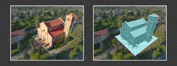
Overlap Between Different Perspectives
Photogrammetry can be simple and rigid or complex and adaptable. Combining different scan patterns adds complexity to the work but improves detail and coverage. We often use examples of combined flights, of which the orbital + nadir grid is a classic. They provide great 3D structure while being easy

Ground Sampling Distance Visualized
Ground sampling distance (GSD) is a ubiquitous term in photogrammetry. While this acronym often describes a specific scan quality aspect, it may be misunderstood or overvalued.
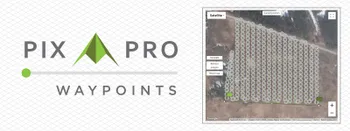
Pixpro Waypoints - Automated Photogrammetry Flights for Newest DJI Drones
The latest DJI drones are the most capable flying cameras on the market. If you need a tool like that or a competent machine for casual creation - DJI Mavic 3, DJI Mini 4, and DJI Air 3 series drones are the best.
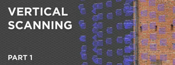
Vertical Photogrammetry Part 1 - Outdoor Walls
Walls, facades, and geological outcrops are examples where the scanned subject is entirely vertical. For some - it may be the focus of their work and the most common use case. This article begins a series on vertical scanning techniques for different subjects and situations.
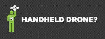
Handheld Photogrammetry with a Drone
Drones are cameras with wings and propellers. The aerial perspective often makes a drone their first dedicated imaging device for many people. Most drones can be used as good terrestrial cameras as well.
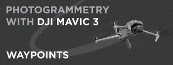
Photogrammetry With DJI Mavic 3 - Waypoints
We got access to waypoints with the most recent software update to the DJI Mavic 3. Waypoints are an automated and repeatable flight type that uses predefined points on the map. We can see the similarities between waypoints and automated grid flights in enterprise drones.
Ready to get started with your project?
You can choose from our three different plans or ask for a custom solution where you can process as many photos as you like!
Free 14-day trial. Cancel any time.
Welcome to Pixpro
Sign in
And access your account.