Pixpro Update 1.7.8 - Timeline and Speed
 Lukas
Zmejevskis
A new update to our Pixpro photogrammetry software is here. It is a small one, with only a few notable changes. However, these changes concern workflows of core features—timeline and cloud computing. It brings a major boost in performance regarding the 3D reconstruction process. So, let us go through the changes and take a deeper look into the timeline functionality, which rarely gets attention in our blog.
New Features
There are four significant changes with the 1.7.8 version:
-
Faster 3D reconstruction algorithm. We are beginning to utilize GPUs in more processing steps, which now include a large part of the initial step, which is 3D reconstruction. This particular step may run 2 - 5 times faster than before. It will be a noticeable improvement for many.
-
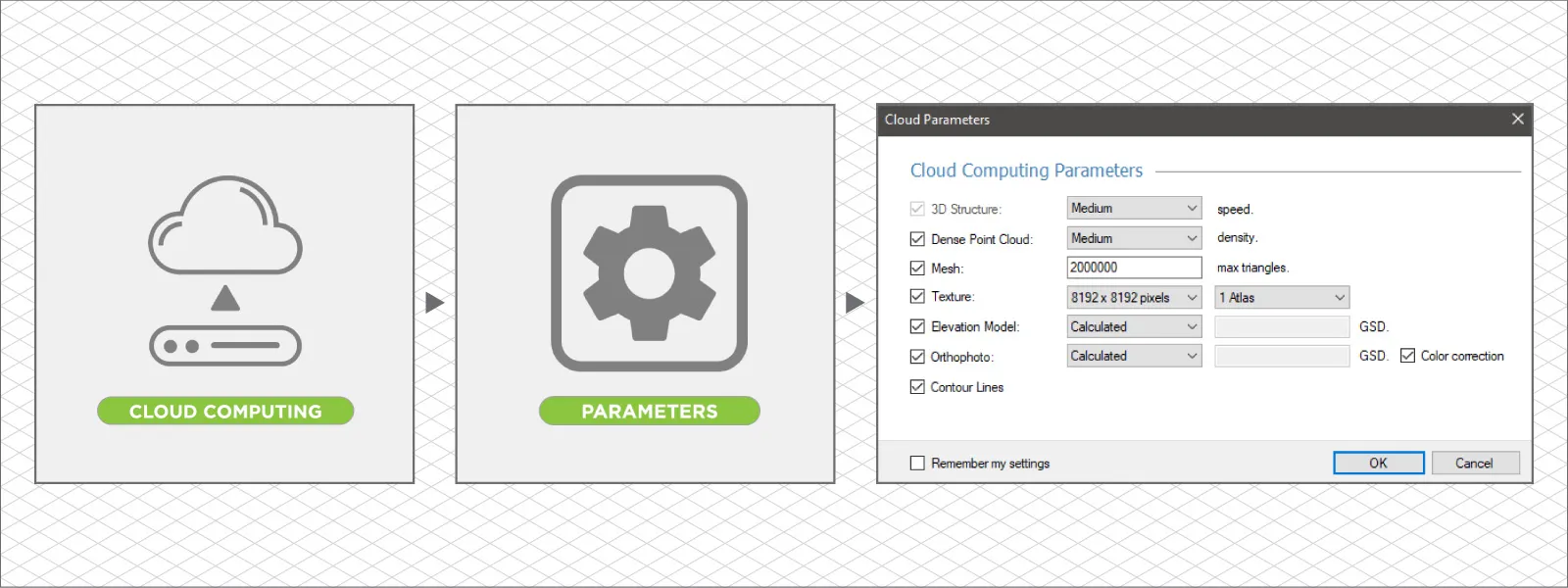
Cloud computing now has layer settings. Before this update, all cloud projects followed a default processing preset, where all layers were created with default settings. Now, we can choose which layers to make and some core settings. However, these options are not available for the cheapest Solo license users; Solo still runs everything by default. Below is a screenshot of the newly available options for all licenses above Solo.
-
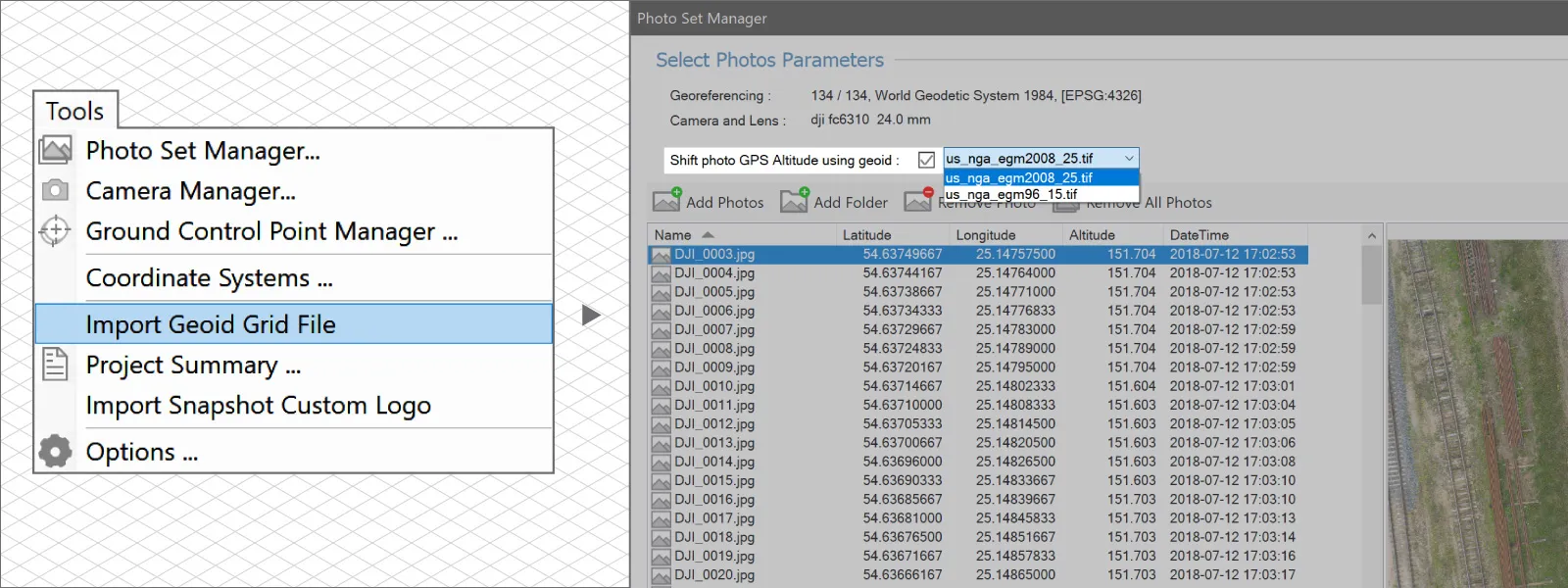
The custom geoid is now available for cloud computing. Another slight improvement for cloud users is that you can now select and use any geoid for Z coordinates when uploading photos. Just choose one from the list in the photo manager. If you want to see your geoid on the list, upload one from the tools menu. Screenshots below.
-
Timeline improvements. Timeline is a good tool for comparing volumes for polygons you draw in Pixpro. It had all of the core features, but it was pretty inflexible. After lots of user feedback, we added a few simple features that allow a more flexible approach to comparing volumes.
As always, there are bug fixes—in this case, 6 notable bugs and a number of small ones have been fixed. This is the extent of the update, but let us take a deeper look at the new timeline features and check out an example.
Timeline Features Explained
If you have multiple surfaces in one project - you can draw a polygon on one of them and then compare volumes as if the same polygon was drawn on all the surfaces. For this to work, there is a core requirement - identical referencing for all surfaces. This means that surfaces must correspond precisely in their location in the respective coordinate system. In layman's terms - they must be in precisely the same place.
This used to mean the XY and Z axes—so complete placement and orientation perfection. With the new update, we are making this a bit more flexible; you "only" need perfect XY coordinate referencing, and we can project the same polygon on the surface, even if the Z (the height) axis is offset between surfaces. You can do this by checking the Project Polygon to DEM checkmark.
Another improvement is that now we can select the reference surface to which volumes are compared and calculations made. We have three options:
-
Previous layer—this refers to the previous layer in the timeline table, so the volume difference will be shown in comparison to a layer above it.
-
First layer—as the name suggests - all entries in the timeline will have volume differences in reference to the first table entry.
-
Base surface—This option does not compare volumes between different elevation maps, but it will compare volumes above and below the selected base surface for each digital elevation map, respectively.
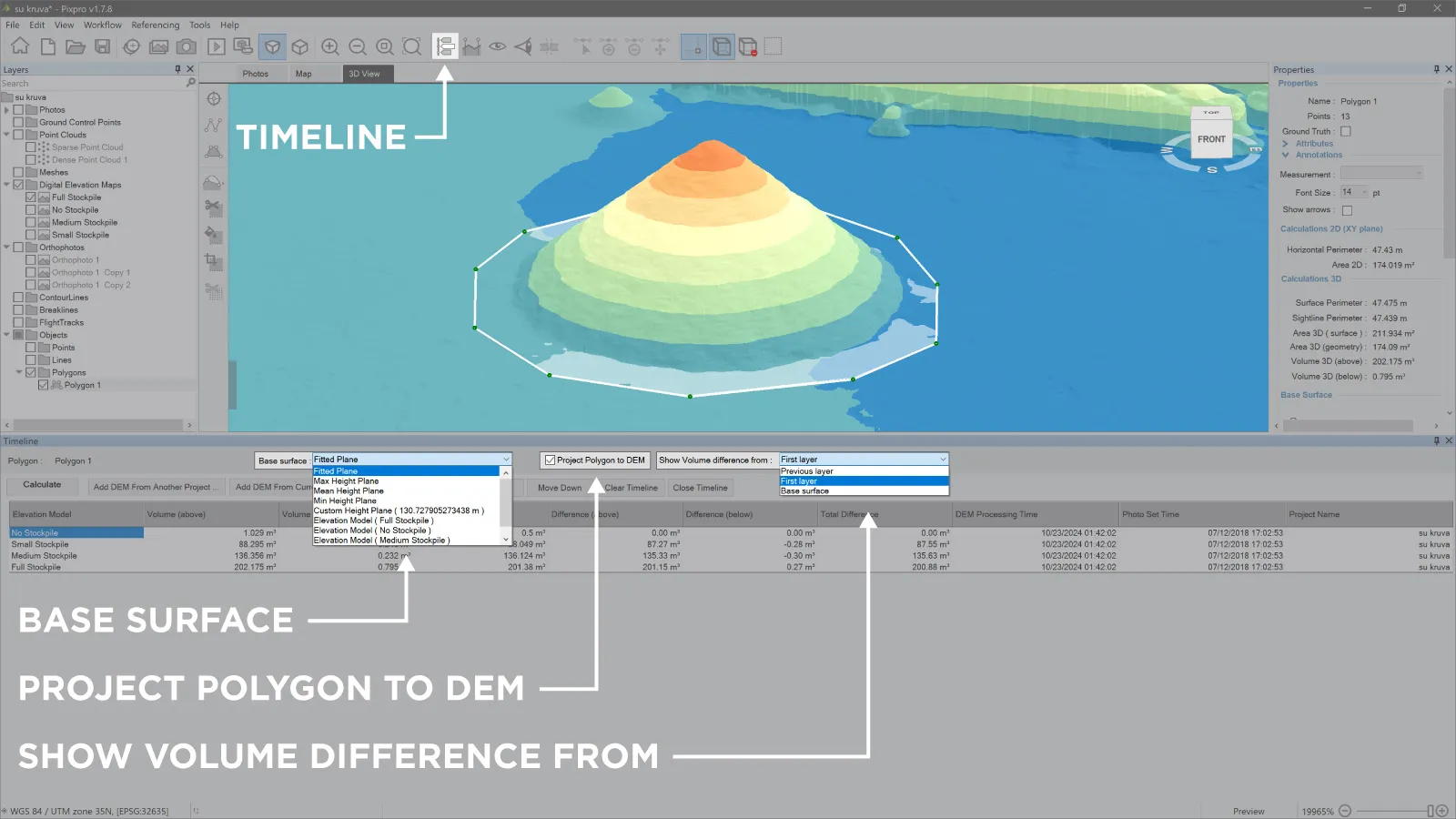 These three options, in conjunction with the Move Up and Move Down buttons, which adjust the position of selected surfaces in the timeline, allow you to choose any combination of comparisons. Finally, as before, we can add DEMs from other projects, use any base plane or base surface for calculations, and export the timeline calculations as a .csv table to use in another environment.
Conclusion
If you want to try our software, you can do it for free with a 14-day trial or get any license with all the features. If you have already exhausted the trial sometime before and wish to try again - write to us via email, and we may renew the license for you so you can try out the newest version of Pixpro.

Photographer - Drone Pilot - Photogrammetrist. Years of experience in gathering data for photogrammetry projects, client support and consultations, software testing, and working with development and marketing teams. Feel free to contact me via Pixpro Discord or email (l.zmejevskis@pix-pro.com) if you have any questions about our blog.
Related Blog Posts
Our Related Posts
All of our tools and technologies are designed, modified and updated keeping your needs in mind
Pixpro 1.7.11 - Seamless Model Sharing
We are keeping the development cycle relatively short these days, so here is a new update to our photogrammetry software. Update 1.7.11 brings improvements related to our cloud service.
Pixpro Version 1.7.10 - New Feature - Inspections
Another new Pixpro version is here, and it brings a singular new feature - an inspection module. Inspections are a large part of photogrammetric scanning because it is the most convenient and long-lasting way of visual remote sensing.
Most Asked Photogrammetry Questions Part 4 - Pixpro Support Picks
I help my team support Pixpro photogrammetry software users on a daily basis and often get forwarded more technical or specific questions. This gives me a good idea of what people ask the most, so I am writing these blog posts to get ahead of many questions.
Ready to get started with your project?
You can choose from our three different plans or ask for a custom solution where you can process as many photos as you like!
Free 14-day trial. Cancel any time.
.svg@webp)
