.svg@webp)
Overlap Between Different Perspectives
 Lukas
Zmejevskis
Lukas
Zmejevskis
Photogrammetry can be simple and rigid or complex and adaptable. Combining different scan patterns adds complexity to the work but improves detail and coverage. We often use examples of combined flights, of which the orbital + nadir grid is a classic. They provide great 3D structure while being easy to execute. However, even simple combination examples sometimes exceed the threshold of being too different. Let us investigate where this threshold is when photos from different sets may not combine into one cohesive scan, even if the subject is clearly the same.
Basics of Combining Photosets
In aerial and drone photogrammetry, covering a subject with a single type of flight is virtually impossible. Orbital roof scan will not have enough detail for roof overhangs and some walls. A nadir grid will not have enough detail for anything even close to perpendicular to the camera plane. Even multi-oriented oblique grid flights like those on enterprise drones might produce lackluster detail in more dense areas.
For these reasons, sometimes we need to combine different flights that contain photos taken with vastly different perspectives of the subject. Here, we may encounter an issue when a set of close-up photos does not mesh with the entire project. If the algorithm does not manage to include such images in the calculations, the data may be rendered useless to us.
 Thus, we need to manage the difference between photo sets, which we would like to process in the same project. We made some practical examples to illustrate how a 3D reconstruction algorithm may behave when we use photos with drastically different views of the same subject.
Do Software Settings Matter?
Before we look at some examples, processing settings may influence how the final results turn out. For most of the testing in this article, we used Pixpro photogrammetry software and default reconstruction settings. Some software may have more leeway than others, and some may be extra picky about combined image sets. Some software may also have more or fewer settings that may help the situation. In any case, the fundamentals we discuss will apply to all photogrammetry scan cases to some degree.
Real-World Examples
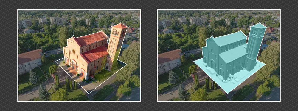
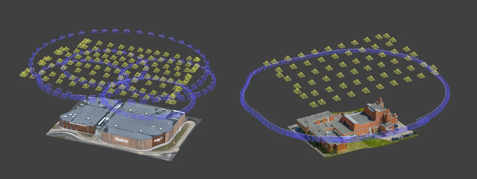
We made a simple scan to test the boundaries of 3D reconstruction tolerance. The base scan is a three-orbit scan of a church, with an orbit around the facade, one around the rear, and an additional orbit around a tower. In total, 196 photo sets were made with the DJI Mavic 3 Pro using our hyperlapse scanning technique.
 This is a combination of similar orbits and is a bread-and-butter workflow for obtaining quick scans. For the purposes of this article, we also made a few close-up photos of four different parts of the church and ran a 3D reconstruction with these photos alongside the three orbits. This represents a worst-case scenario where a vastly different perspective is represented by only a single image.
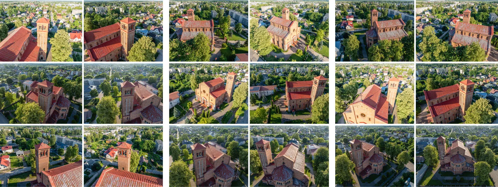
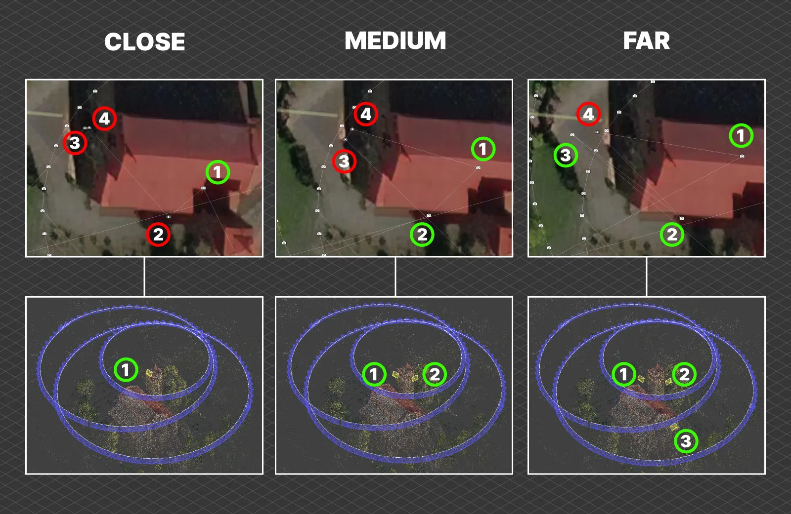
 The close-up photos are divided into three groups according to their proximity to the church—close, medium, and far. After adding each group to the project and processing them in default settings, we got logical results.
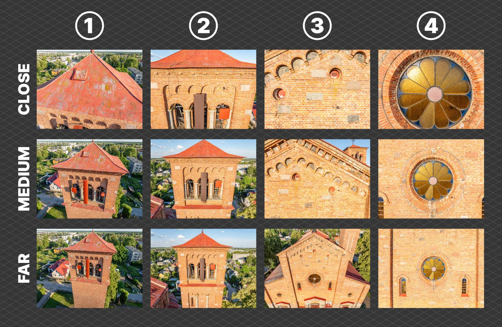 The more extreme examples of close-up photos are not included in the reconstruction, while the picture of an area that is focused less in the standard image set failed to be included in all three cases we experimented with. You can evaluate the examples above and below.
Different Cameras and Groups
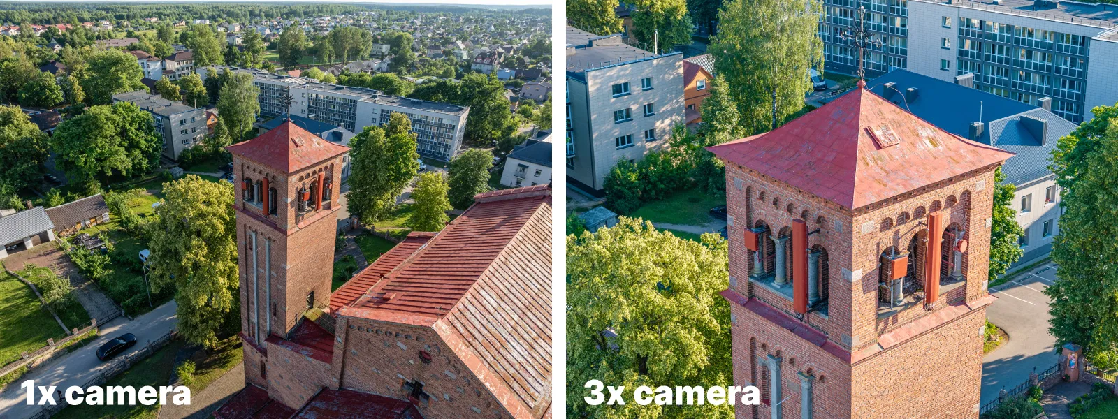
Similar rules will apply to adding entire grids or groups of photos made with different cameras and lenses. Mavic 3 Pro also has a 3X lens, which is quite usable even for photogrammetry due to the available tracking feature. This feature works in the same hyperlapse mode as with the 1X.
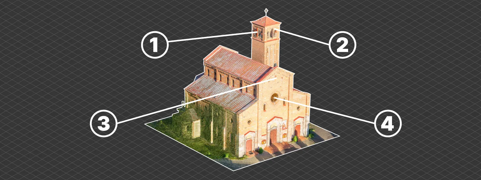
We made an example of combining photos from the 1X and 3X cameras to increase the detail of the church tower. A full orbit of 3X photos focusing only on the tower was added to the dataset. However, for it to work on Pixpro photogrammetry software, we had to select a different mapper option (hybrid instead of incremental+hybrid) in the advanced 3D reconstruction settings.
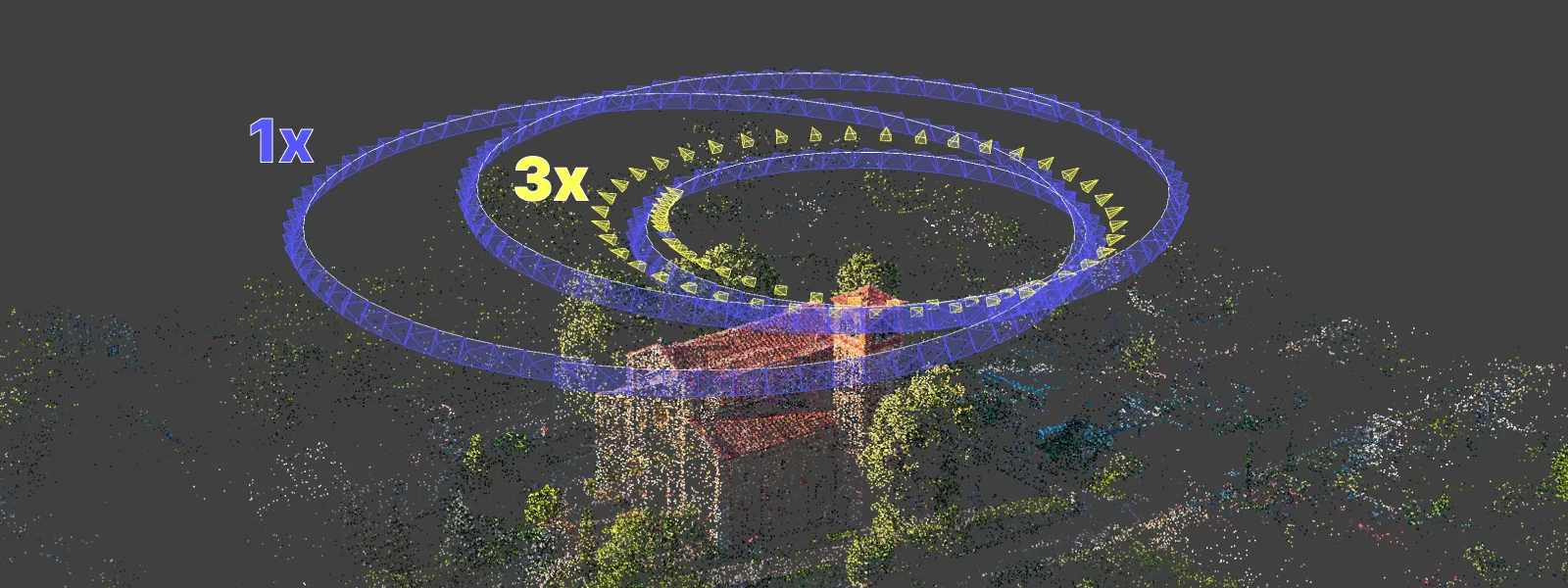
 The orbit was successfully included because the photos are similar, covering the tower with different levels of detail but fundamentally overlapping with the base set orbit. If the base set did not have a dedicated orbit for the tower with the 1X camera - the 3X orbit would not work.
 Conclusion
Combining photos is the go-to technique for most nonbasic scans. However, we can not just mix random images of the same subject. Different flights or photo groups must have a clear visual connection between them. Drastically different compositions of the same subject will not connect to a cohesive dataset. In this article, we only scratched the surface of this technique. In the future, we will explore more nuanced aspects of combining photos with more extensive and detailed examples.
Photographer - Drone Pilot - Photogrammetrist. Years of experience in gathering data for photogrammetry projects, client support and consultations, software testing, and working with development and marketing teams. Feel free to contact me via Pixpro Discord or email (l.zmejevskis@pix-pro.com) if you have any questions about our blog.
Powiązane posty na blogu
Nasze powiązane posty
Wszystkie nasze narzędzia i technologie są zaprojektowane, modyfikowane i aktualizowane z myślą o twoich potrzebach
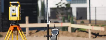
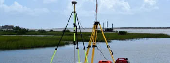
Dlaczego warto używać fotogrametrii do geodezji i mapowania?
Fotogrametria to proces polegający na generowaniu precyzyjnych pomiarów z fotografii. W ostatnich czasach fotogrametria przekształciła się w wielozadaniową technikę, która została z łatwością zintegrowana z szeregiem nowoczesnych zastosowań.
Inteligentne, proste i bezpieczne pomiary
Jak wiadomo, branża geodezyjna jest daleka od prostoty. Dla profesjonalnych geodetów typowy tydzień pracy może przynieść wiele wyzwań, które nie poddają się łatwym rozwiązaniom ani "szybkim naprawom".
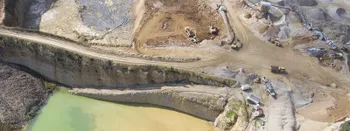
Badanie trendów w sektorze górniczym
Szybko rozwijające się innowacje w sektorze geomatyki przynoszą wcześniej nieprzewidziane możliwości, które stanowią ogromne wsparcie dla geodetów górniczych i całej branży. Geodeci pełnią kluczową rolę, ponieważ dostarczają niezbędne informacje wszystkim innym dziedzinom górnictwa.
Gotowy, aby rozpocząć swój projekt?
Możesz wybrać spośród naszych trzech różnych planów lub poprosić o niestandardowe rozwiązanie, gdzie możesz przetwarzać tyle zdjęć, ile chcesz!
Bezpłatna 14-dniowa wersja próbna. Anuluj w dowolnym momencie.