.svg@webp)
Multiple Overlapping Orbits - Pixpro Waypoints
 Lukas
Zmejevskis
Lukas
Zmejevskis

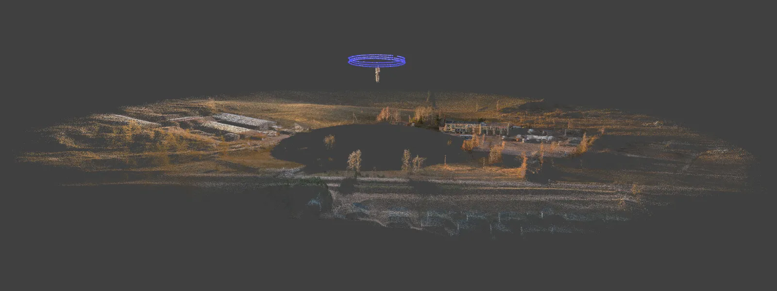
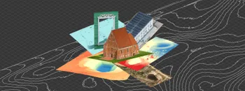
Orbital flights are an effective and straightforward way of obtaining good-quality scans of isolated or more homogenous objects. However, if we overlap many orbits side by side, it becomes just as efficient in capturing oblique data for quite large, multifaceted areas. For this article, we used the Pixpro waypoints service to plan a multi-orbit scan and executed it with a DJI Mavic 3 Pro drone. Let us review how we did that and the 3D result we got.
Multi Orbitals
Orbital flights are bread and butter for roof scans, towers, buildings, monuments, or any isolated object that can be flown around. However, anyone who has ever done orbital scans and seen the results is familiar with the vast area around an orbital scan, which will allow 3D reconstruction of the reconstruction region, which is not limited. That is because orbitals provide quite a lot of data beyond the central subject. We can get a lot of robust oblique data if we overlap many orbits in a single area.
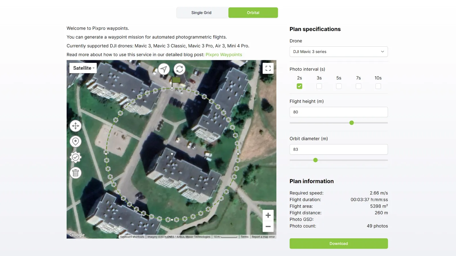
Pixpro Waypoints
Pixpro waypoints can only do single orbits, where we can select the center. The service will generate the flight path and calculate the required speed to get a good amount of photos for that diameter. The service is a workaround that takes advantage of DJI waypoint features and gives us automatic flight capabilities that are close to enterprise drone basics. If you are not familiar with our service, check out these previous articles:
Pixpro Wayoints - Automated Photogrammetry Flights for Newest DJI Drones
DJI Mini 4 Pro Photogrammetry - Pixpro Waypoints
Multi-battery Scans with Pixpro Waypoints
Commercial Roof Scan and Inspection
Pixpro Waypoints v2 - Orbitals and Height Offset for DJI Drones
Drawing Overlapping Orbits
Suppose you already know how to use orbitals. In that case, you may have noticed 4 dots on each orbit when drawing the initial circles (on the circle's edge, marked every 90 degrees). We used those as a reference to export multiple orbitals per plan, making our orbit overlap by the radius of each circle. Our method can be summarized as follows:
-
Draw the initial orbit at the corner of the rough area where you want to scan.
-
Choose all of the settings of the orbital scan, such as photo interval, altitude, and diameter.
-
Export this orbit and save it on your computer or other device.
-
Move the orbit by the center point to the previous orbit's edge marker.
-
Export this orbit without changing any settings.
-
Repeat this procedure by moving the orbit again to the desired direction.
-
Do as many orbits as you like to cover your area of interest.
We captured the process of these steps on a PC. The workflow may be a little more complicated if you are using a touchscreen device.
File Replacement and Flight
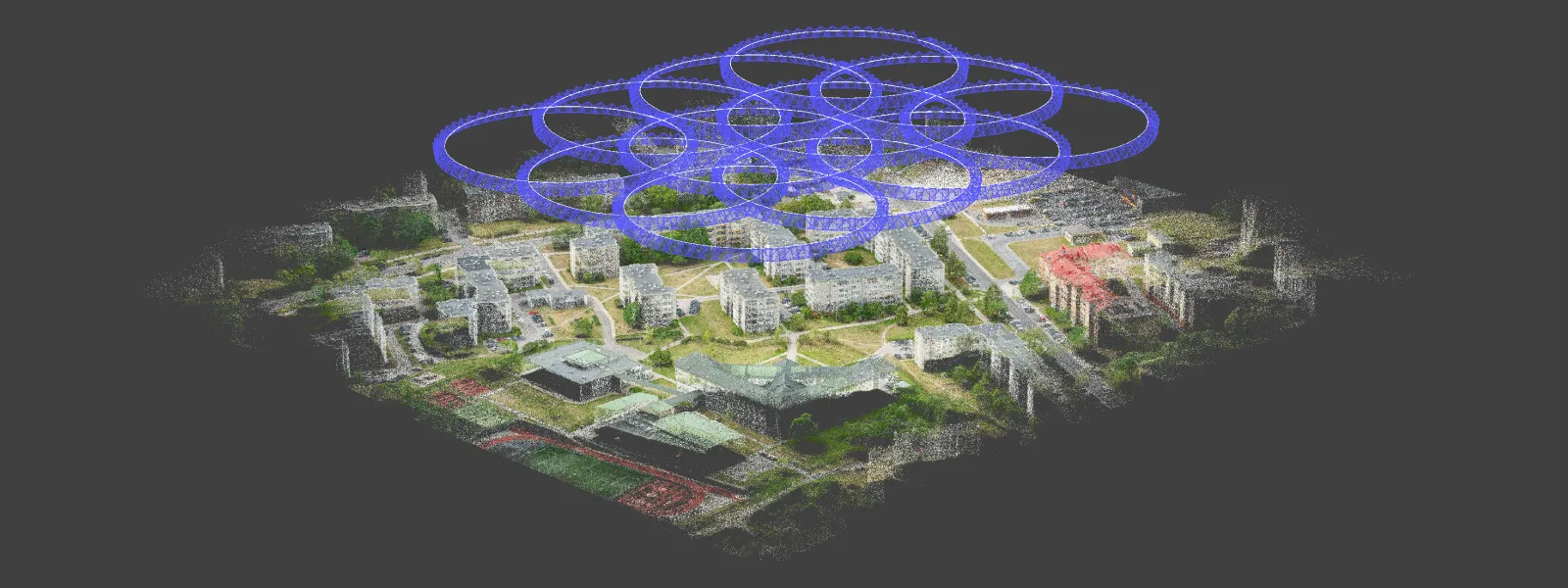
The result of this process is a bunch of .kmz files we need to input into our device; before doing that, we need to create as many waypoint flights in the DJI Fly app for replacement. While making our example, we created 12 overlapping orbital plans and a nadir grid. This means we need to create 13 waypoint flights within the app before replacing them with Pixpro waypoints.
This might seem a bit tedious, but creating a waypoint map in the DJI Fly app is just a matter of tapping the screen a few times. Remember—what waypoint flight you create for replacement does not matter. Just tap a few arbitrary waypoints on the screen, tap on the waypoints icon to exit, choose to save the flight, and repeat.
Once the files are replaced, the flight is easy. Open the waypoints plan, tap on next and let the drone fly. For photo capture - choose the same interval as you did in the waypoints service and when the drone reaches the start of each orbit - trigger or end the image capture. You do not need to land between the orbits, just select the other plan when one is complete and execute it. Repeat until all plans are done. Below is a screen capture from DJI fly app how we executed a couple of orbits in a row.
Our Example
To test our method, we made an example of an urban area with multi-story flat buildings in an industrial town. There are lots of walls and vertical detail, with moderate-height buildings—where a nadir flight would not be enough for reasonable detail.
We chose 80-meter diameter orbits purely visually, as the diameter felt about right for the objects in the area. There is no exact science here (yet); for now, it will be a matter of experimentation on what size orbits work for what kinds of areas. We also chose an 80-meter flight height and a 2-second interval for the camera.
 Once all files were in place, we used the DJI Mavic 3 Pro to execute each flight one by one, without landing; two fully charged batteries were used up to do all 12 orbital flights and the nadir one. We shot raw with locked exposure for maximum flexibility and consistency.
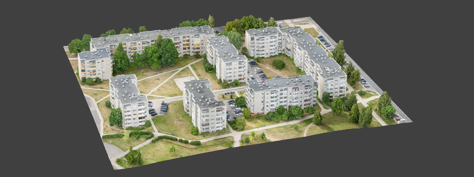
 950 photos were obtained for the scan in total, and we processed them in Pixpro photogrammetry software. There were no areas with poor coverage and obviously lower dense point cloud coverage, which means the plan worked and gave good results.
Conclusion
Multi-orbital scans are great for urban environments with many walls and large buildings. Orbitals require a minimum number of photos to obtain good coverage and result in good-quality 3D models. With some creativity, you can use Pixpro waypoints to make multi-orbital scans just like we did, which more expensive enterprise drones do not even offer. Try Pixpro Waypoints alongside Pixpro photogrammetry software for free and experiment yourself.
Photographer - Drone Pilot - Photogrammetrist. Years of experience in gathering data for photogrammetry projects, client support and consultations, software testing, and working with development and marketing teams. Feel free to contact me via Pixpro Discord or email (l.zmejevskis@pix-pro.com) if you have any questions about our blog.
Related Blog Posts
Our Related Posts
All of our tools and technologies are designed, modified and updated keeping your needs in mind
Where do we use Photogrammetry? A list of 3D scanning use cases.
Photogrammetry has revolutionized numerous industries by transforming real world scenes into 3D models, using only simple photographs and processing algorithms.
Most Asked Questions - Pixpro Waypoints
We have been receiving a lot of questions about our waypoint service. Pixpro Waypoints allow users to use the latest DJI drones for automated photogrammetry scans.

Overlap Between Different Perspectives
Photogrammetry can be simple and rigid or complex and adaptable. Combining different scan patterns adds complexity to the work but improves detail and coverage. We often use examples of combined flights, of which the orbital + nadir grid is a classic. They provide great 3D structure while being easy
Ready to get started with your project?
You can choose from our three different plans or ask for a custom solution where you can process as many photos as you like!
Free 14-day trial. Cancel any time.