.svg@webp)
Where do we use Photogrammetry? A list of 3D scanning use cases.
 Lukas
Zmejevskis
Lukas
Zmejevskis

Photogrammetry has revolutionized numerous industries by transforming real-world scenes into 3D models, using only simple photographs and processing algorithms. Its applications are vast and varied, from enhancing entertainment experiences to improving construction efficiency. In this article, I will list photogrammetry use cases within a few major categories, each with 10 more specific examples. I am sure there are many use cases I am still unaware of, but to find new ones, we must look at what is widely adopted now.
Entertainment
-
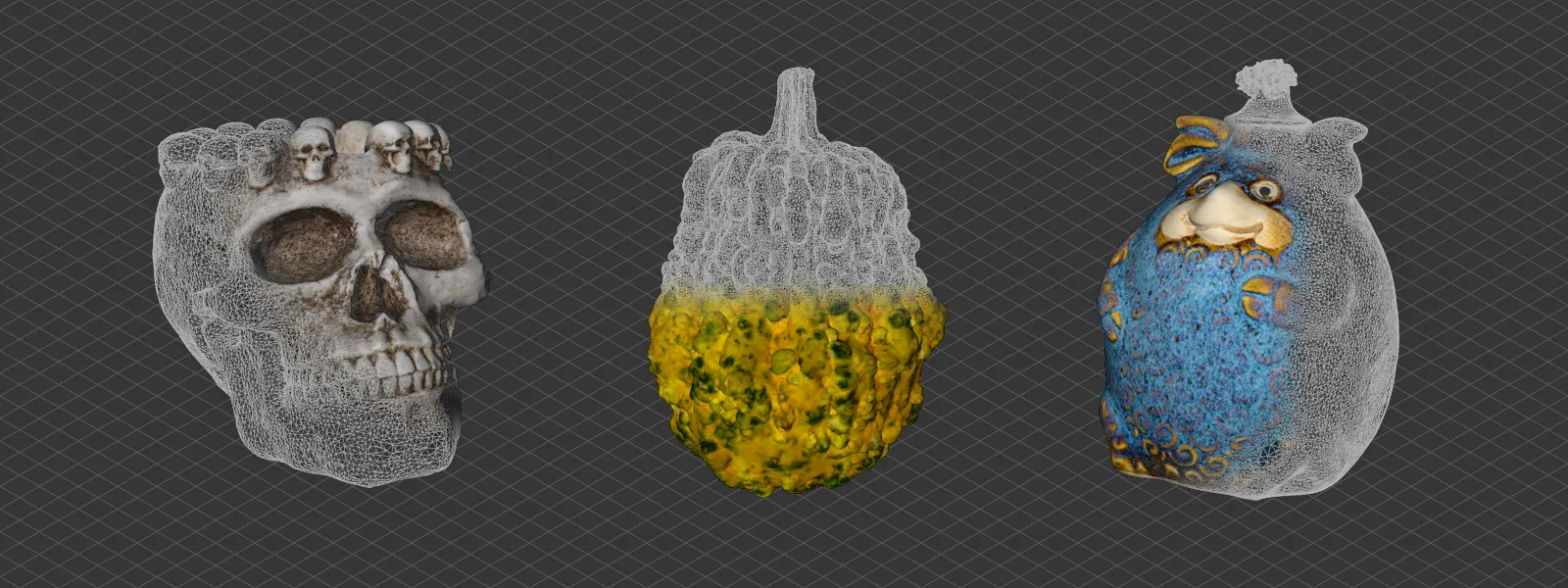
Game Asset Creation
Photogrammetry is used to scan real-world objects and textures to create realistic 3D assets for video games. These kinds of models require a good bit of post processing, but photogrammetry provides the best starting point or reference there is.
3D Asset Creation with Photogrammetry -
VR Environment Building
Real locations are captured in 3D to build immersive virtual reality environments for training, storytelling, preservation, education. -
Film Set Visualization
Used in pre-visualization and CGI-heavy productions to create accurate digital doubles of real-world sets, locations and assets. -
Character Modeling
People's faces and bodies can be scanned for realistic digital humans in film and games. A huge part in CGI replacement workflows, or entirely new, computer generated character creation.
Human Face and Body Photogrammetry with a Single Camera -
Prop Replication
Real-world props are scanned for exact duplication in CGI or for 3D printing replicas. This can be often done with scale adjustment for miniature reproduction. Sadly - a dying form of art in moviemaking.
Custom Christmas with Photogrammetry and 3D Printing -
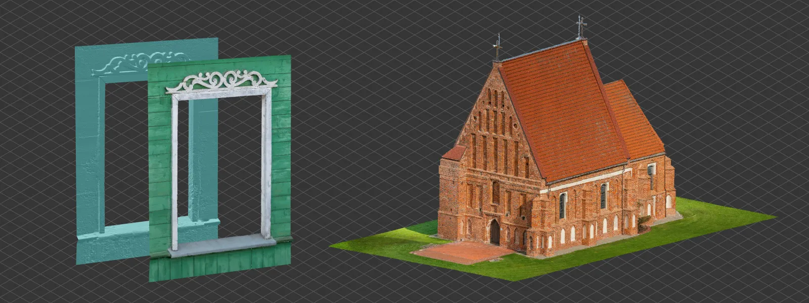
Cultural Heritage in Games
Historic sites scanned with photogrammetry are featured in educational or exploratory game content. Or just as immersive epic environments which could not really be experienced in any other way. -
Augmented Reality Assets
Real-world objects are digitized for use in AR apps and experiences. AR is definitely one of the fastest growing technology today. -
Virtual Production / LED Stage Integration
Scanned environments are used as digital backdrops for real-time LED screen production. The most famous example is “the Volume”. -
Storyboard / Scene Planning
Filmmakers use 3D scans of locations for blocking and planning scenes before physical shoots. Nothing better than having an entire environment at the palm of your hand. -
Marketing Visuals
Products or environments are scanned for use in high-fidelity interactive ads or 3D previews.
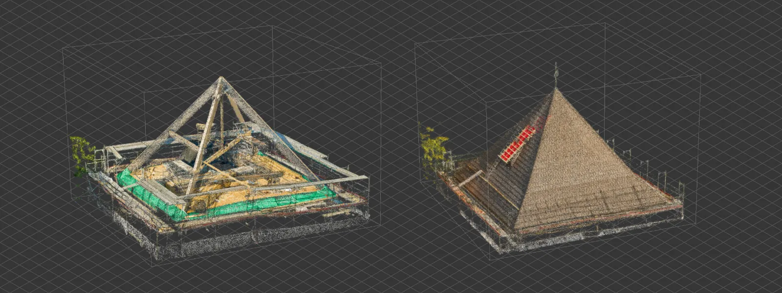
Construction
-
Site Planning and Safety
Drone scans help map out job sites for planning logistics, identifying hazards, and improving safety compliance. Monitoring over time included.
Construction Site Inspection with Photogrammetry -
Progress Monitoring
Regular scans document construction progress over time, enabling comparisons and schedule tracking. -
Earthworks and Volume Measurement
Measuring excavated or filled material volumes. Much more accurate way of determining how much material or truck volume to order. Beats everything we had before handily.
Smartphone Photogrammetry for Stockpile Scanning
Pit Volume Measurement in Pixpro Photogrammetry -
Design Validation
Compare as-built photogrammetry models to CAD or BIM models to detect design discrepancies early. Best kind of evidence to resolve disputes. -
Stockpile Management
Quickly assess material stockpiles on-site and track usage or deliveries over time.
Comparing Surfaces in Pixpro Part 1
Comparing Surfaces in Pixpro Part 2 -
Digital Twins for Buildings
Create accurate digital models of construction phases or finished structures for documentation. -
Facade Inspection
Scan facades for defect identification and analysis or planning renovations without scaffolding. -
Underground Utilities Mapping
Use photogrammetry in open-trench scenarios to record utility layout before backfilling. -
Permit and Compliance Documentation
Provide detailed visual and metric records for permitting or regulatory bodies. A workflow not adopted quickly enough in parts of the world. -
Client Reporting and Visualization
Deliver interactive 3D models to stakeholders for clearer communication of site conditions and progress. Before and after construction.
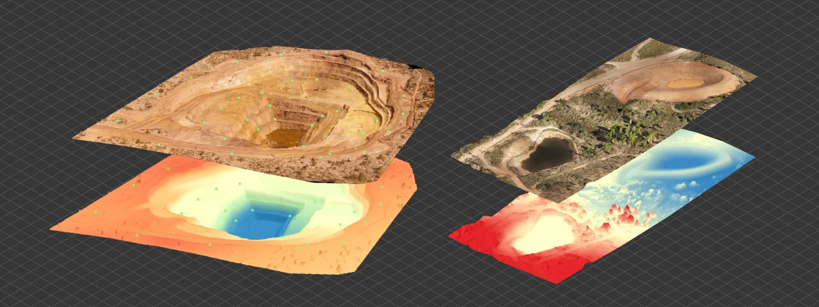
Mining
-
Open Pit Monitoring
Use drone photogrammetry to measure pit geometry, slope stability, and plan future extractions. -
Volume Calculations
Precisely calculate the volume of stockpiles or mined areas for inventory and production tracking. -
Tailings Dam Inspection
Monitor dam shape and deformation over time for safety compliance. -
Blast Planning
Analyze terrain and material spread to optimize blast patterns and improve efficiency. -
Reclamation Planning
Map out and monitor land reclamation efforts with accurate before/after 3D models. -
Infrastructure Mapping
Digitize mining infrastructure like roads, buildings, and conveyor systems for site management and safety.
What is Drone Mapping? -
Underground Mapping
Handheld camera photogrammetry to scan tunnel interiors and mine shafts. Safety, inspection and further planning. -
Compliance Reporting
Create detailed models to meet reporting requirements for environmental agencies. -
Ore Pass and Shaft Documentation
Document vertical or steep features for maintenance or closure planning. -
Dust and Hazard Zone Mapping
Use 3D modeling to identify areas prone to dust accumulation or other safety concerns. Scanned environments can be an essential part for simulations.
Energy
-
Solar Farm or Roof Layout Planning
Use aerial scans to assess terrain or building suitability and layout optimal panel arrangements. Such scans can be used for accurate simulations of plant efficiency and output. -
Solar Panel and Wind Turbine Blade Inspection
Capture high-resolution images without the hazard of physical human access. -
Power Line Corridor Mapping
Document and monitor vegetation encroachment or structural clearances along power lines. -
Substation Digitization
Create detailed models of electrical substations for asset management or remote inspections. -
Oil & Gas Infrastructure Monitoring
Monitor pipelines, tanks, and refineries for structural integrity and deformation. -
Utility Pole Assessment
Scan poles and surrounding areas for maintenance planning and vegetation control. -
Geothermal Site Modeling
Capture surface features and site layout for early-stage geothermal exploration. -
Hydroelectric Plant Mapping
Document dam structures, surrounding terrain, and spillways for inspections or retrofitting. -
Asset Lifecycle Management
Maintain up-to-date 3D records of energy infrastructure for maintenance and planning. -
Emergency Response Planning
Provide accurate terrain and asset data for planning emergency access or containment.
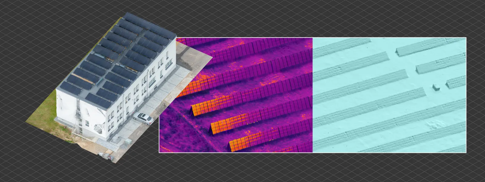
Inspection

-
Roof Inspections
Scan rooftops to detect damage, plan repairs, or prepare for solar installations.
Easy Roof Inspection with Pixpro -
Bridge Condition Assessment
Capture detailed images of hard-to-reach areas without lane closures or scaffolding. -
Building Facade Surveys
Digitally inspect cracks, water damage, or structural issues on large or tall buildings. -
Tower Inspections
Use drones to capture telecom or broadcast tower imagery for close-up inspection. Photogrammetric 3D scenes are the best frameworks of storing and using such data.
Tower Inspection with Photogrammetry -
Pipeline Surveillance
Monitor long stretches of pipeline routes for shifts, leaks, or unauthorized access. -
Flood Damage Mapping
Create before/after models to evaluate damage extent and guide recovery. -
Roadway and Pavement Condition
Survey roads for potholes, cracks, or wear for maintenance prioritization. -
Industrial Site Audits
Quickly scan large industrial plants or yards to assess condition or layout changes. -
Thermal Overlay Integration
Combine thermal and photogrammetry data for leak detection or insulation checks.
Thermal Photogrammetry Basics -
Fire Damage Documentation
Capture detailed post-fire scenes for insurance, restoration, or forensic purposes.
Heritage
-
Historic Building Preservation
Digitally archive historic structures in high detail for conservation or reconstruction. -
Archaeological Site Mapping
Scan excavation sites to document every phase of discovery, monitoring and support analysis. -
Museum Artifact Digitization
Create 3D models of artifacts for online collections or VR exhibitions. -
Reconstruction Planning
Use scanned remains to digitally reconstruct lost or damaged heritage sites. -
Virtual Tours
Build immersive VR walkthroughs of cultural landmarks for education and accessibility. -
Monitoring Structural Degradation
Compare scans over time to track wear, erosion, or structural instability. -
Unreachable Site Access
Digitize cliffside ruins, caves, or fragile environments without disturbing the site.
Cave Entrance Finding with Photogrammetry -
Crowdsourced Scanning Projects
Combine public scans of landmarks to create detailed, communal 3D models. -
Research and Measurement
Provide scholars with precise recreations of structures and surfaces remotely. -
Disaster Risk Assessment
Assess heritage sites’ vulnerability to natural disasters like landslides or earthquakes.
Others
-
Agriculture & Crop Monitoring
Use multispectral drone photogrammetry to create NDVI maps and assess crop health, growth stages, and irrigation needs. -
Forestry Management
Measure tree heights, canopy coverage, and biomass estimates from aerial scans for sustainable forestry planning. -
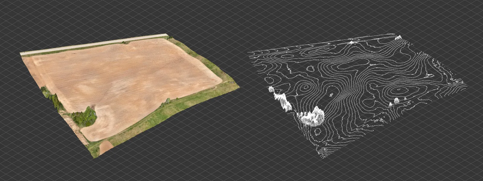
Land Surveying
Replace traditional survey methods with fast, accurate photogrammetry-based terrain models and topographic maps.
True Orthophoto - Orthorectified Imagery and Pixpro Workflow -
Real Estate Visualization
Create 3D property walkthroughs and site models to enhance listings or pre-construction marketing. -
Event Planning & Venue Layout
Scan large venues or outdoor locations to plan infrastructure, safety zones, or crowd flow for festivals and events.
Event Planning with Photogrammetry -
Insurance Claim Documentation
Quickly generate visual and metric documentation of damages (fire, flood, storm) for accurate claim processing.
Quick Vehicle Accident Documentation with Photogrammetry -
Education & Training
Use real-world 3D data in classrooms or online platforms to teach surveying, architecture, or GIS concepts. -
Disaster Response & Recovery
Deploy drones to rapidly assess damage zones, map collapsed structures, or plan rescue and recovery operations. -
Environmental Monitoring
Track erosion, coastal change, or glacier retreat using photogrammetric models taken at intervals. -
Urban Planning & Zoning
Scan city blocks or new developments to support planning meetings, visualize zoning impacts, or simulate urban growth.
Conclusion
These are not all use cases and probably not all categories for having 3D twins of something from real life as digital data. Computers allow data analysis and storage, which is just necessary if you want to get something done these days. Having a digital copy of anything you are working on is becoming the norm in more areas and industries. Photogrammetry is one of the backbones of that when it comes to initial 3D scanning. It only requires a camera and a bit of data crunching.
Photographer - Drone Pilot - Photogrammetrist. Years of experience in gathering data for photogrammetry projects, client support and consultations, software testing, and working with development and marketing teams. Feel free to contact me via Pixpro Discord or email (l.zmejevskis@pix-pro.com) if you have any questions about our blog.
Related Blog Posts
Our Related Posts
All of our tools and technologies are designed, modified and updated keeping your needs in mind

ChatGPT – Image Quality Checking for Photogrammetry with AI
Good input data is everything in photogrammetry. The results we get from processing can never "exceed" what we input into the software. If only we could always check our input data before starting the relatively long process of 3D reconstruction.
Roof Scan for Inspection and Solar Panel Addition – Use Case
Roof photogrammetry is one of our client base's most common use cases. Obtaining accurate measurements is essential for designing a solar panel layout, determining how many panels fit on a roof, and conducting a prior inspection.
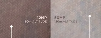
Resolution vs. Altitude: Do 50 Megapixels Actually Matter?
We all know that megapixels are not the only defining factor of image quality, and the megapixel race is long over. However, we need to know their uses when we have two resolution options.
Ready to get started with your project?
You can choose from our three different plans or ask for a custom solution where you can process as many photos as you like!
Free 14-day trial. Cancel any time.