Most Asked Photogrammetry Questions Part 4 - Pixpro Support Picks
 Lukas
Zmejevskis

I help my team support Pixpro photogrammetry software users on a daily basis and often get forwarded more technical or specific questions. This gives me a good idea of what people ask the most, so I am writing these blog posts to get ahead of many questions. This is part 4 of the most-asked series, and this time, we are focusing specifically on questions we received from our existing or potential users over the last five months.
Top Questions in no particular order
1. What are the best drones for photogrammetry to use with Pixpro Waypoints at the moment?
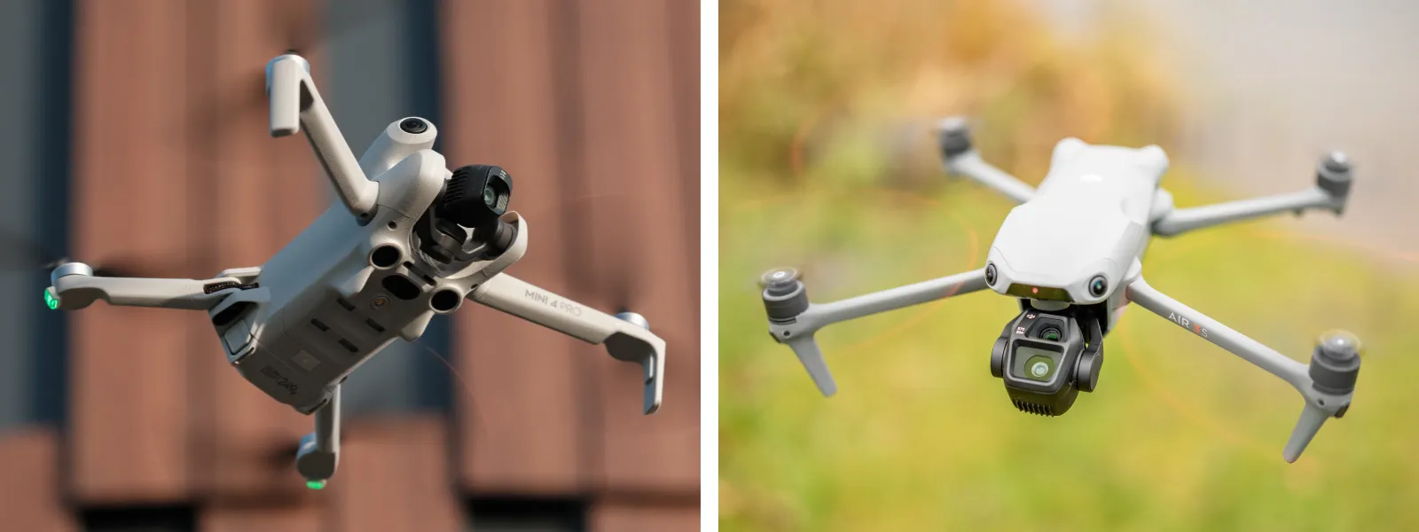
The best sub-250-gram drone is the DJI Mini 4 Pro, while the best regular mid-size drone is the DJI Air 3S. Both are best when paired with the DJI RC2 controllers, which work flawlessly with Pixpro Waypoints, an automated flight workaround solution.
 2. What is the best professional drone with RTK for photogrammetry currently?
Practically, there is only one choice at the moment - DJI Mavic 3E.
3. Which drones are recommended for tasks such as roof measurements or surveying?
The ones mentioned above. If you are a professional surveyor, keep in mind that if you already have an RTK rover/station to measure GCPs, you might not need an overpriced RTK drone, using GCPs + the DJI Air 3S (with Pixpro Waypoints), for example - is a superior combo that requires marginally more work (measuring GCPs, adding them to projects) while providing exceptional results at a lower purchase price.
4. Are RTK-capable drones (like DJI Mavic 3E) necessary for highly accurate measurements?
No. Measurements stem from good relative accuracy, which requires having a good scan overall. So, good photo quality, coverage, and overlap are the fundamentals of photogrammetry. RTK drones provide much better absolute accuracy and can possibly improve measurement accuracy in extreme cases, like huge and/or oddly shaped projects.
5. What causes curvature or distortion in my 3D reconstructions, and how can I correct it?
The bowing effect is usually caused by insufficient oblique data on the scanned surface or scene. In practical terms, this means more perspectives are needed to rectify the project - and fix its shape. This usually occurs in aerial nadir scans (camera facing top down) of flat areas; g, orbitals, or oblique grids are used to fix the bowing effect. Read more here:
Common Photogrammetry Problem - the Bowl Effect
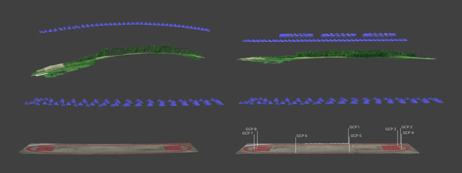 6. Can I upload ground control points during cloud processing?
Yes, there are a few ways of doing that. For a more detailed explanation, read these:
7. Can your software generate 3D models from 360° or standard video footage?
No, at least not yet.
8. Is the software compatible with macOS or other operating systems besides Windows?
No. Pixpro software is currently available for Windows only, but Pixpro Waypoints is a web service accessible on any device.
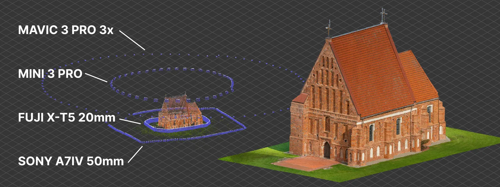
9. Is it possible to create detailed 3D building models using both drone and ground-level images?
Yes. You need to ensure proper overlap between and within the different sources of photos, and you will get great results. More about that in this post:
Multi Camera Photogrammetry in Pixpro
 10. Why are some photos excluded during processing, and how can I ensure all images are utilized?
Photos can be excluded mainly due to two reasons: a photo is of lousy quality, and the software did not find any features on it to tie it together with others, or the photo is part of a cluster of images that did not connect to the whole set (this includes irrelevant accidentally uploaded photos as well). The main culprit for the first reason is photo blur due to motion when the shutter speed is left on auto, and the drone does not select a fast shutter speed to freeze the motion. A blurry, too-dark, or too-bright photo is useless for the software. The second reason is usually due to poor overall scan planning and photos not connecting with each other because they do not have intermediates that serve as connective tissue, so to speak.
11. Can I draw on the 3D model?
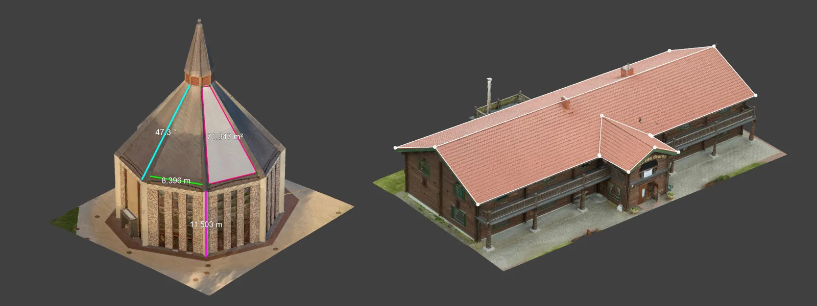
Yes, with Pixpro, you can draw lines, points, and polygons on your 3D scene, point cloud, or surfaces. Those drawn vectors also serve as measurements and can carry text annotations.
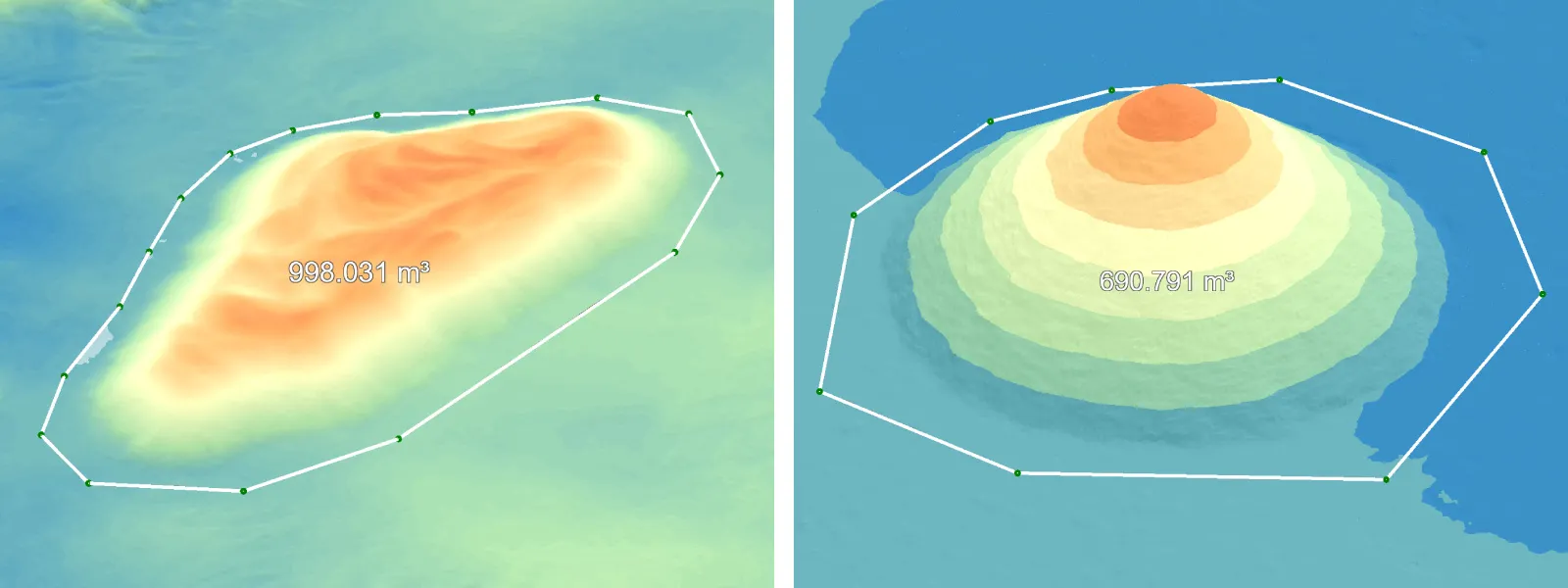
 12. How do I accurately measure volumes (e.g., stockpiles or piles of material)?
First, you need to make a good project overall. Second, carefully draw the polygon around your pile and select an appropriate base plane. You might need an empty lot scan for an accurate base surface in more advanced and sensitive cases. More on this topic in these blog posts:
Smartphone Photogrammetry for Stockpile Scanning
Pit Volume Measurement in Pixpro Photogrammetry
Surface Comparison Part 2
13. Is Pixpro suitable for creating detailed 3D models of smaller objects like artwork/assets?
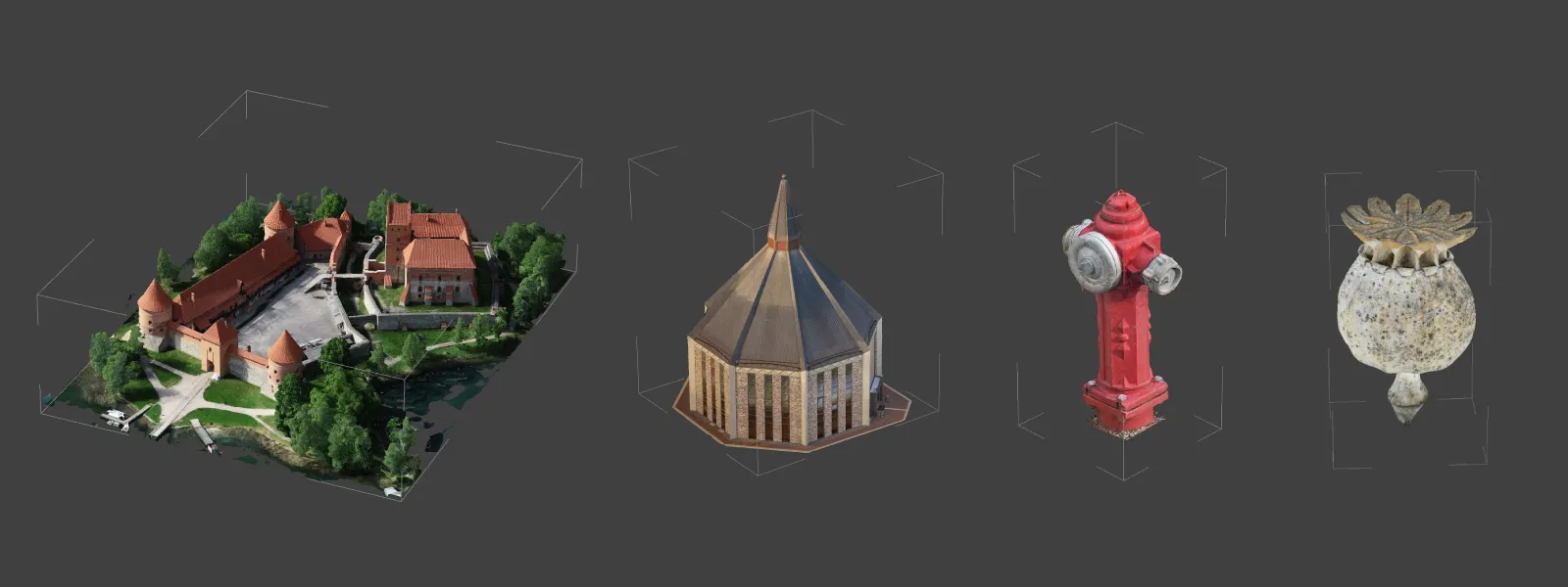
While we focus on more survey-oriented aerial photogrammetry, our software works for any type of scan, including smaller objects scanned with cameras or phones.
3D Asset Creation With Photogrammetry
Macro photogrammetry - Combining Multiple Techniques
 14. Do you provide lifetime licenses or flexible licensing terms?
Yes, but for that, you will need to contact us via email to get an individual offer.
15. Do you have a trial version, and can I test advanced features during the trial?
Yes, Pixpro has a 14-day trial, which is not limited in any way, depending on the subscription tier you choose to try. The trial period is free, of course.
16. Why are some buttons greyed out (e.g., generate mesh)?
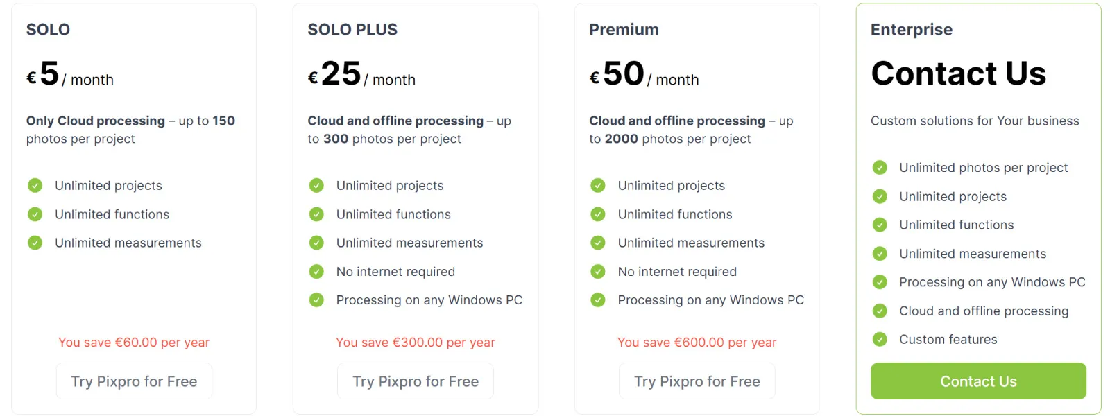
The most common issue is the Solo subscription plan, which does not allow local processing. Remember, if you want to try out the software, you can choose the Premium tier, and when you cancel before the trial is over - you will not be charged any amount.
17. Where can I find documentation or a manual of your software?
We have a technical help database here. In practice, this blog is the best place to learn how Pixpro works.
18. Which subscription plan is best for a beginner?
Solo Plus. The Solo plan is for those who know they do not need the local processing stuff and have project scales under control, while the Solo Plus provides more flexibility and a better learning experience for a reasonable price.
 19. Does the Solo plan suffice for advanced surveying tasks?
If you can live with 150 photo limits and no local processing - yes. However, in practice, surveyors go for the Premium plan and have the flexibility for more serious work.
20. Does Pixpro support automated drone flight planning, or do I need a third-party solution?
Pixpro Waypoints is our current solution for the latest DJI drones. It works super well when you get the hang of it, and in my opinion, it renders enterprise drones irrelevant if you do not need RTK or have a GCP rover. If you have an enterprise drone, its data will work fine with Pixpro photogrammetry software.
Conclusion
Did you not find the question you were looking for? Check out these previous, also quite condensed FAQ articles:
Most Asked Photogrammetry Questions - Our Answers Part 1
Most Asked Photogrammetry Questions Part 2 - Pixpro Software
Most Asked Photogrammetry Questions Part 3 - Getting Deeper
If that does not help, I would suggest exploring this blog using the search feature. You can also join our Discord server, where we can chat in real time. There are no bad questions, and our support team is very patient.

Photographer - Drone Pilot - Photogrammetrist. Years of experience in gathering data for photogrammetry projects, client support and consultations, software testing, and working with development and marketing teams. Feel free to contact me via Pixpro Discord or email (l.zmejevskis@pix-pro.com) if you have any questions about our blog.
Related Blog Posts
Our Related Posts
All of our tools and technologies are designed, modified and updated keeping your needs in mind
Pixpro 1.7.11 - Seamless Model Sharing
We are keeping the development cycle relatively short these days, so here is a new update to our photogrammetry software. Update 1.7.11 brings improvements related to our cloud service.

Pixpro Version 1.7.10 - New Feature - Inspections
Another new Pixpro version is here, and it brings a singular new feature - an inspection module. Inspections are a large part of photogrammetric scanning because it is the most convenient and long-lasting way of visual remote sensing.

Pixpro version 1.7.9 and our 2025 Goals and Expectations
In this blog post, we have a small update to our Pixpro photogrammetry software and a bit of speculation and planning for the upcoming orbit around our G-type main sequence star.
Ready to get started with your project?
You can choose from our three different plans or ask for a custom solution where you can process as many photos as you like!
Free 14-day trial. Cancel any time.
.svg@webp)
