.svg@webp)
Dirt Race Track Photogrammetric Inspection and Measurement
 Lukas
Zmejevskis
Lukas
Zmejevskis

We are back with another simple photogrammetry use case from the real world. We captured an area that contains an amateur dirt race track and is part of an entertainment complex. Our goals were to produce an orthophoto image and measure various sections of the track, including widths, lengths, and slope angles. Here is a detailed account of how we did this.
Data Capture
We used a DJI Mavic 3 Pro Drone and Pixpro waypoints service for data capture. Our services allowed us to select the area on the map, choose a flight altitude, and execute a single grid flight plan automatically. The service has become a staple amongst our users when creating blog content, including real jobs like this. An actual game change for DJI Mavic 3, DJI Mini 4 Pro, and DJI Air 3 drone owners. You can read more about waypoints in these articles:
Pixpro Wayoints - Automated Photogrammetry Flights for Newest DJI Drones
Multi-battery Scans with Pixpro Waypoints
Pixpro Waypoints v2 - Orbitals and Height Offset for DJI Drones
Multiple Overlapping Orbits - Pixpro Waypoints
Most Asked Questions - Pixpro Waypoints
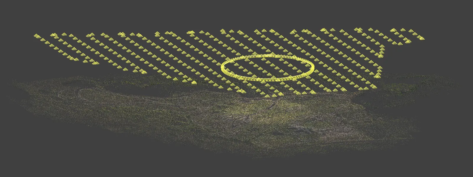
We planned our grid at a 120-meter flight height, which allowed us to cover the entire area with a single battery with an 80 percent overlap. We also added a few orbitals above the area necessary for better 3D reconstruction. Large-scale nadir scans are often troublesome without RTK data, so we must add oblique data. Oblique data - photos taken at an angle help the 3D reconstruction and camera calibration processes under the hood and eliminate the probability of such effects as bowing or poor scale.
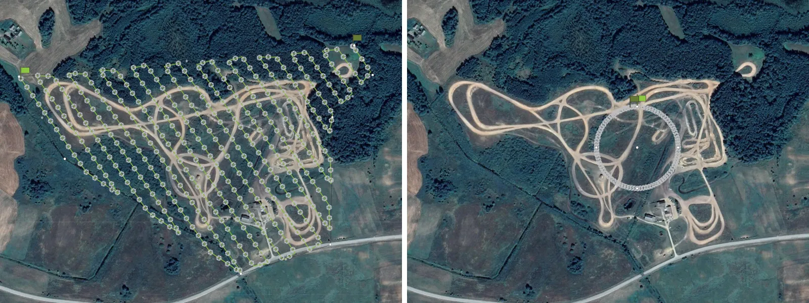 Orbitals are the most efficient way of adding oblique data to a scan and are hard to mess up. We also used Pixpro waypoints for the orbits; we added a 200-meter radius orbit above the center of the area at a 100-meter altitude. The camera was set at a -45-degree angle.
We captured 500 photos in RAW format using the drone's primary camera while in shutter priority mode and shutter speed set at 1/640 of a second, which is a safe value that will not introduce motion blur in any way.
 Data Processing
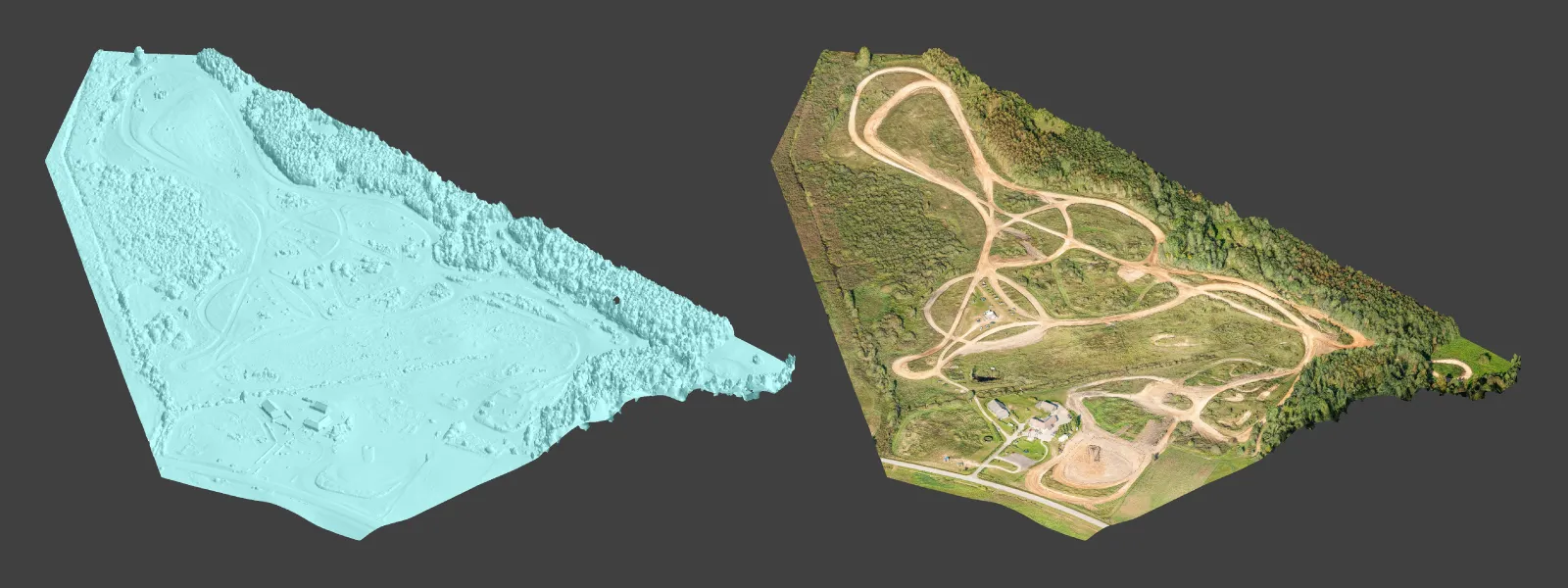
We converted RAW photos to JPEGs using Adobe Lightroom and used simple processing guidelines from our article here. Then, we uploaded the pictures to Pixpro photogrammetry software and made the 3D layers we needed. As a deliverable, we created an orthophoto image requiring a dense point cloud and a digital elevation map.
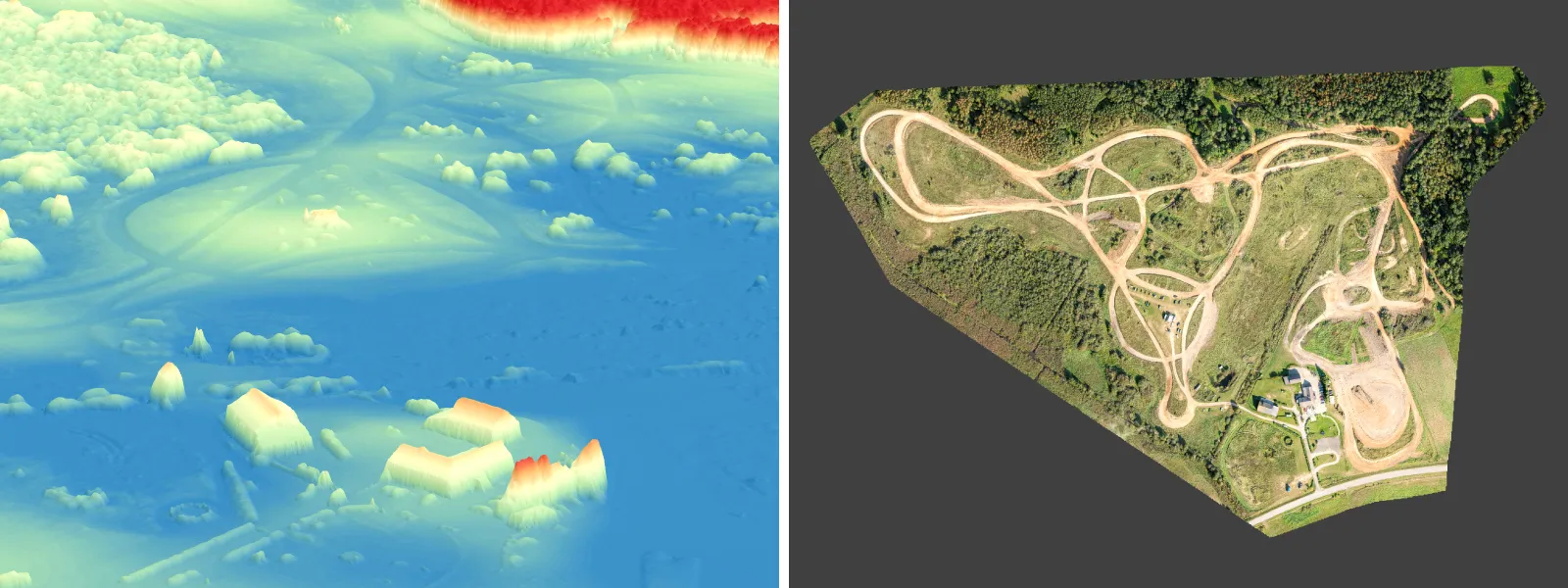 For measurements and 3D visualization, we made a 3D mesh with texture.
 Measurements
In Pixpro, we measure by drawing Points, Lines, and Polygons. In this use case, we measured various sections of the track. Track width, length, and slope angle can be obtained by drawing Lines in relevant sections of the track.
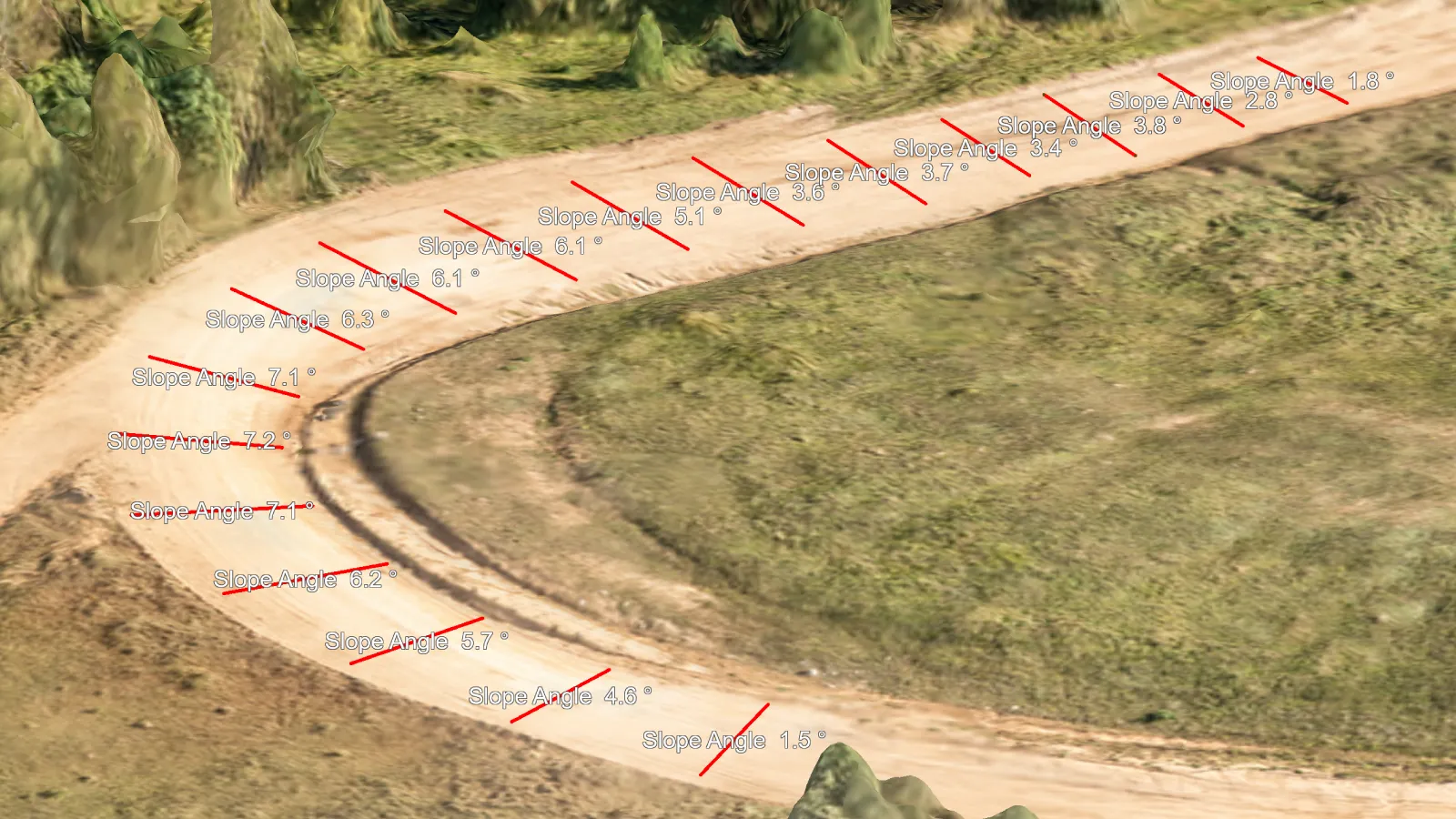 We can also check the terrain profile to evaluate the steeper bits of the track.
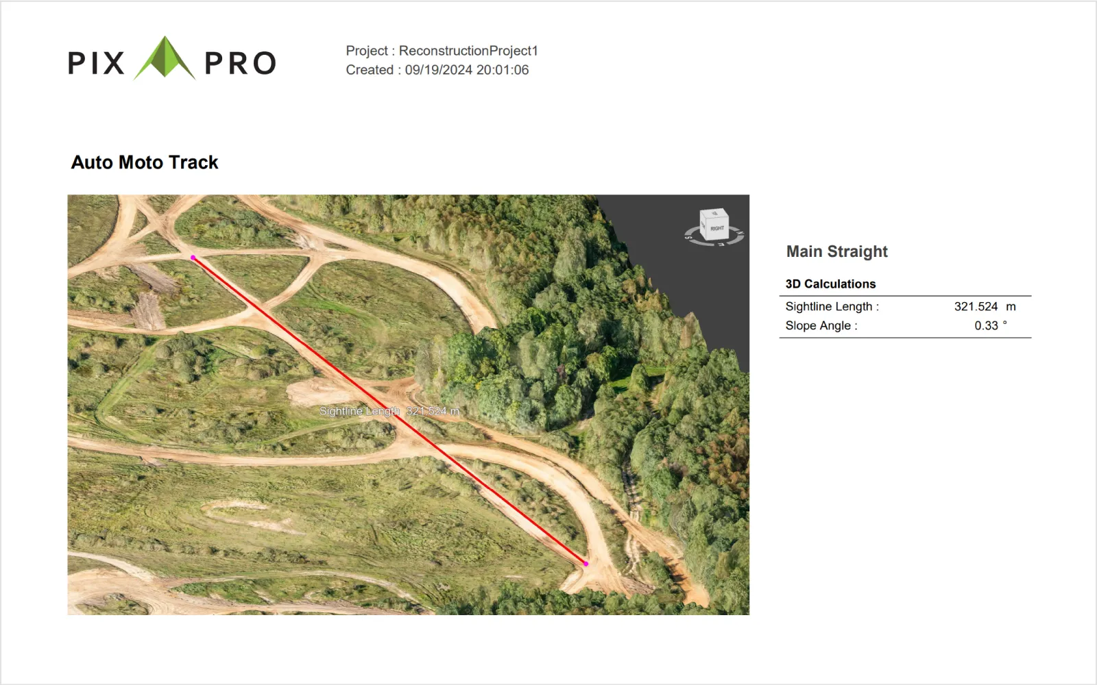
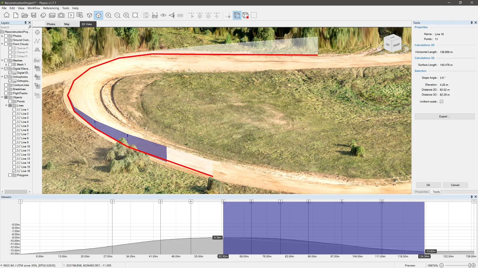 We can save our measurements as simple Pixpro snapshots - which input information into tables alongside the screenshot of the 3D view. These are saved as simple PDFs.
 Conclusion
Photogrammetry has become extremely accessible. A consumer-grade drone with some knowledge may get you everything you need for a quick measurement, inspection, and evaluation job. For relative accuracy—aka measurements and good reconstruction—you do not need an RTK enterprise drone. Here, we provide knowledge and software for capture and processing. Just bring your drone and try out Pixpro photogrammetry software for free, which comes with the waypoint service at no extra charge.
Photographer - Drone Pilot - Photogrammetrist. Years of experience in gathering data for photogrammetry projects, client support and consultations, software testing, and working with development and marketing teams. Feel free to contact me via Pixpro Discord or email (l.zmejevskis@pix-pro.com) if you have any questions about our blog.
Related Blog Posts
Our Related Posts
All of our tools and technologies are designed, modified and updated keeping your needs in mind
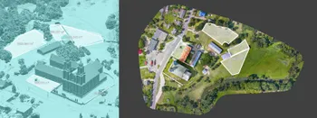
Large Property Photogrammetry – Real Estate Development Use Case
Property scans are one of the most common use cases, especially for our software. Pixpro is affordable and works well with RTK data and ground control points when necessary.
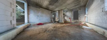
Handheld Photogrammetry Construction Interior Scan Use Case
Interior 3D scanning can be useful in a myriad of ways. In this article, I present a scan of a residential building construction site, with its foundation walls and roof almost complete. Further construction will require some visualizations and design according to “the fact.”
Event Planning with Photogrammetry – Use Case from A to Z
Photogrammetry for event planning was the first use case I wrote about on this blog. Now we are back with another venue and an event that will take place in a couple of months.
Ready to get started with your project?
You can choose from our three different plans or ask for a custom solution where you can process as many photos as you like!
Free 14-day trial. Cancel any time.