.svg@webp)
Pixpro Waypoints Update - Multi Grids
 Lukas
Zmejevskis
Lukas
Zmejevskis
We are updating our Pixpro Waypoints service with a new plan—multi grids—and a few other minor improvements. In this blog post, we will go through these changes and provide an example made with the new plan type and a short description of how to use it. Adding multi grids to the existing orbitals and single grids marks what we deem to be the core of aerial photogrammetry flight types, which will cover many use cases.
New Updates
Besides the new flight plan, we also added a few small things:
• A search bar. You can search for any Google Maps objects or addresses, as you would in a regular Google Maps interface.
• Orbital overlap. During orbital flights, orbitals finish when making slightly more than a full circle (by 10 degrees). We added this so we can begin photo capture only after the drone starts moving and not lose coverage.
• Minor interface changes, including a wider map view and some bug fixes.
 Multi Grid Use Cases
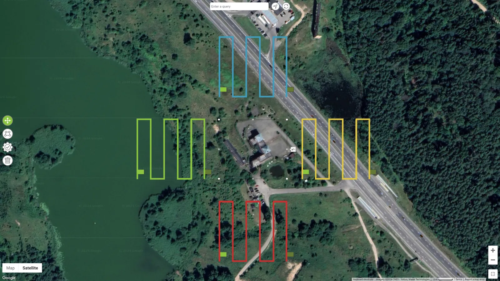
Multi-grid flights are made to provide the best data you can get when flying in a flat plane. Our multi-grid variation generates four oblique flight plans from the four compass directions. This gives a great amount of oblique data for isolated buildings, compounds, or even entire towns or city scans. Multi-grids are best used in combination with single-grid nadir plans, which give a total of five directions of data for the designated area.
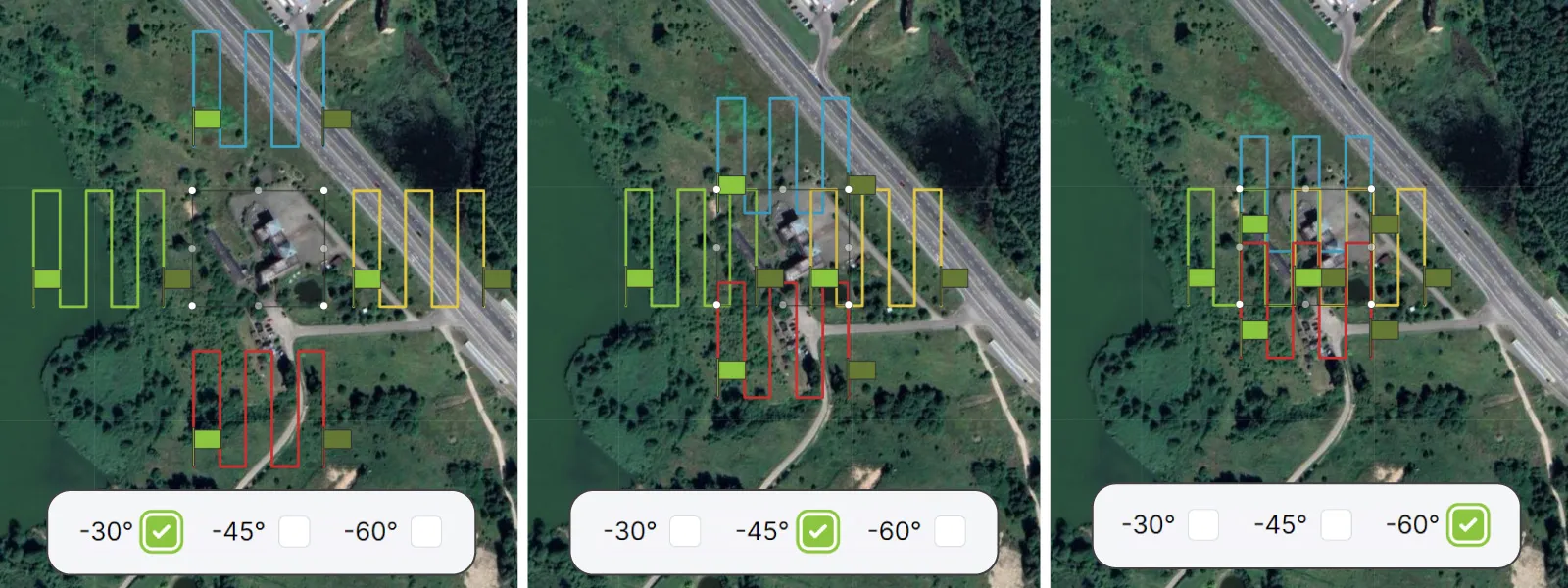
 We provided three camera angles for this flight plan -30 -45 -60. -30 being the most oblique one, focusing on the vertical data in the area, while a -60 degree option is for reducing the flying area and total flight time while still having some oblique capture. -45 is, of course, the middle-of-the-road variant, often the go-to for many.
 As you can see, the flight grid is offset accordingly, so the selected areas are always kept in the frame. Overlap is calculated according to the flight height and will never be less than specified. The execution procedure is unchanged compared to orbitals or single grids, bar one thing—we generate four different files for each direction. So, for each multi-grid plan, you will need to create four waypoint flights.
Example
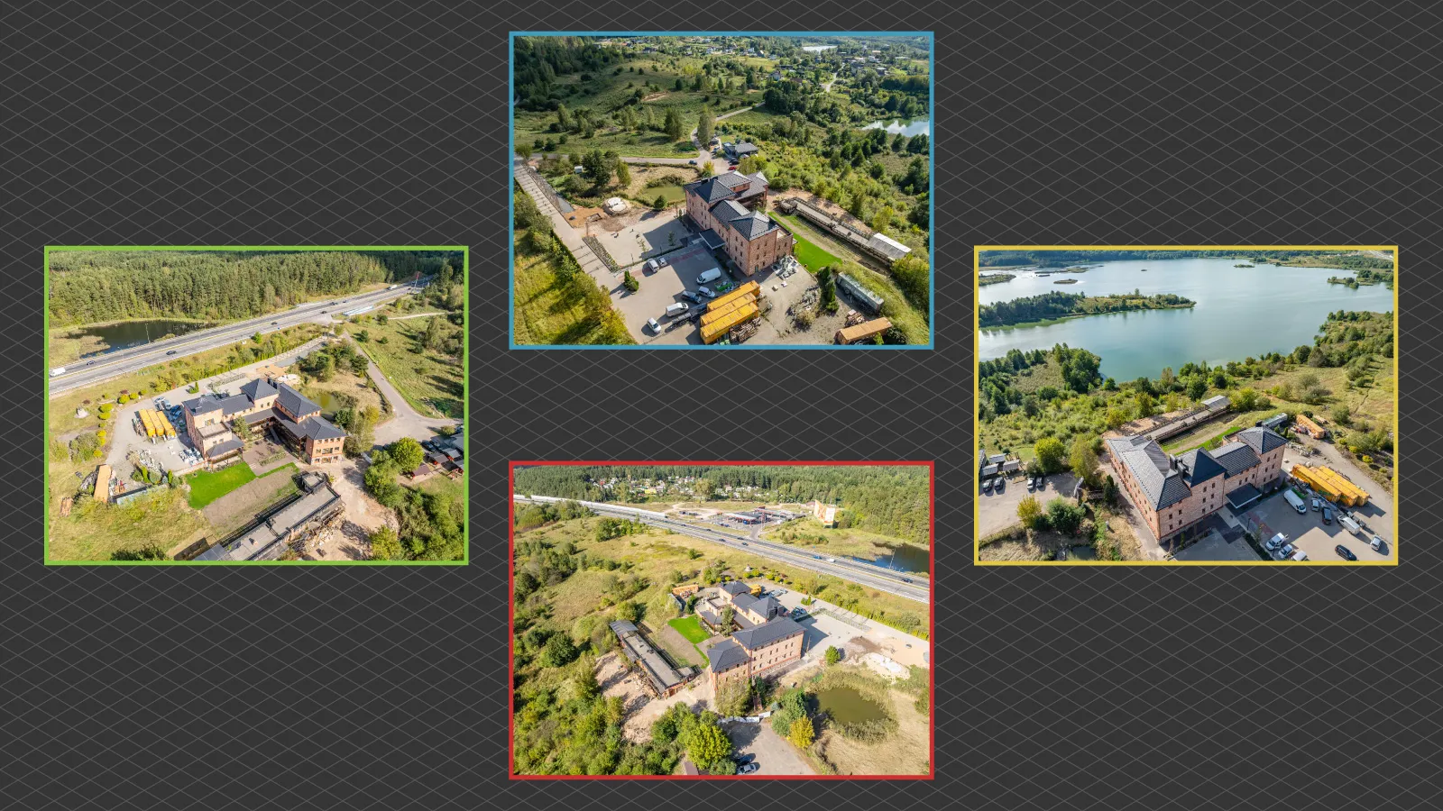
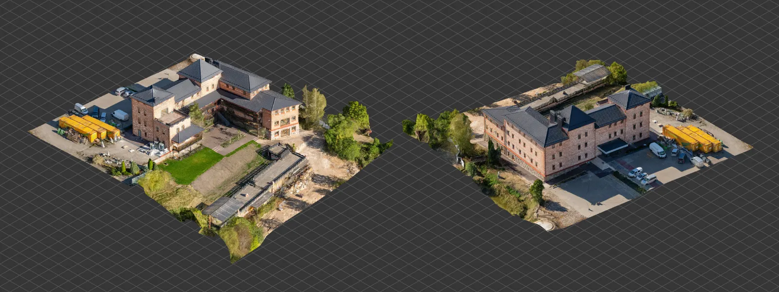
We made a small scan of a restaurant with some buildings at -30 degrees and an overlapping nadir scan at 90 degrees above the compound.
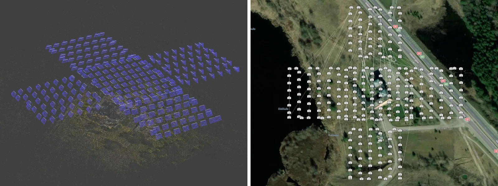
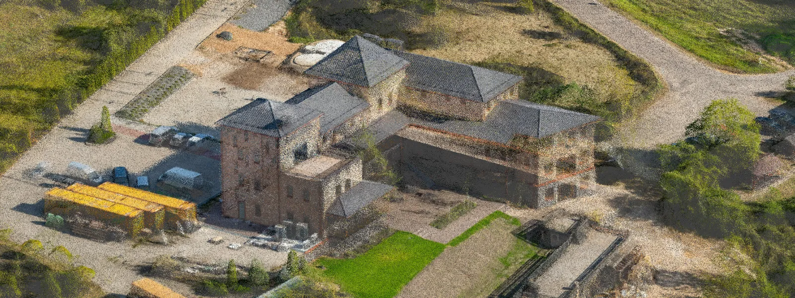 There is nothing really special to talk about here. The point of a multi-grid plan is to not leave any holes, and that is what we have. Consistent coverage and detail are dependent solely on the flight height—the lower you fly, the better the result.
 We can execute the 4 grid flights sequentially without landing or leaving the waypoint interface. Our time estimation adds a few minutes for takeoff and landing, so take that as a very conservative estimate unless you are doing maximum-size flights where drones take a while to reach the beginning of each grid. In the case of large grids, you can execute them one by one while changing the batteries or pausing in the middle of the flight. Below is a short screen capture of how we connect two grids effortlessly without landing.
Known Issues
We do have one issue regarding iOS devices that needs fixing. It seems that our flight paths do not straighten out when using DJI Fly on Apple devices. We are investigating whether we can fix this.
We also observe that sometimes flight paths scramble in the preview, on the map. We addressed this in our previous article, but this time we got a video showing how in actuality it does not influence drone flight in any way. The drone will execute the flight as it should despite the wonky lines.
Conclusion
Waypoints come with any Pixpro subscription, including the free trial, so you can try our service for free initially. This blog post is more of an update, so to get more information on how to use waypoints, check our other blog articles:
Pixpro Wayoints - Automated Photogrammetry Flights for Newest DJI Drones
Multi-battery Scans with Pixpro Waypoints
Pixpro Waypoints v2 - Orbitals and Height Offset for DJI Drones
Multiple Overlapping Orbits - Pixpro Waypoints
Photographer - Drone Pilot - Photogrammetrist. Years of experience in gathering data for photogrammetry projects, client support and consultations, software testing, and working with development and marketing teams. Feel free to contact me via Pixpro Discord or email (l.zmejevskis@pix-pro.com) if you have any questions about our blog.
Related Blog Posts
Our Related Posts
All of our tools and technologies are designed, modified and updated keeping your needs in mind

ChatGPT – Image Quality Checking for Photogrammetry with AI
Good input data is everything in photogrammetry. The results we get from processing can never "exceed" what we input into the software. If only we could always check our input data before starting the relatively long process of 3D reconstruction.

No. 1 Mistake You Are Making in Photogrammetry Right Now
As photogrammetry software developers, we need to troubleshoot multiple projects from our clients every week. The number one mistake, especially when making measuring projects, is using redundant photos. These photos can appear for a few reasons, which I will describe, and they can be quickly dealt
Revopoint Miraco Plus 3D Scanner - First Impressions
3D scanners were these exotic, expensive devices that seemed to do magic. This is not the case anymore. This article is not a full review, but it contains my first impressions and initial thoughts while keeping my experience in photogrammetry in mind.
Ready to get started with your project?
You can choose from our three different plans or ask for a custom solution where you can process as many photos as you like!
Free 14-day trial. Cancel any time.